
We are celebrating 15 years — and counting — of stories that are deeply researched and deeply felt, that build a historical record of what the city has been.
We are celebrating 15 years — and counting — of stories that are deeply researched and deeply felt, that build a historical record of what the city has been.
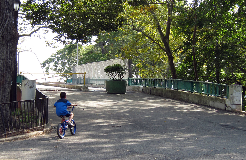
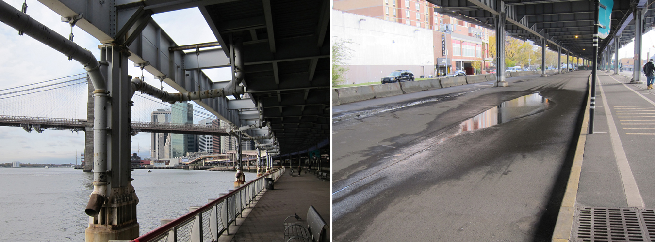
As New York City’s waterfronts have deindustrialized over the past forty years, residential and recreational redevelopment has transformed the edges of Manhattan’s West Side, Brooklyn Heights, and the East River’s eastern banks in Williamsburg, Greenpoint and Long Island City. Its western banks, however, confront a much harsher set of edge conditions, especially in the southern half of Manhattan. The FDR Drive, disused piers, superblocks of towers-in-the-park housing, and large institutions like hospitals and power stations all conspire to limit public access to the waterfront and, moreover, to the water itself. And while the aim of all the recent attention paid to riverside public spaces (such as the renovation of East River Park) is to create high quality spaces near the water, these efforts don’t necessarily prioritize access to the waterway itself, a fast-moving tidal strait long considered unsafe, unclean and otherwise unfit for a wide range of uses, including waterborne recreation, transportation, and ecological education and restoration.
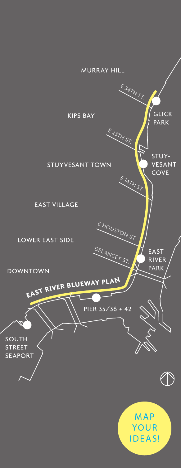
Providing New Yorkers exactly those opportunities has led the Office of Manhattan Borough President Scott Stringer and State Assemblymember Brian Kavanaugh to support the efforts of local community-based organizations, community boards, City and State agencies to make it easier for New Yorkers to get into the water.* WXY Architecture + Urban Design is the firm charged with planning a network of sites, listening to community stakeholders, recommending access strategies and identifying opportunities for capital projects along the East River from the Brooklyn Bridge up to East 38th Street. So we sat down with Adam Lubinsky, a managing principal at WXY, to discuss the process behind the East River Blueway Plan. The potential of New York City’s waterways extends beyond riverfront open space or residential real estate with river views. But to get past the water’s edge, as Lubinsky tells us in the interview below, requires a multivalent strategy of community engagement, urban planning and design. –C.S.
Before we talk about the East River Blueway project, can you tell me what a blueway is?
Generally speaking, a blueway trail or a blueway plan is a series of sites along a water body where people can get into and out of the water: usually boat launch points, sometimes camping sites. Planning a blueway is not typical in highly urban places like New York City, but, increasingly, a lot of smaller cities with rivers running through them are starting to implement them.
So what might it mean in a place like New York?
The East River has historically been perceived as intimidating, unclean and – over the past 80 years – very separate from the people living next to it. Our project essentially asks: how can you get down to and into the water? Given the barrier of the FDR, how can you connect to the waterfront at all? And once you do, how can you create linkages along the waterfront that tie together all of those points of access? There’s a water quality element to the project as well, because if you’re going to get into the water, the water itself has to be safe. The final piece is to raise awareness of everything that’s happening on the East River, since it’s been off of New Yorkers’ radar. The infrastructure there creates a really hard edge, and all of the buildings built over the past 80 years have turned their back to the river. Part of the challenge is to get residents to turn around, to realize the river is there, to be aware of it and to start to use it more.
How did the East River Blueway project get started?
The offices of the Manhattan Borough President and State Assemblymember Brian Kavanaugh were both instrumental in getting this off the ground. The area we’re looking at runs from the Brooklyn Bridge up to East 38th Street. The initial push came when community groups at either end of what has become the proposed blueway joined forces. Towards the northern end, in Community Board 6, a group of people have been working hard to transform Stuyvesant Cove Park over the past 20 years. And with SolarOne operating there, there is a real sense that the area can be an innovative, environmental hub for the city. Towards the southern end, in Community Board 3, many Lower East Side residents and community groups have been very active in trying to improve access to the waterfront and to find opportunities for community benefits at Piers 35, 36 and 42.
And, of course, there are a lot of places to look at in between. When you’re talking about a blueway, you have to consider a long stretch, a network of sites.
How did WXY get involved? What was the scope of work?
The Manhattan Borough President’s Office put out an open request for proposals (RFP), and a wide variety of kinds of firms – landscape architects, urban planners, architects – responded. In our proposal, we emphasized WXY’s combination of civic design in architecture with community-based master planning. We really focused on how we could use conversations with the community as our evidence base for what we take forward. And as designers, we also have a lot of experience in waterfront parks. We know how to create a masterplanning framework and also how to drill down to specific sites with schematic designs. The brief from the Borough President’s Office specifically asks for both a comprehensive plan as well as design propositions for particular sites. And both the planning and the design really build on Vision 2020, the Department of City Planning’s Comprehensive Waterfront Plan.
What does Vision 2020 outline for the East River waterfront in particular?
Vision 2020 came out about a year ago. It’s a great document because it sets a policy context for everything that should happen on the waterfront. It sets out goals, guidelines and strategic initiatives for particular “waterfront reaches,” which are geographical areas such as Lower Manhattan, and then outlines neighborhood strategies within those areas. A lot of our work involves picking this up and trying to take it further.
So how do you go about doing that?
The overall deliverable is a draft plan for the entire area that looks at various elements. It looks at water quality and stormwater issues, connectivity issues, and different possibile uses along the waterfront to come up with conceptual and schematic designs for particular places along the blueway. Our process begins with a significant research phase, moves on to specific stakeholder and community engagement work, and then we’ll create a draft plan and finally concept designs, paying particular attention to what the costs will be and how to fund aspects of the plan.
Our work has to take into account a variety of other projects along the East River. The Parks Department, for example, recently released a separate RFP for Pier 42, for which the last of the Lower Manhattan Development Corporation (LMDC) money was allocated. The Economic Development Corporation (NYCEDC) has been working on Piers 35 and 36. Just north of East 38th Street, where our study area ends, is the East Midtown Waterfront Study that looks at the United Nations esplanade and the Con Edison pier. And there has been a huge amount of work on the stretch from the Brooklyn Bridge up to the southern end of East River Park. So part of our process is making sure that we’re complementing all of this ongoing work.
At this point, we’ve completed our existing conditions and stakeholder engagement work. And we recently held our first major public event. Working with Community Board 6, we focused on the stretch between 14th Street and 38th Street. We had a great turnout of about 100 people, who shared some very good ideas. For us, the key is to identify those places that have a lot of interest and activity from the community-based organizations and nearby residents and to build off of that interest and activity.
What are some examples of what the community is interested in?
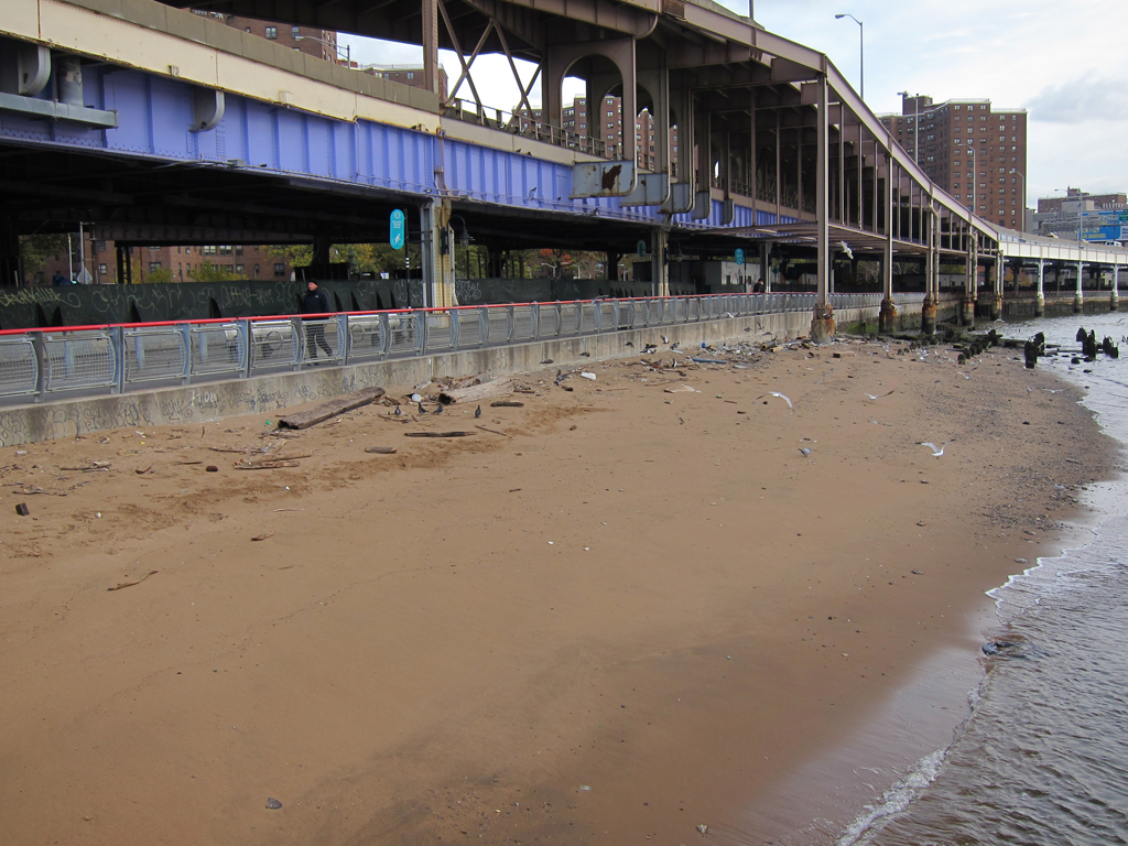
The SolarOne facility at Stuyvesant Cove Park is one area where a lot of different interests have coalesced. Community Board 6 has been really supportive of finding ways to get into the water at Stuyvesant Cove. Kayakers and boaters want to be able to launch from there. There’s interest in an “eco-dock” that would enable people to walk out over the water and provide opportunities for environmental education and ecological restoration projects. There’s interest in swimming in the river, which obviously requires doing things upland to stormwater and sewer outfalls in order to improve the water quality. There’s a lot of fishing at Stuyvesant Cove now, so there is a desire for fish cleaning facilities. There’s an old parking facility, the Skyport Garage, that might eventually be envisioned as including a restaurant or café. Some people are interested in ferry access from East 23rd Street. There’s also a huge desire to solve what we’ve been calling “the pinchpoint,” which is at the top of East River Park where the greenway narrows to less than four feet wide alongside the ConEd facilities and people walking and on bikes collide on a daily basis. Underneath the Brooklyn Bridge there’s a naturally forming beach that has the potential for nesting grounds, for real habitat creation along the bulkhead that educates people and provides an interesting experience. There are a huge number of waterborne possibilities.
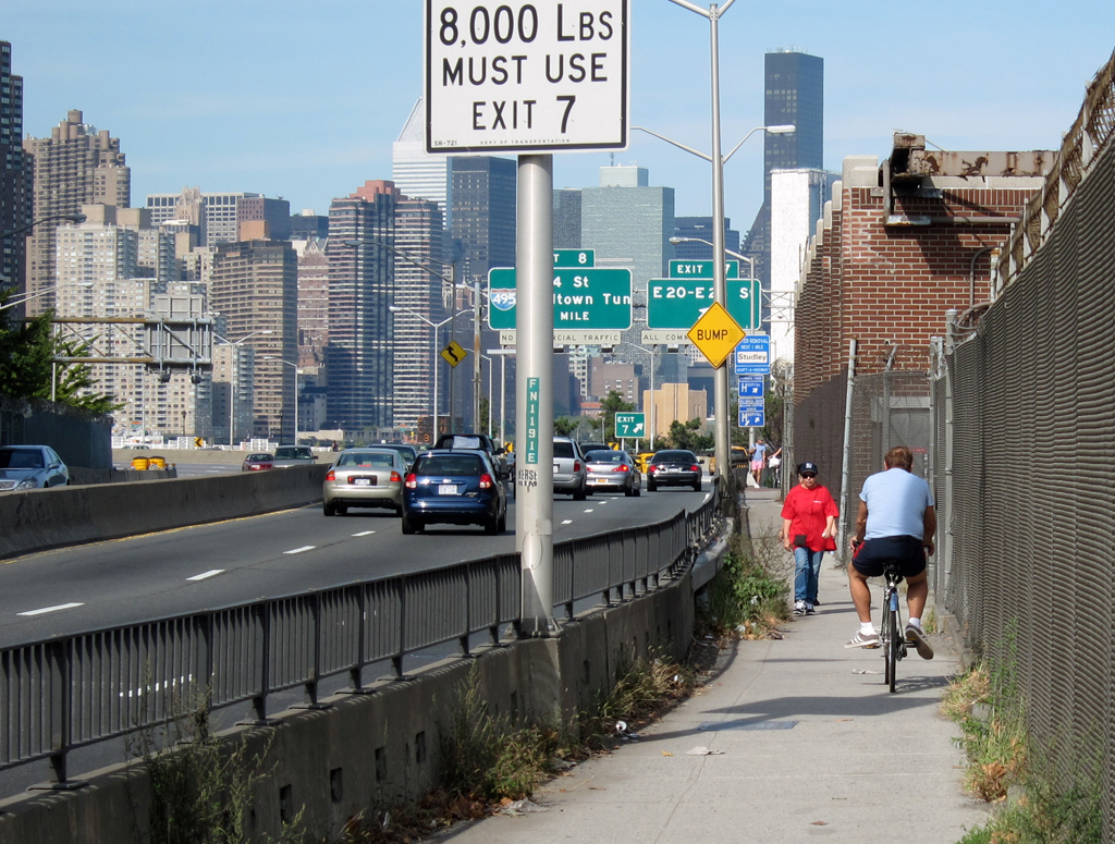
And, of course, taking advantage of these potential uses requires greater levels of “upland access,” whether it’s crossing the FDR or South Street on foot, on a bike, via public transit. How you get from your house to the waterfront is as important as how you get across a bulkhead into the water.
Let’s talk about upland access for a moment. I understand your recommendations include both improvements to the physical infrastructure, like bridges over the highway, as well as coordinating with the MTA to get additional bus stops nearer to the river.
The question for us was how to create a connection that feels like an extension of the park reaching into the neighborhoods of the Lower East Side, the East Village, Stuyvesant Town and Murray Hill. If you compare it to the West Side, the East Side has about half the number of access points to the waterfront. So we looked at both the number of access points as well as the quality of the crossing: at the street level, sometimes there will be a southern crosswalk but not a northern crosswalk; sometimes the crossings are very long; sometimes the conditions – especially if you are going underneath the FDR – are very poor and unpleasant. The overpasses have similar challenges: some of them are not ADA accessible; some of them are too narrow to accommodate both a cyclist and a pedestrian at the same time; some of them are fenced to the point of feeling like cages.
The upland access issues require sitting down with multiple agencies. The Parks Department, which maintains the overpasses over the FDR, is definitely interested in our work. And hopefully there will be enough resources to implement some of our recommendations. The New York City Department of Transportation (NYCDOT) could decide to redesign a couple of intersections based on our findings as well. The crosstown bike paths are currently not aligned with key access points or with overpasses that can accommodate them. The bus stops could also be keyed into where overpasses are located.
Were there precedents or relevant case studies from other blueways that informed your work?
We’ve looked at a few blueway plans, but there are very few precedents in urban areas. There are a lot of good precedents for site-specific strategies to break down a hard edge that separates land from water. But what we’re trying to do, combining an urban plan at this scale with a series of site-specific designs within a very urbanized setting, isn’t done that often. That’s why we want to develop a model process.
But there is certainly a lot of attention being paid to waterfronts in deindustrializing cities. How is the East River Blueway different from or complementary to the general opening up of urban waterfront areas for public access?
Well, in many ways the conditions here are unique. The community pressure, especially in the lower end of the site, for neighborhood park space is quite strong. The site abuts the Financial District and there are concerns about how to maintain this as a park that meets the needs of residents and creates amenities for them. So we really want our process to provide a model for using community feedback as the evidence base for developing solutions.
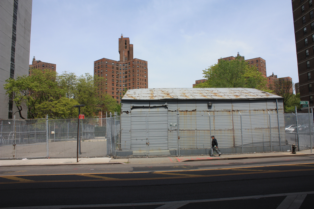
And, in urban design terms, the edge is a lot less permeable than a lot of the rest of the Manhattan. The neighborhoods adjacent to the East River between the Brooklyn Bridge and East 38th Street have a lot of public housing on superblocks and a lot of large institutions like hospitals that have historically faced away from the river. So the challenge here isn’t simply how to green an industrial waterfront and repurpose redundant warehouses. It’s much more complex.
So how does that specific series of conditions influence the way you’re thinking about green infrastructure, combined sewer overflow points (CSOs), and water quality issues more generally?
When we started thinking about this project, the questions of how to get people to the water and into the water was primary. What’s become more clear over time is the extent of the challenge that absorbing stormwater presents to the water quality piece of this project. If you look upland at all the New York City Housing Authority properties, there is a lot of green space, and there are people working hard to do as much as possible to absorb water there. One example is Two Bridges Neighborhood Council’s work to create a raingarden in the area.
But South Street presents enormous challenges of its own. The FDR has these downspouts that create unbelievable pooling on South Street after a storm. And ideally the streetscape there would have crossings and lighting and street trees that actively welcome you to the waterfront. So in terms of both green infrastructure and urban design, there are guidelines for future development that we will continue to think about.
There’s a lot of potential for change on South Street. Almost every single building has its back to the street. There are very clear ways that can change. And there are also a lot of parking lots that NYCHA and other groups are looking to develop. The whole relationship to parking will shift, and that will create a lot of opportunities.
You mentioned public information as one way to try to raise awareness and change attitudes about what’s possible on the river. How does that fit into your plan?
Rather than putting our final product on a website at the end of the project, we’ve started with the website. It’s a good platform for getting some people’s voices out there: people who have worked hard for 20 years trying to change the waterfront, experts who can explain some of the green infrastructure issues in simple fashion. We put our material up there to download. We link to everything that’s going on on the East River. People can upload photos and map their own ideas about challenges and opportunities.
Of course, we’re sensitive to the digital divide and realize that the website can’t be the only form of public engagement. We’re talking to people constantly, holding community meetings, we went on a CSO walk a few weekends ago. We want these public events and the website to create an open forum that isn’t just about getting ideas, but is also laying the foundation for building awareness, for helping to realize that there’s a there there.
All images courtesy of WXY Architecture and Urban Design.
*Project Partners:
Manhattan Borough President Scott Stringer
Assemblymember Brian Kavanagh
NYS Department of State Division of Coastal Resources
Community Board 3
Community Board 6
Lower East Side Ecology Center
The views expressed here are those of the authors only and do not reflect the position of The Architectural League of New York.


Comments