
We are celebrating 15 years — and counting — of stories that are deeply researched and deeply felt, that build a historical record of what the city has been.
We are celebrating 15 years — and counting — of stories that are deeply researched and deeply felt, that build a historical record of what the city has been.
On a pleasant weekday afternoon at the end of July, I hopped on my bike and headed to the far south east of Brooklyn. I found a proud, isolated (and proudly isolated) neighborhood and uniquely divided park. Their distance from the more dense sections of New York has given them a character unlike anything else you can find in the city.
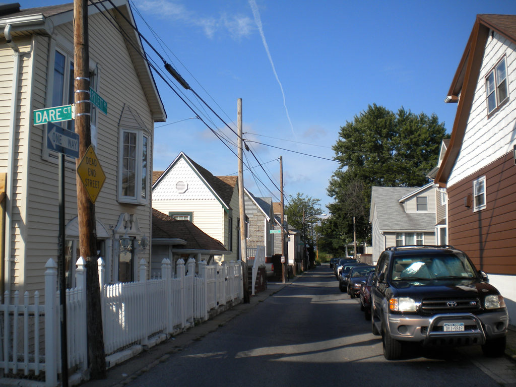
A typical street in Gerritsen Beach
Gerritsen Beach
Near the bottom of Brooklyn is a peninsula that juts into Jamaica Bay. Salt air and seagulls announce that you’re getting close to Gerritsen Beach. Home to New York City’s last remaining volunteer fire department, this community of over 5,000 is defined by its unique geography.
Few things create community like isolation. Gerritsen Avenue is the only road in or out and the nearest edge of the neighborhood is a half hour walk from the closest train station, so car, bike or bus are the options for getting there. Besides a few shops and restaurants, the neighborhood is entirely residential. If you’re going to Gerritsen Beach, chances are you live there, or know someone who does. As I made my way through the neighborhood, residents eyed me curiously. I didn’t belong, I think they knew because they know everyone that does. But with a friendly wave all was well.
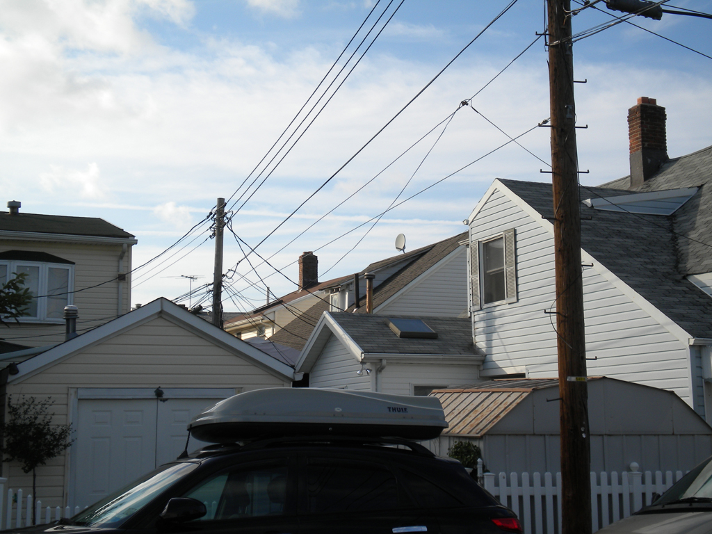
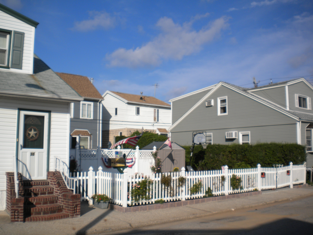
In the 1920s, Gerritsen Beach was developed as a beach community of wood bungalows on small 45- by 50-foot lots. Over time, residents winterized and added onto these small homes. What was envisioned and laid out as a vacation destination became a year-round neighborhood affordable to Brooklyn’s Italian and Irish working middle class. Many families have stayed for generations and often parents, children, aunts, uncles and cousins live within these blocks. Removed from the city and with lots suited to little else but small residences, the neighborhood has not been transformed by gentrification. Nor were its bungalows ever abandoned by urban flight only to be re-discovered and expensively restored. Rather, Gerritsen Beach has remained solidly in the middle class since its beginnings, its homes continually upgraded and repaired by their residents’ experienced hands. These bungalows aren’t cute and preserved; they’re lived in and expanded for families. It’s an historic neighborhood that has continued to live, not frozen itself in time.
Neighborhood Density
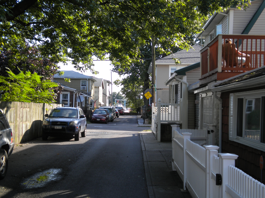
A woman sits on her second story patio, putting her only a few feet from the sidewalk.
The area’s original plan as a resort community resulted in a unique street fabric. Heading down the larger cross streets you pass what look like alleys, until you realize these are the twenty-foot-wide streets that make up most of the neighborhood. The houses are small and built right to the property line. Some might mistake them for garages, similar in scale at first glance. With homes built so close to the public realm of the street, the two interact. On a warm afternoon, only a few feet and an open window separate a living room from the sidewalk. The sounds of televisions, conversations or arguments spill out onto the street. Sitting on a patio is in essence sitting on the sidewalk. But its geographic separation from the rest of the city and its strong community give the whole neighborhood a semi-private feeling to begin with. Whereas most neighborhoods draw sharp lines between the public and private, with typical American suburban homes set back for privacy and many urban apartments elevated above the street, the entirety of Gerritsen Beach exists in a shared middle ground. The houses are semi-public and the streets semi-private.
Given the tiny lot sizes, most houses utilize their entire property. The few houses that have any yards to speak of can credit adjacent lots remaining undeveloped, creating a side-yard. In most single-family dwellings, the front yard is a green buffer between street and home, and the backyard is private space for recreation. The side-yard subverts that. It provides no buffer to the street and offers no privacy from it. It is recreational space that is open to the street and is in full view of two, three, sometimes four adjoining houses built right to its edge. Again, in Gerritsen Beach the private and the public fuse together.
One house’s side-yard, overlooked by four neighbors and open to the street.
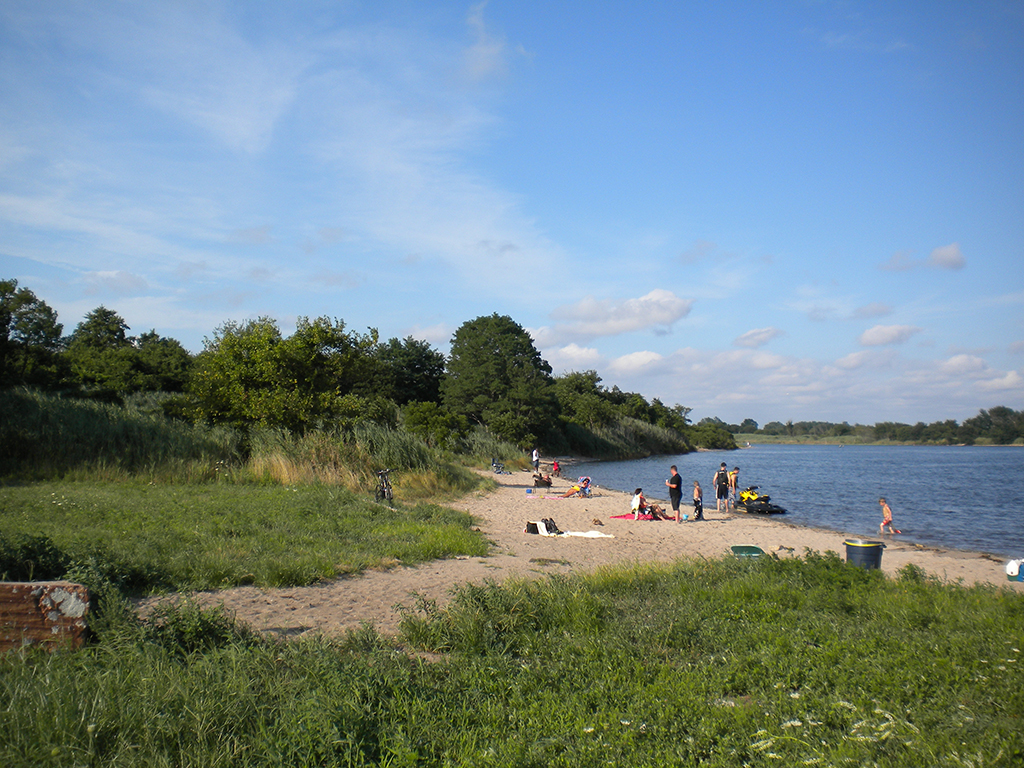
“The Point”
Unique urban characteristics are often responses to unique geographies. Much of Gerritsen Beach’s character comes from being on a peninsula. Streets reach out to Jamaica Bay, terminating with views of open water. A canal cuts most of the neighborhood into the “Old Section” and the “New Section” (architecturally, it doesn’t appear many years separated these two eras) and most houses facing the waterfront have docks and boats. In addition to the “Kiddie Beach,” where locals pay a yearly fee to support a safe beach for neighborhood children, there is “The Point,” a gritty beach at the terminus of Gerritsen Avenue. On a weekday afternoon it was filled, but there was not a single car parked. Everyone had walked there from around the neighborhood, and everyone but the kids had a beer in hand.
Gerritsen Beach occupies the western part of the peninsula. The eastern half is part of Marine Park, the largest park in Brooklyn. That’s where I headed next.
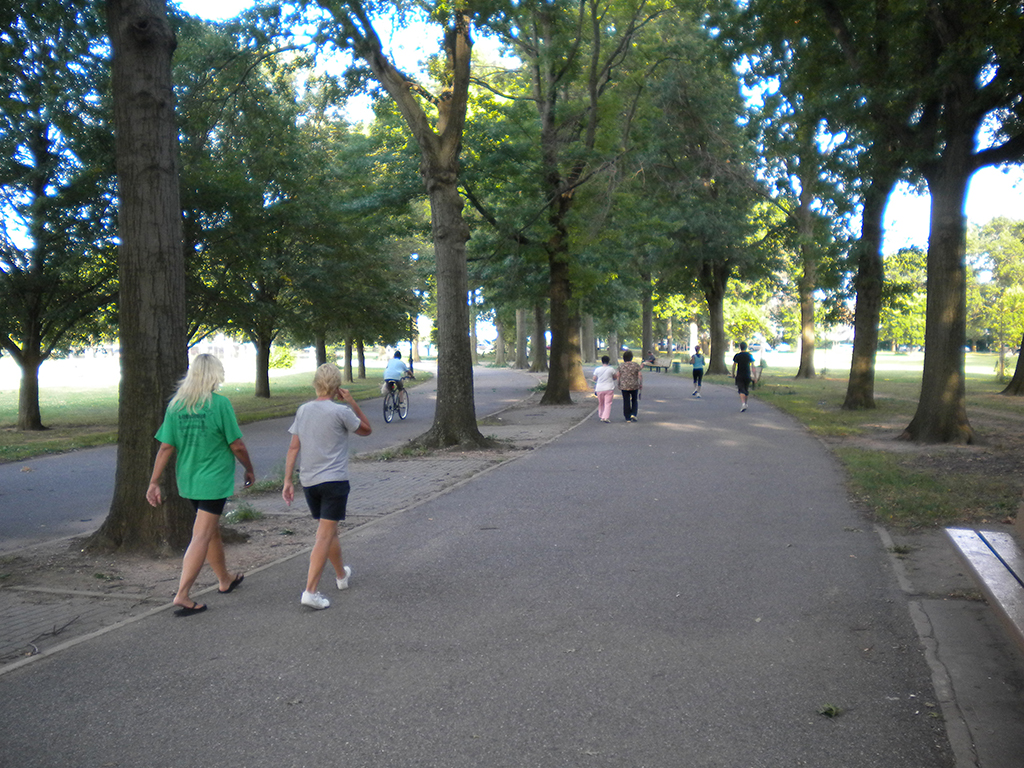
Well-used walkway in the neighborhood of Marine Park.
Marine Park
Who owns a park and what does it do?
Marine Park has two faces. To the north and west, the park borders the neighborhoods of Gerritsen Beach and the eponymous Marine Park. To the east lies Floyd Bennett Field. It’s not a destination park that attracts people from all over the city with seasonal programming, pavilions designed by famous architects, and twenty-somethings playing Frisbee. This park belongs to the neighborhood; it’s filled with groups of middle-aged women in track suits walking and talking, elderly couples sitting in silence, children playing Little League baseball games, and dog walkers of every age. The grass is patchy, but the paths are well populated by residents of a few blocks in either direction. It’s the kind of park too few neighborhoods have, fostering community and quality of life in the neighborhood around it. In a city that is fully developed, the opportunity for building more large, neighborhood parks like this one may have already been missed. But I couldn’t help wondering what opportunities we lost in developing a few high profile parks instead of more less-expensive ones. How many parks could embed themselves in and enrich neighborhoods for the price of one pier at Brooklyn Bridge Park? We can’t trade one for the other, and establishing a new park is an entirely different proposition now than it was when New York was transitioning from rural to urban, but it’s an interesting thought experiment.
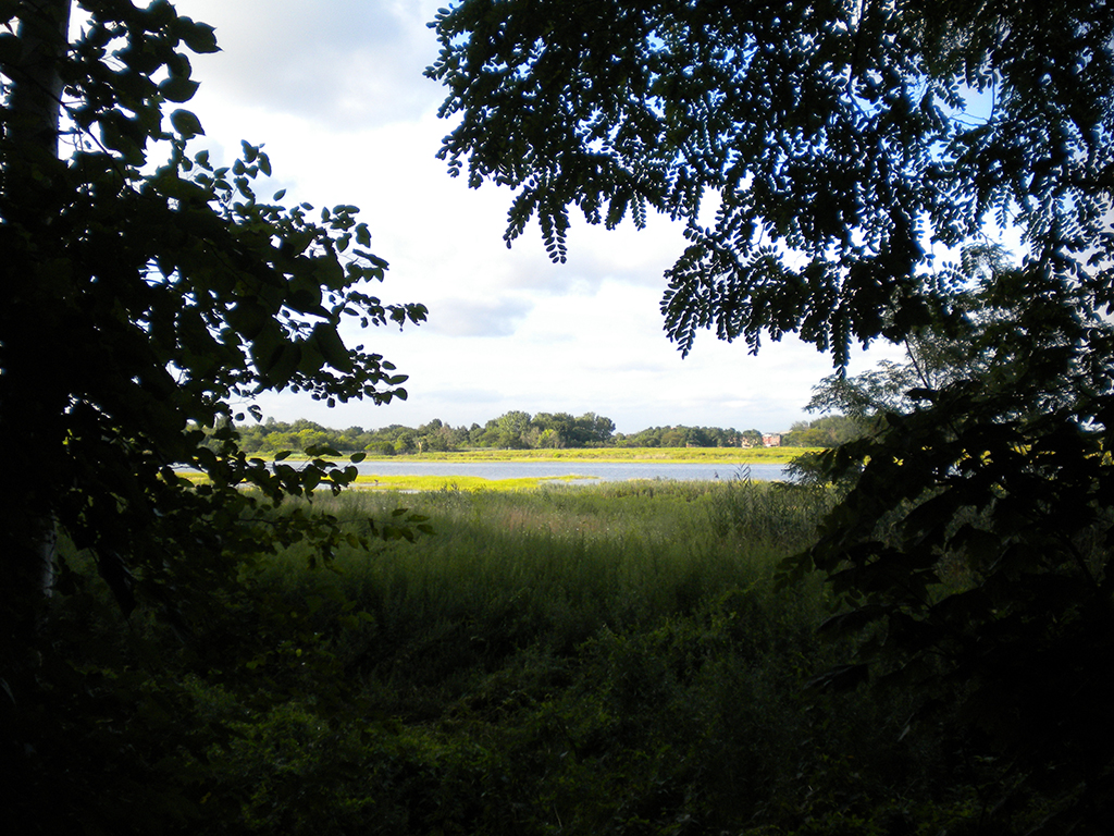
Glimpse of the landscape beyond from a neighborhood sidewalk.
Urban parks conjure images of manicured lawns, sports fields, carefully laid out allées of trees. The relationship between these man-made green spaces and dense urban fabric is one that we are comfortable with because we’ve created green space that conforms to the rigidity of urban form. But what happens when urban fabric directly abuts preserved natural landscape?
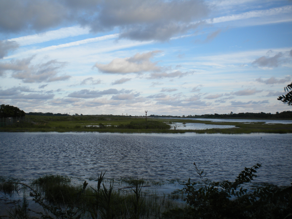
The periphery of the park abuts and serves residential neighborhoods, but its interior, engulfing the westernmost inlet of Jamaica Bay, is a nature preserve that protects one of the largest intact salt water marsh habitats in the city. It seamlessly connects to the Gateway National Recreational Area, 26,000 acres of preserved lands across Brooklyn, Queens, Staten Island and New Jersey controlled by the National Park Service. The neighborhood park is an asset to the surrounding neighborhoods, but the natural preserve is an asset to the entire region. It’s a place to both preserve the last bits of land where the region’s natural systems can still function, but also a place to give all residents of the area a chance to come see a tiny glimpse of what the landscape used to be.
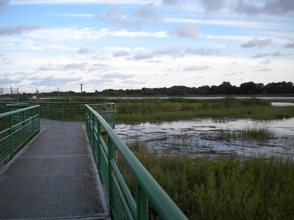
Nature Walk over and through the salt marsh.
Beginning not a hundred feet from busy Avenue U is a nature walk that plunges you immediately into the land as it once was. A bridge over the marsh lets you walk no more than a few inches over the water at high tide (slightly uncomfortable if you grew up, as I did, in a place where marsh means alligators), creating a powerful connection to the natural landscape. But overlooking the pristine salt-water marshland are the tops of apartment buildings, and in the distance loom the piers of the Marine Parkway Bridge. There is no middle ground, no pseudo-natural man-made landscape. This part of the park is the absolute natural versus the fully urban. What would the effect be if Central Park were restored to a natural landscape instead of one of the world’s great designed ones?
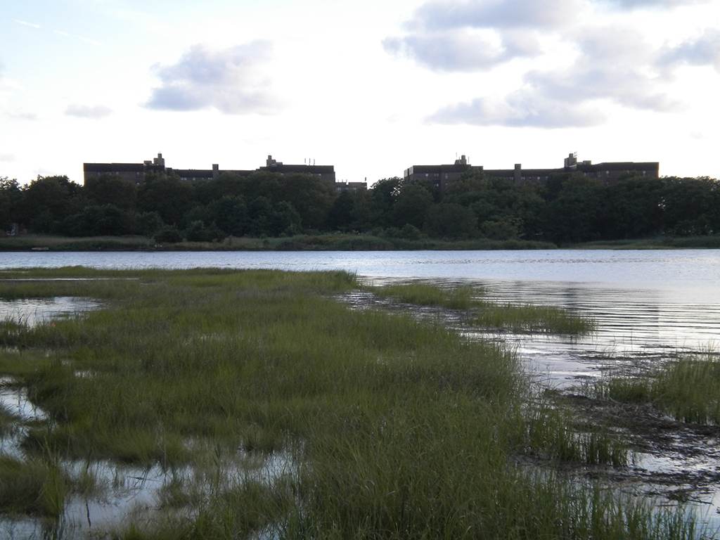
The tops of apartment buildings loom large.
When 99% of a natural environment has been destroyed to give birth to New York City, is there real value in preserving 1% in its natural state? Natural preserves like Marine Park can serve as showcases, educational opportunities, and retreats. What was once a natural landscape is now a city, the only way to turn that back would be to destroy the city itself. But these spaces let us know what used to be and let us escape to that, if only for a walk. If we are to live in the city, the least we can do is acknowledge what we changed. Not regret it, but acknowledge it.
The natural landscape
The views expressed here are those of the author only and do not reflect the position of Urban Omnibus editorial staff or the Architectural League of New York.
The views expressed here are those of the authors only and do not reflect the position of The Architectural League of New York.
Comments