
We are celebrating 15 years — and counting — of stories that are deeply researched and deeply felt, that build a historical record of what the city has been.
We are celebrating 15 years — and counting — of stories that are deeply researched and deeply felt, that build a historical record of what the city has been.
“With Randall’s and Ward’s Islands as stepping stones, the TRIBOROUGH BRIDGE strides into three boroughs—Manhattan, Queens, and the Bronx. The bridge proper, near the confluence of the Harlem and East Rivers, is a Y-shaped structure comprising four overwater bridges and twelve grade separations (or bridges over land)…On Randall’s Island the Bronx arm of the bridge meets, at a right angle, the Manhattan arm in the circular swirl of under- and overpasses of what is probably the most ingenious traffic-sorter ever constructed. From there the Bridge marches in a single long reach of stilted viaduct and trestle across Little Hell Gate and Ward’s Island to turn eastward on suspension cables over Hell Gate (East River) to Astoria, Queens…To prevent the customary degeneration of underbridge land into unsightly catchalls, these parts of the Triborough right of way were landscaped as parks and playgrounds…To the motorist, the Triborough Bridge brings an exhilarating freedom from congestion and stop lights that is worth much more than the toll charge. He must pass but one toll point, and he never crosses the path of another vehicle at grade. To the pedestrian, the bridge offers one of the most spectacular high-level walks in the country. In recommending that walkers start from the Astoria end, Lewis Mumford wrote: ‘Here is one of the few places…where one can see New York across a foreground of verdure and water and it must be counted one of the most dazzling urban views in the world.’”
-New York City Guide: A Comprehensive Guide to the Five Boroughs of the Metropolis
(Works Progress Administration, 1939)
The article below is one of a series of Field Trips on Urban Omnibus that revisit sites documented in the New York City edition of the Federal Writers’ Project’s (FWP) American Guide Series. The Guides were a Depression-era, Works Progress Administration (WPA) project to create travel guides to the 48 states (of the time) plus Alaska, Puerto Rico, and Washington DC, as well as 1,200 additional books and pamphlets recording American cities, roadways, folklore, and oral histories.
The Guides are not only one of the most comprehensive accounts of the United States at a specific historical moment, but they also provide a particularly interesting lens through which to view our present. This series of UO Field Trips is inspired by an online project called The American Guide, which encourages and collects similar documentation of contemporary America using the original FWP publications as a springboard. Previously in this series, Jonathan Tarleton went camping in Floyd Bennett Field and visited the former company town home to Steinway & Sons piano factory in Astoria, Queens. Here, Tarleton crosses the Triborough Bridge and examines the planning decisions that give the Bridge and Randall’s Island their particular character.
New York is a city of bridges, distinguished more by its many surrounding water bodies — an ocean, a sound, a tidal strait, bays, rivers, creeks — than by political lines on a map. Its boroughs are linked by behemoths of steel and concrete that are at once landmarks, transportation corridors, and symbols and manifestations of the city’s grandeur. Each has a distinct identity, some better known than others, defined by architecture, historical importance, connecting points, and users.
I only feel I have a sense of a bridge when I’ve walked or biked it, visually connecting the span with its end points. Many New Yorkers and tourists alike have experienced the Brooklyn, Manhattan, Williamsburg, and Queensboro Bridges in this way. This is where the Triborough Bridge, or the Robert F. Kennedy Bridge as it was renamed in 2008, loses out; walking or biking this bridge, as I found out on a recent morning, is neither simple nor intuitive, contributing to a lack of status in the city’s popular imagination that I felt compelled to explore.
Although it may not be ingrained in the typical New Yorker’s conception of the city, the Triborough (as I will continue to call it) certainly has an identity, or really a split personality. The one bridge is actually three, connected by a long overland overpass that stretches across Randall’s and Ward’s Islands, two formerly distinct land bodies made one after a fit of New York’s favorite pastime, landfill. The three branches of the bridge physically connect Harlem; Astoria, Queens; and Port Morris, Bronx. Its true purpose, however, was readily apparent as I began the gradual climb from the Astoria end across to Randall’s Island: this is a bridge to connect highways, not people or neighborhoods.
The car-centricity of the bridge is unsurprising given its origins with Robert Moses, the master builder of the car-centric city. Initiated in 1929 and, following a hiatus thanks to that pesky depression, completed in 1936, the bridge was conceived as a panacea for Manhattan’s east side traffic woes and an artery from the Bronx, upper Manhattan, and New Jersey to Moses’ parks on Long Island. The bridge now connects the Brooklyn-Queens Expressway, the Grand Central Parkway, the FDR, the Major Deegan Expressway, the Bruckner Expressway, and Harlem River Drive; all Moses projects that fan out to twist and meld with still more highways, parkways, and expressways.
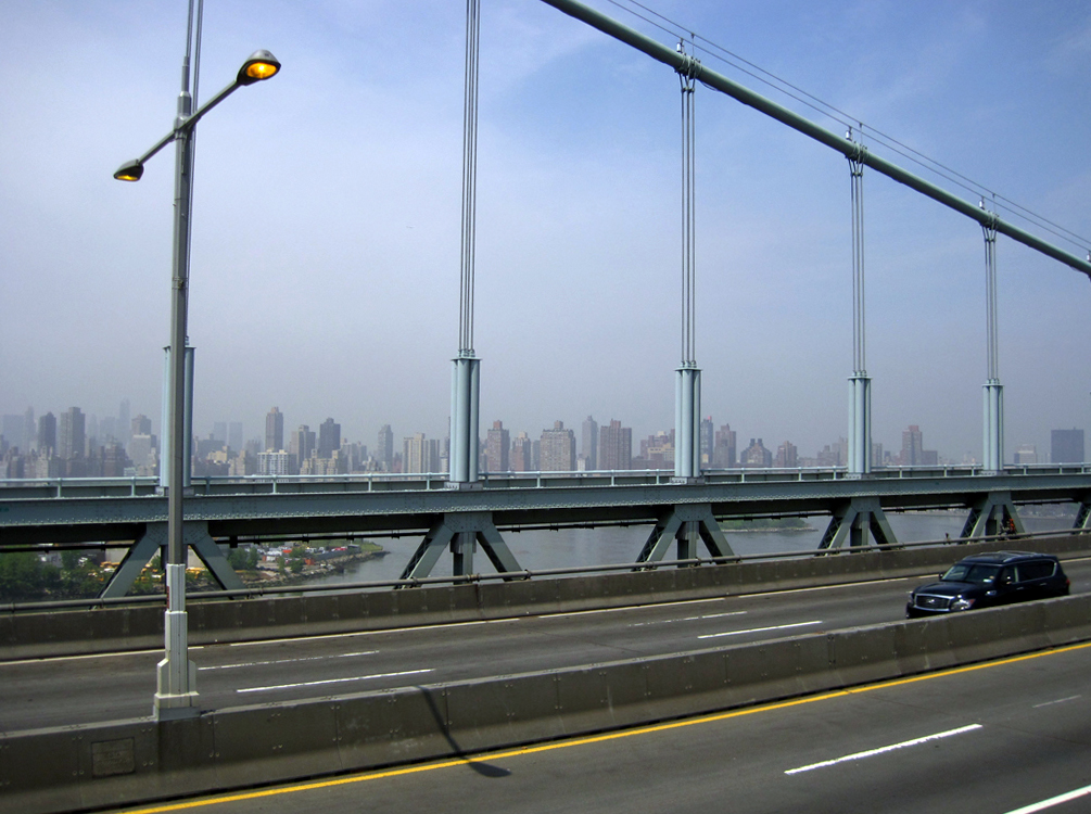
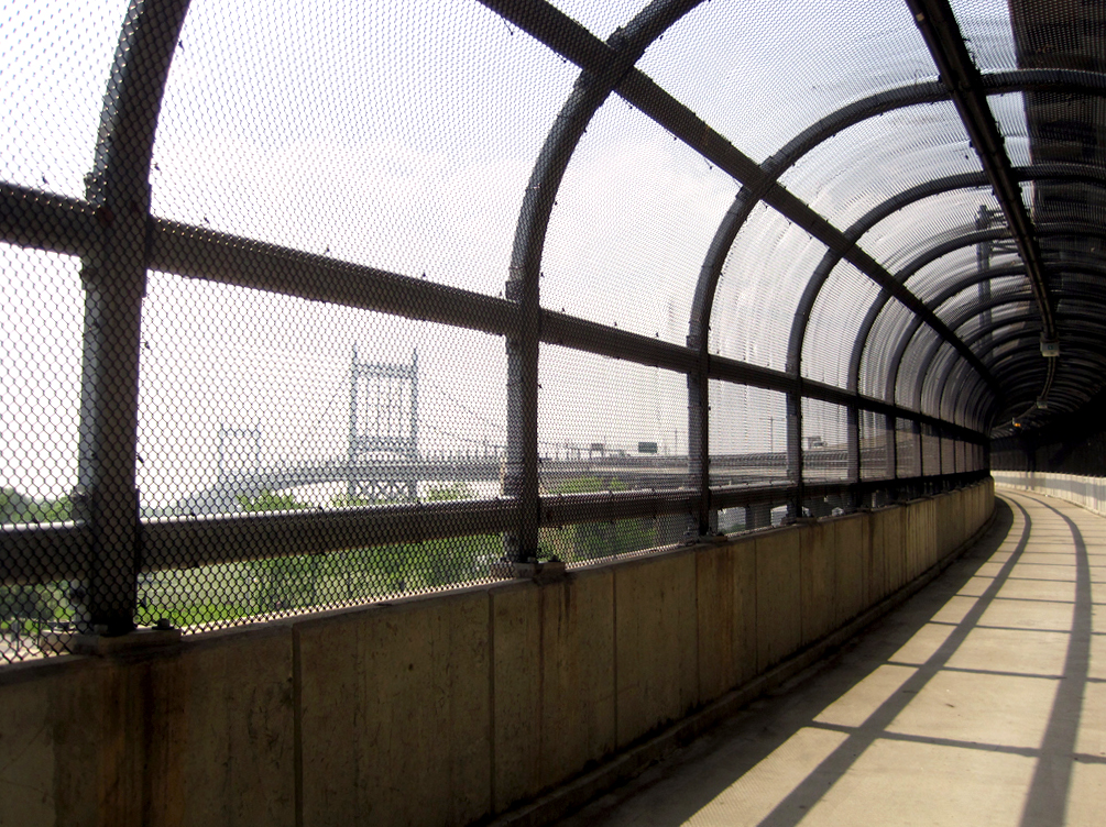
The beginning of the pedestrian path across the Astoria span, a suspension bridge that connects Queens to Randall’s Island, puts you side by side with eight lanes of speeding interstate traffic. The morning I crossed was foggy, the magnificent view described by Lewis Mumford in the New York City Guide largely obscured. Though the hazy outline of a phantom Manhattan in the distance was in itself beautiful, I found it difficult to enjoy with only a thin concrete barrier separating me from my much bigger fellow bridge users. A few sets of stairs near the center of the span mercifully led me above traffic level soon enough. Although the Astoria span is the monumental sibling of the Triborough triplets, its towers looked spindly in contrast with the Hells Gate Bridge, an elegant, red through-arch bridge to the north. The pathway fencing abated, and having only encountered one other crosser thus far, I felt strangely isolated perched above the East River.
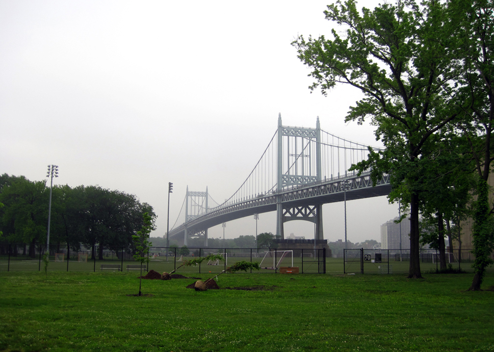
On the descent, the bridge curves to meet its island stepping stone, spitting pedestrians and bicyclists out on a road at grade while cars continue to speed on elevated concrete supports toward the Manhattan and Bronx spans. With no signage or paths to indicate where one might pick up a walkway to follow along, I took in some of the verdure Mumford mentions, ample parkland and sports fields, and wandered north on a winding road to find paths to shepherd me across the Triborough’s other arms.
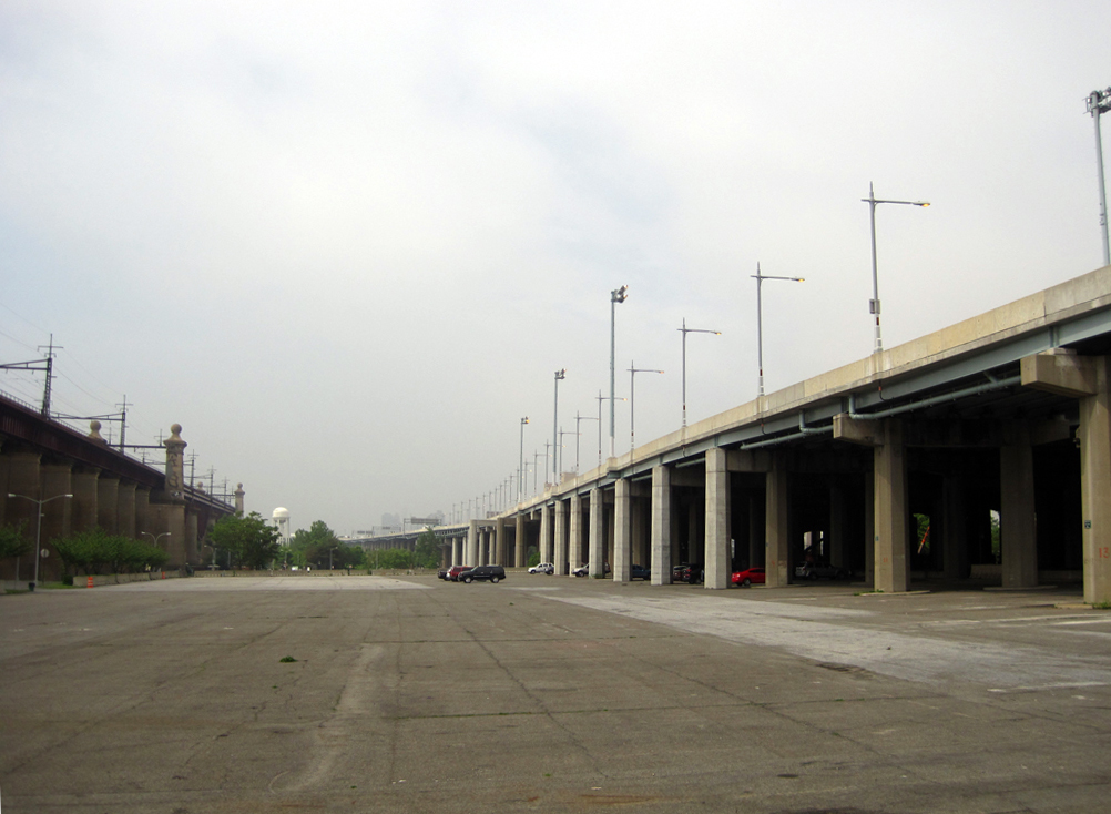
While the lush grass fields are enough to make any soccer player swoon and the views across the East and Harlem Rivers are majestic, Randall’s fails to fully live up to the propaganda of the guide. The WPA Guides were, after all, meant in part to shore up American identity in a time of crisis, so some embellishment of the accomplishments of its great citizens is unsurprising. To my eye, “customary degeneration of underbridge land into unsightly catchalls” has not been avoided in all parts. Some plots are used for Parks Department storage, others are barren and dark, and a substantial number scarred with empty parking lots. The greener pastures of the island were reserved largely for park employees, a high school lacrosse team, and me that morning, partially thanks to the paltry pedestrian connections to the island Moses intentionally neglected, thus reserving the island for the wealthier car-driving customers of his great bridge. I was, however, grateful for the quiet then as I took in the many manicured paths and fields.

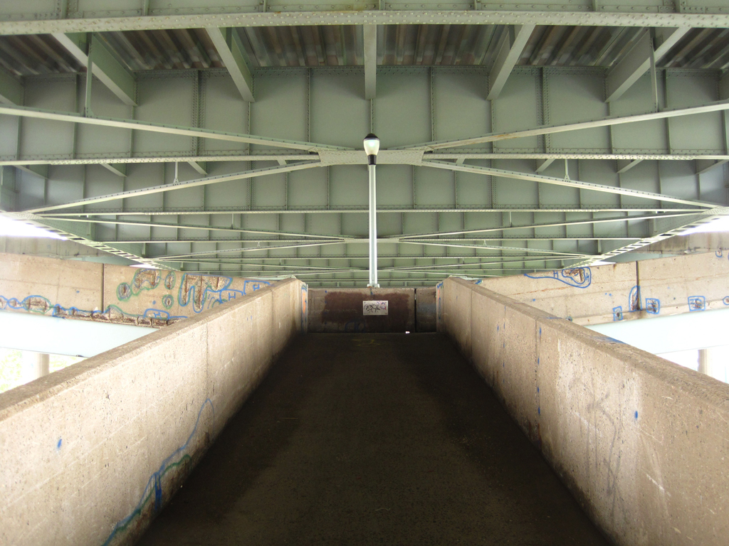
On the north end of the island, closer to Harlem and the Bronx, the fields become somewhat scragglier, and the green space is interrupted by “the circular swirl of under- and overpasses.” After some snooping around the grimy underside of the Manhattan span — a maze of cars, fences, and cracked asphalt — I headed across the vertical lift bridge toward the eastern terminus of 125th Street. Here the view was not of a distinctive skyline or greenery, but rather more cars and asphalt framed by angled meshes of metal. I kept my jaunt into Manhattan brief, surveying the mindboggling confluence of Harlem River Drive, the FDR, and 125th Street; whether the traffic patterned “worked” or not, it was rather unpleasant.

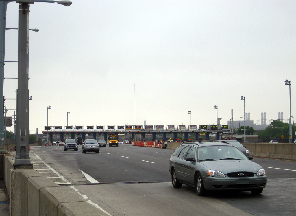
Hopping back to Randall’s Island from Manhattan gives you a full view of the center of an empire: the Triborough toll booth. The bridge, and specifically the public authority that constructed and controlled it, was Robert Moses’ most powerful tool. As the sole member of the public authority that managed the bridge, he used the proceeds from its tolls to amass power and still more funds through new projects that only he had the money to build while the City’s budget floundered, largely outside of the realm of public review thanks to the legal status the authority enjoyed.
Back down on hard ground, I biked past the MTA’s complex, situated just below the toll booths, to head up the walkway of the Bronx span. While the Manhattan and Astoria spans of the Triborough preserve the navigability of the water below for large ships, the ambiguous strip of water separating Randall Island’s fields from the Bronx’s industrial waterfront was deemed unnavigable. The bridge itself is thus a fairly dull affair — a flat truss span without any distinguishing flair — but the views below exposed the stark juxtaposition of some of the still-active industrial waterfronts of the city and the complex estuarine confluence of the city’s waters. Herons perched in what most likely was once a thriving marsh below, evidence that the ecology of the area, though radically reshaped by dredging, landfill, and pollution, still exists in spite of our best efforts.

After quickly surveying the industrial yards in the Bronx, I headed back across to Randall’s once again and south to gain the Astoria pathway. The sun had begun to peek out, and as I biked back across to Queens, I could see more of the view Mumford held in such high esteem. While the Manhattan skyline brings to mind feats of engineering, trying to conceive of the scope of Triborough proved more fascinating for me. I suppose this was the identity that I had seen in the bridge: a complexity, multiplicity, and a kind of utilitarian monumentalism that makes it less appealing and knowable than the graceful single spans downriver, but no less impressive.
All photos by Jonathan Tarleton.
The views expressed here are those of the authors only and do not reflect the position of The Architectural League of New York.