
We are celebrating 15 years — and counting — of stories that are deeply researched and deeply felt, that build a historical record of what the city has been.
We are celebrating 15 years — and counting — of stories that are deeply researched and deeply felt, that build a historical record of what the city has been.
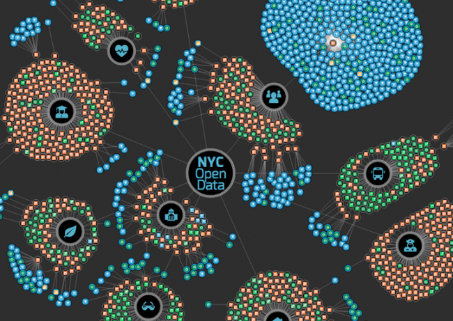
Visualization of the NYC Open Data portal | Image via NYC Open Data
Open data, and the interactive mapping and data visualization that can come of it, has become a de facto engagement and storytelling tool among contemporary journalists, social justice activists, and civic-minded technologists. But despite its allure, open data’s potential for fostering civic engagement and creating transparency and dialogue is plagued by issues of usability, access, and quality control. New York City has been at the forefront of opening government data for analysis and use by the public thanks in large part to the support of pro-technology officials, such as Manhattan Borough President Gale Brewer and NYC’s Department of Information Technology and Telecommunications’ Director of GIS Colin Reilly, and civic tech advocacy groups like BetaNYC, Code For America, and Open Plans. Such groups aim to make this data actionable to the benefit of both the general public and local governments, some of which lack the capacity or foresight to develop their own tools that do so. New York’s open data needs this: while available from online sources like NYC Open Data or Bytes of the Big Apple, its datasets still have many drawbacks.
Barriers to open data’s use in developing meaningful analysis, visualizations, or applications range from knowing where to find current and appropriate data, effectively cleaning and parsing it, locating useful metadata and readable documentation, becoming comfortable with obscure data formats, and learning database programming and/or helpful open source software that enable working with the data. Civic technologists Anthea Watson Strong and Mark Headd both see the answer to some of these problems in “dogfooding,” a tech industry term that means the team developing software actually uses the product to evaluate its effectiveness. If the government isn’t using the tools through which it is publishing its own data, then it has little incentive to improve them.
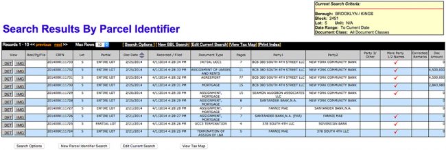
Screenshot of ACRIS query
New York’s available data is spread across a number of different formats and sources. Some data web portals, like the New York City Department of Finance’s Automated City Register Information System (ACRIS), provide an interface for searching for discrete pieces of data but lack features to encourage their instrumentalization. ACRIS is an extremely valuable resource for tenants’ rights groups fighting issues of speculative landlord harassment or negligence, as it allows a user to look up any NYC property’s transaction history, one of the few tools to discover who actually owns a property. This is especially crucial now, when the registered owners of many properties, especially those purchased as speculative investments, are Limited Liability Companies (LLCs) that hide the identities of individuals or parent companies that own them. Although access to these transaction histories is a boon to public information, ACRIS lacks the ability to search by owners’ registered business addresses, a method that may help find other properties a landlord behind a particular LLC may own. Furthermore, ACRIS renders property transaction histories as HTML tables in a user’s web browser and does not allow a user to download search results in a machine-readable table format, such as a Comma Separated Value (CSV) or Excel file.
I recently sought an education in computer programming and web development with the desire of using this kind of data for the public good. Carrying with me the perspective of a cartographer, geospatial information specialist, urbanist, and social justice activist, I have recently worked on two web applications, Am I Rent Stabilized? and the North West Bushwick Community Map, that attempt to tackle challenges of access and usability with New York City’s open data by using it as a prompt for civic action. Developing these projects led me to critically examine how strengthening the connection between data and advocacy can help augment the work of affordable housing advocates.
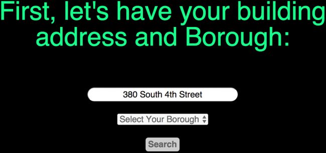
Screenshot of Am I Rent Stabilized?
Am I Rent Stabilized? encourages NYC tenants to find out if their landlord may be illegally overcharging them for rent-stabilized units[1] and, if so, helps them take action. New York landlords are required yearly to register their buildings’ rent-stabilized apartments with the New York State Department of Homes and Community Renewal (DHCR). But there is no penalty for non-compliance, making registration voluntary in practice. The lack of a publicly available, comprehensive database of rent-stabilized apartments presents a significant challenge to preserving New York’s existing affordable housing stock.
Landlords have a financial incentive to remove rent-stabilized units through vacancy decontrol: once a tenant moves out, landlords are allowed to raise rents higher than yearly rates set by the Rent Guidelines Board for those units when they are occupied. Once an apartment’s monthly rent exceeds $2,500, the unit is destabilized and landlords can rent at market rates going forward. To move the process of destabilization along, harassment and coercion of long-term tenants with cheaper, legally regulated rents into leaving their apartments, as well as lying about the cost of apartment renovations or the true rent of the apartment, are well-documented strategies employed by some landlords. It is estimated that vacancy decontrol has resulted in a loss of 300,000 rent-regulated units since 1993 when the current vacancy decontrol loophole was enacted in New York’s rent laws.
To make matters worse, the burden of proving illegal vacancy decontrol or rent overcharge is placed on the tenant, and proactive investigation by government agencies of such illegitimate practices by landlords is lacking.[2] The current system requires that tenants file a complaint with the DHCR and/or take their landlord to court to dispute an overcharge. This procedure can be overwhelming and arduous for tenants, especially those who have low incomes, work full time, or speak English as a second language, if at all.
The process of building Am I Rent Stabilized? illustrates the gap between open information and an actionable framework. Although the most current list of buildings with registered rent-stabilized apartments is available on the Rent Guidelines Board’s website, it is published in a PDF file format and thus not easily machine-readable. Following a Freedom of Information Law request, I was able to acquire the lists from 2002, 2005, and 2009 through 2013 in Excel format so that they could be parsed. I then went about identifying buildings that may have unregistered rent-stabilized apartments. I compared properties on the DHCR lists with a query on the city’s tax lot database (PLUTO) for properties with buildings that were constructed prior to 1974, include six or more residential units, aren’t co-ops or condos, and don’t belong to the NYC Housing Authority — the housing stock that could still contain rent-stabilized apartments designated under the Emergency Tenant Protection Act of 1974.[3]
The data confirms the presumption that many landlords do not register rent-stabilized apartments with the DHCR, enhancing the potential for them to mislead new tenants. Through inspecting my own building’s tax documents on the NYC Department of Finance’s website, I learned that all but three units in my building are rent-stabilized, though my building wasn’t registered until recently, in 2013. Am I Rent Stabilized? allows anyone to search for their address, and using a combination of the NYC PLUTO query described above with the DHCR list of registered buildings from all years to which I had access, the application tells users whether or not they live in a building that likely has rent-stabilized apartments. Following the search result, the app encourages the user to request their rent history, a better indicator of an individual unit’s rent-stabilization status. Finally, the app recommends either seeking advice from a local tenants’ rights group if the rent history is unclear or filing a complaint with DHCR if a rent overcharge is apparent.[4]
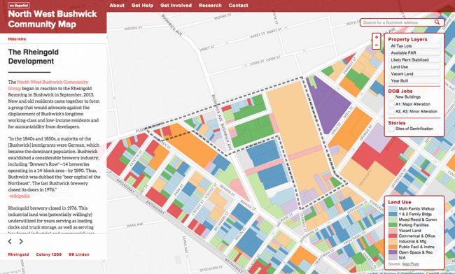
Screenshot of North West Bushwick Community Map
While Am I Rent Stabilized? takes a citywide approach, the North West Bushwick Community Map focuses on a specific NYC neighborhood. The map’s development came in response to the recent purchase of the expansive former Rheingold Brewery complex by a private developer, and its subsequent rezoning from industrial to residential. The complex’s owners had originally planned to fully redevelop the land into luxury housing; residents of Brooklyn’s Community District 4 were not notified of the plans until the rezoning process was well underway. The North West Bushwick Community Group (NWBCG) organized in response and residents succeeded in pressuring the developer into designating 30 percent of the units affordable and donating smaller lots for community use. At the time of this writing, it is unclear if the developer will be held accountable to this commitment.
Michael Mintz of the NWBCG originally developed the map as an interactive, web-based tool to give community development and tenants’ rights groups in Bushwick improved access to open government data related to housing, land use, and property. Through an interactive map, a user of the website can easily look up owner information (including a direct link to a building’s transaction history on ACRIS), what properties likely have rent-stabilized apartments, the location of vacant lots, where Department of Buildings permits have been filed, and a building’s available Floor-to-Area Ratio (FAR).[5]
In the fall of 2014 as part of a team of graduate students from the Parsons MFA Design and Technology program, I worked with Mintz and the NWBCG to improve the map’s usability, design, and the optimization of its data storage and retrieval. Because the map exists as a public website, the Parsons design team persuaded NWBCG to make the map appealing to a general public beyond its primary audience of housing rights advocates. To accomplish this we included an introductory, interactive narrative that links data to the story of affordable housing and displacement in Bushwick. The site also contains information and resources for tenants to protect themselves from landlord harassment, such as where to get help with housing issues and how to get involved with NWBCG and similar organizations.
That the original creator of the website was part of NWBCG made it easier for the Parsons team to partner with the group to determine practical and meaningful design choices while completing the redesign. NWBCG also facilitated wider use of the site and solicited feedback through its network of community development and tenants’ rights partners. Future planned updates to the map include incorporating participatory GIS data[6] and the addition of personal stories of residents who have experienced displacement due to gentrification.

Screenshot of North West Bushwick Community Map
Web applications, especially civic-oriented ones like Am I Rent Stabilized? and the North West Bushwick Community Map, do not exist in a vacuum. For these projects to be genuinely successful, they need to be developed with the audience they seek to benefit, and promoted through non-digital forms of networking and partnerships. Since their release, both websites have received praise and criticism. Tenants’ rights organizations provided invaluable feedback about Am I Rent Stabilized?, some noting that labeling a building as rent-stabilized can be misleading given their typical mix of stabilized and market-rate apartments. Using a simple app to provide information about a complex situation without misleading users is perhaps the greatest challenge of this kind of project. I am currently redesigning the app based on such feedback, incorporating Spanish and Chinese translations, a mobile-responsive design, and a feature that identifies tenants’ rights groups that operate in a user’s neighborhood based on the address searched. The version two update should be live next week. And this month I’ll be reaching out to roughly 90 community organizations and tenants’ rights groups across the city to promote the site’s use. The opportunity to redesign the NWB Community Map is particularly atypical — most affordable housing advocacy organizations and similar social justice groups lack the capital for hiring the design and tech talent needed to realize such projects. Often, they may not even realize to what extent contemporary technology can help with advancing their work. The Parsons MFA DT student team was in a unique position to accomplish this work with no budget.[7]
Am I Rent Stabilized? and the NWB Community Map are not intended to be perfect solutions to the problems of open government data mentioned here. They are however first pass attempts at creating tools with contemporary web technology to improve how open government data can be utilized for civic good. This work has solidified my understanding that future efforts to use open government data for civic good should be informed by the needs and work of the citizen groups that can most benefit from them. There’s no doubt that this is an exciting time to be involved with open data and civic tech. But it is clear that without external organizations and individuals advocating for improvements, the data available on government open platforms will continue to be limited in terms of access, usability, quality, and, ultimately, impact.
NOTES:
[1] Rents in rent-stabilized units cannot be raised above a certain rate set yearly by the City’s Rent Guidelines Board, and tenants in rent-stabilized units retain the right to renew their lease. For more on rent stabilization, visit the Rent Guidelines Board website.
[2] Mayor de Blasio did, however, recently announce a new, city-state run Tenant Harassment Prevention Task Force to investigate landlords engaging in such practices.
[3] It should be noted that more recently constructed apartments may also be rent-stabilized through tax exemptions such as 421-A.
[4] If the DHCR finds a tenant’s complaint to be valid, the tenant’s landlord will be required to reimburse the tenant for back rent and penalty fees. In one recent case, a Hamilton Heights man was awarded $112,000 in back rent.
[5] Available FAR (a building’s total allowed FAR minus its currently built FAR) is a useful indicator for determining what properties are likely to be purchased and renovated, as FAR determines a developer’s ability to legally build larger without zoning changes or variances.
[6] Namely, a survey of vacant properties and new development in Bushwick that was created by residents with assistance from the Parsons Urban Ecologies program during the fall of 2014.
[7] We were connected to NWBCG through our Parsons class Tactical Urbanism, taught by the extremely talented NYC-based artists, activists, and community organizers Melanie Crean and Caroline Woolard in Fall 2014.
The views expressed here are those of the authors only and do not reflect the position of The Architectural League of New York.