
We are celebrating 15 years — and counting — of stories that are deeply researched and deeply felt, that build a historical record of what the city has been.
We are celebrating 15 years — and counting — of stories that are deeply researched and deeply felt, that build a historical record of what the city has been.
Just a few months ago, New York City’s zoning code celebrated its 100th birthday. With the passage of time, zoning — the set of laws that determine what can be built where — has become both mythologized and mystifying. On the one hand, it has spawned ziggurats, POPS, and other urban innovations. On the other, the rules can be so complex that residents need special tools to make sense of them. The last year has seen planners and historians celebrate the zoning code and ask what comes next, while New Yorkers worry what rezoning has in store for the neighborhoods they call home.
In the wake of the anniversary, the curators of Mastering the Metropolis, currently on view at the Museum of the City of New York, dive deep into what zoning has meant for New York City neighborhoods. From Flatbush to Fieldston and from SoHo to Inwood, zoning has not been the technical process its forefathers imagined, but rather a fierce political arena where New Yorkers fight over the form and content of their neighborhoods and the future they imagine for the city. –M.M.
The 19th century city was crowded, chaotic, darkened by looming skyscrapers, and dirtied by factories. First instituted in 1916, New York’s zoning code proposed an antidote: the rational organization of structures, with commercial towers downtown, manufacturing along the Brooklyn waterfront, and low-density housing on the border of Queens and Nassau County. The control projected by the City’s new zoning maps belied the fierce battles that redrew the maps and amended the code thousands of times. It turned a technical planning process governed by anonymous experts with some promise of democratic negotiation into a political negotiation freighted with power asymmetries, prejudice, and the influence of money.
The debates in the neighborhoods preserved and transformed by the code bring this struggle into relief. Over the last 100 years, New Yorkers and the City of New York have turned to the code to exclude apartment buildings from single-family districts, make room for artists in moribund industrial neighborhoods, and require the private sector to develop affordable housing that the City cannot pay for or is unwilling to build with taxpayer money. The code’s ability to adapt to shifting demographics and political agendas makes it a vital arena where New Yorkers wrestle to shape their city.
In 1913, lawyer Edward Bassett began to investigate zoning as a means to regulate New York’s development. He first looked to Germany, where a “zone system” had first been established in the late 19th century. But ultimately Bassett found the vision for what he wanted to achieve much closer to home, in Flatbush, Brooklyn. Development in Flatbush had a semblance of order, separation, and cohesion: it consisted of major business streets for shopping, areas of detached houses, and buffer districts of apartment houses to separate them. Bassett hoped that the zoning rules his commission established in 1916 would help spread this pattern of development through the outer boroughs. Although the original code did seek to separate high- and low-density housing, it still tolerated a great deal of residential mixing. In part, this was due to Bassett’s fear that a zoning code that pushed too far would be overturned in court, but it also came out of his belief that neighborhoods should be composed of small, homogenous areas.
But in the first decades of the Zoning Resolution, wealthy New Yorkers argued that they needed even greater separation and development restrictions in their neighborhoods to protect property values from the invasion of apartment buildings and the types of people that lived in them. Elite homeowner associations lobbied the City Planning Commission to amend the code, splintering the city’s residential districts into types and safeguarding homeowners’ desire to self-sequester.
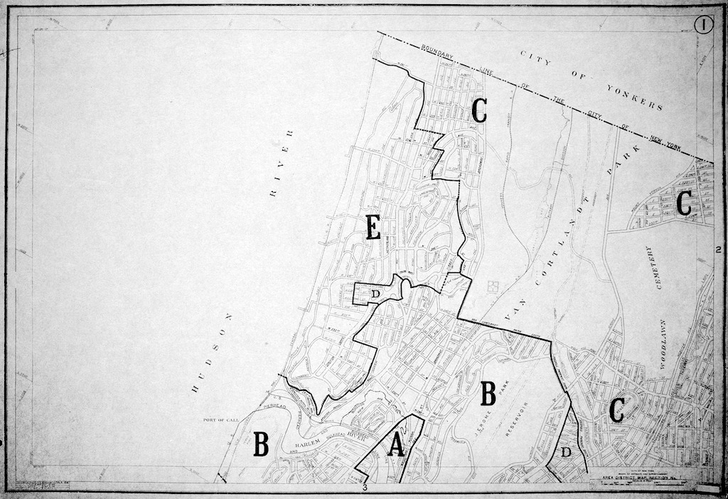
The neighborhood of Fieldston in the Bronx was at the forefront of this movement in the 1930s and 1940s, a period when the city’s residents were just learning how zoning operated. The original code zoned most of Fieldston and neighboring Riverdale as a residential “E district,” the most restrictive zoning intended for “high-class villas.”
E districts were designed to protect neighborhoods like Fieldston — planned in 1909 as a bucolic enclave with winding paths and homes on large lots — from an “invasion” of apartment buildings that offered more affordable rental units than the neighborhood’s stately mansions. Afraid that the courts would not uphold exclusive single-family housing districts, the writers of the 1916 code hoped that the significant yard and lot requirements of the E district would deter the construction of apartment buildings. The E district designation was originally given to a few upper-class neighborhoods that were primarily made up of country homes, like portions of Bay Ridge in Brooklyn and the Riverdale-Fieldston section of the Bronx.
But developers quickly found ways to evade the restrictions, primarily by assembling large lots, and began building apartment houses in E districts. To close these loopholes, villa owners persuaded the City to establish an F district in 1922, which required 15 percent more space for yards than an E district and reduced the developable footprint of any new building.
The cat and mouse zoning game between Fieldston homeowners and developers intensified when the Henry Hudson Bridge connecting Manhattan and Riverdale was completed in 1936. As developers sought to exploit loopholes and build apartments in newly covetable single-family zones, homeowners demanded ever more stringent “Area District” designations to protect their neighborhoods’ suburban character. In 1937, the A.C. & H.M. Hall Realty Company announced plans to develop a series of multi-family houses in lower Riverdale. The Fieldston Property Owners’ Association persuaded the City Planning Commission to establish the G district designation in 1938, exclusively for single-family homes. G districts quickly spread throughout the city, mapped at the requests of homeowners who lobbied the city government to keep apartment buildings out of their neighborhoods. Throughout the 1930s and 1940s, the City established districts that further stratified residential types, creating area districts for row houses (D-1), for one and two-family houses on small plots and no apartment houses (E-1), for single-family homes or low-rise apartments (F-1), and for districts that would act as buffers between “choice” neighborhoods and apartment sections (DD). This balkanization became part of the zoning’s DNA and was enshrined during the code’s first major revision in 1961, which established ten different residential zones.
Zoning, unlike taxes or alternate side of the street parking rules, is a tool used by both city government and residents to achieve their desired ends. In Fieldston and Riverdale, residents used zoning to preserve their bucolic, low-density corner of the Bronx from intensive development. The City of New York used the 1961 comprehensive overhaul of the 1916 code to reserve land for industrial uses by explicitly protecting it from residential and commercial conversion — an ironic turn from the earlier complaints about the invasion of factories on Fifth Avenue in the early 1900s. Rather than allow industrial land to be converted to housing or commercial uses, in the same way that Bronxites in Riverdale and Fieldston objected to the development of apartment buildings in their neighborhood, the City Planning Commission took action and re-wrote the code to preserve industrial land.
Studies from 1950 and 1958 projected the primacy of industrial jobs in the local economy into the 1970s. Armed with these facts, the City Planning Commission rewrote the zoning code to prevent the conversion of industrial sites to residential and commercial uses. The 1961 code eliminated the hierarchical separation of uses that allowed residential and commercial uses to locate in zones designated for industry, but excluded industrial uses from locating in commercial or residential districts. James Felt, the Chair of the City Planning Commission who presided over the development and implementation of the 1961 Zoning Resolution, argued that the 1916 code’s permissive mixing in unrestricted zones made city sites less attractive than cheaper and larger suburban sites that were easily accessed by the automobile. Despite Felt’s attempts to protect industry from the relocation of factories to New Jersey and families to Long Island through zoning changes, the 1961 Zoning Resolution was powerless to stem the tide of postwar suburbanization and the deindustrialization of American cities.
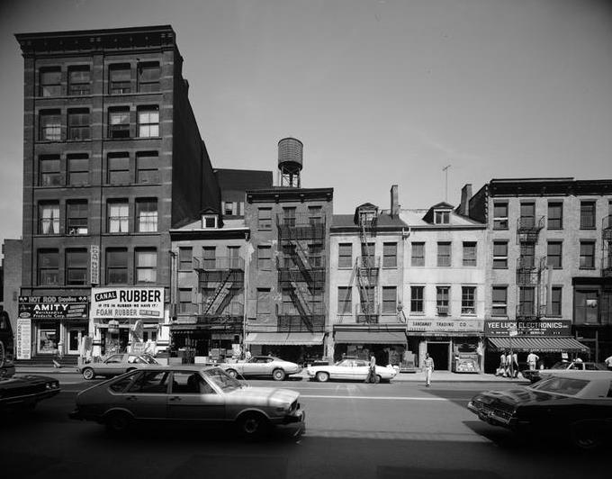
The faith of the authors of the 1961 code in New York’s ability to continue to attract residents and industrial jobs produced a code that overzoned land for manufacturing uses and made it difficult for landowners to convert sites to commercial or residential uses. In SoHo, artists took advantage of this regulatory sclerosis and set up studios and residences in buildings zoned for manufacturing. For nearly three decades, the promise of the Lower Manhattan Expressway cast a shadow of uncertainty over the neighborhood. Ambivalent SoHo landlords held onto their buildings but allowed them to fall into disrepair. Artists moved into manufacturing lofts there, renovated them at their own expense, and paid landlords a nominal rent.
The longer the City waffled on LoMEx, the more artists poured into the neighborhood. By 1970, an estimated 2,000 artists lived in SoHo. Yet, their presence there contradicted a zoning code that did not allow for residential and commercial conversions in industrial areas. They organized and used their connections to elite cultural institutions to lobby the City to recognize their right to live in these spaces. In 1971, two years after LoMEx was “demapped,” the City Planning Commission legalized artists’ occupation of properties zoned for manufacturing uses in SoHo.
In SoHo, zoning regulations were amended to protect a small group of committed, organized, and well-connected artists to reanimate a languishing neighborhood. They carved out a new housing type that still remains the exclusive domain of certified artists — the enforcement of this regulation is a separate story. While zoning was used to curb development in Fieldston and protect the neighborhood’s context, in SoHo, artists used zoning to overturn the existing neighborhood’s character and create a new hybrid work/living type that had previously not existed.
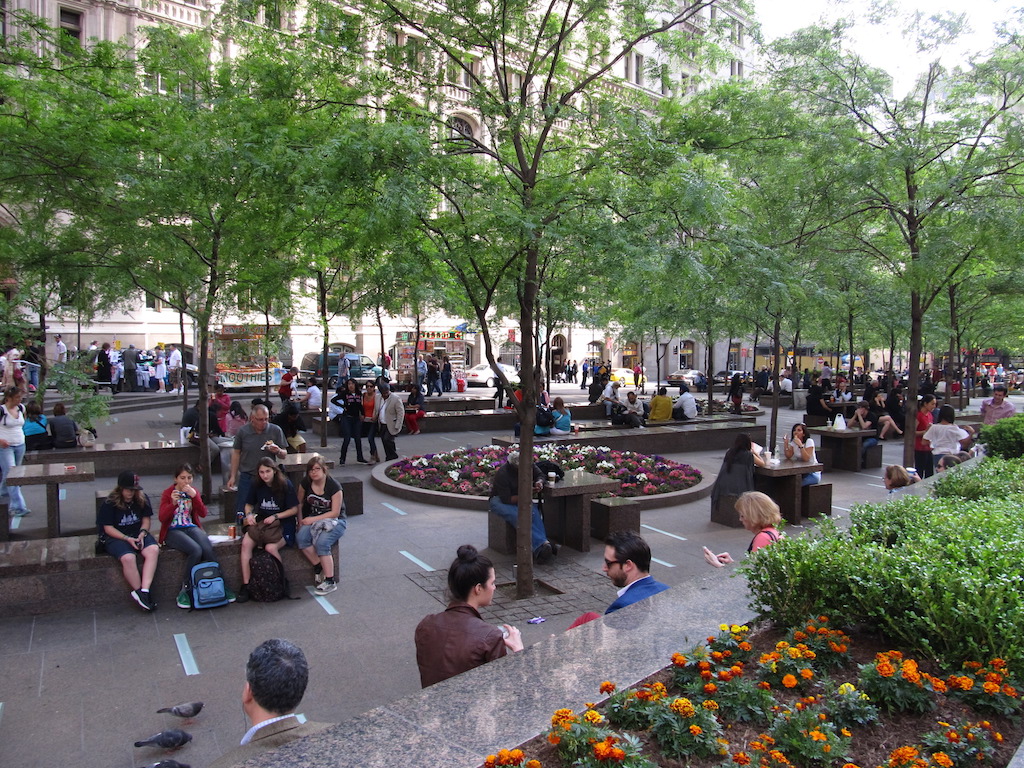
In areas like Midtown Manhattan, incentive zoning has been extremely successful — if we measure success by the willingness of the private sector to do the City’s bidding. Beyond the Central Business District, however, the uptake of incentive zoning has been far more modest. Of the more than 500 plazas built through the 1961 zoning code’s FAR bonus program, for instance, only five have been built outside of Manhattan. The hyper-concentration of plazas in Manhattan reveals one of zoning’s clear limitations: it is not able to conjure specific development from the private sector on the City’s terms.
Planners and elected officials have tried to overcome the tyranny of Manhattan’s real estate market by using zoning to develop affordable housing across the city. During the 2005 rezoning of Williamsburg and Greenpoint in Brooklyn, the City introduced an Inclusionary Housing program that traded additional bulk for affordable housing units. The program was designed to be taken up outside of Manhattan in areas that were undergoing large-scale redevelopment, such as Williamsburg and Greenpoint. Like earlier incentive programs, the program was optional. Over the last 30 years, zoning incentives have produced fewer than 10,000 units of affordable housing, while there were more than two million rental units in New York City as of 2014.
Mayor Bill de Blasio has pledged to use zoning more aggressively than previous administrations to increase the supply of permanently affordable housing units. When an area is rezoned to increase density, Mandatory Inclusionary Housing (MIH) requires the construction of affordable housing, instead of incentivizing it. As Deputy Mayor for Housing and Economic Development Alicia Glen testified before the City Planning Commission, the goal of MIH is to “harness the strength of the market and the popularity of [New York]” to extract affordable housing from the demand for development.
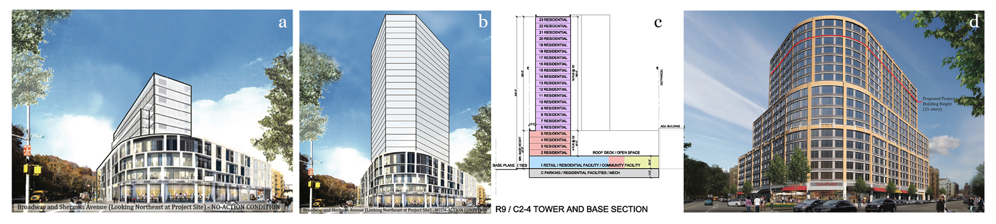
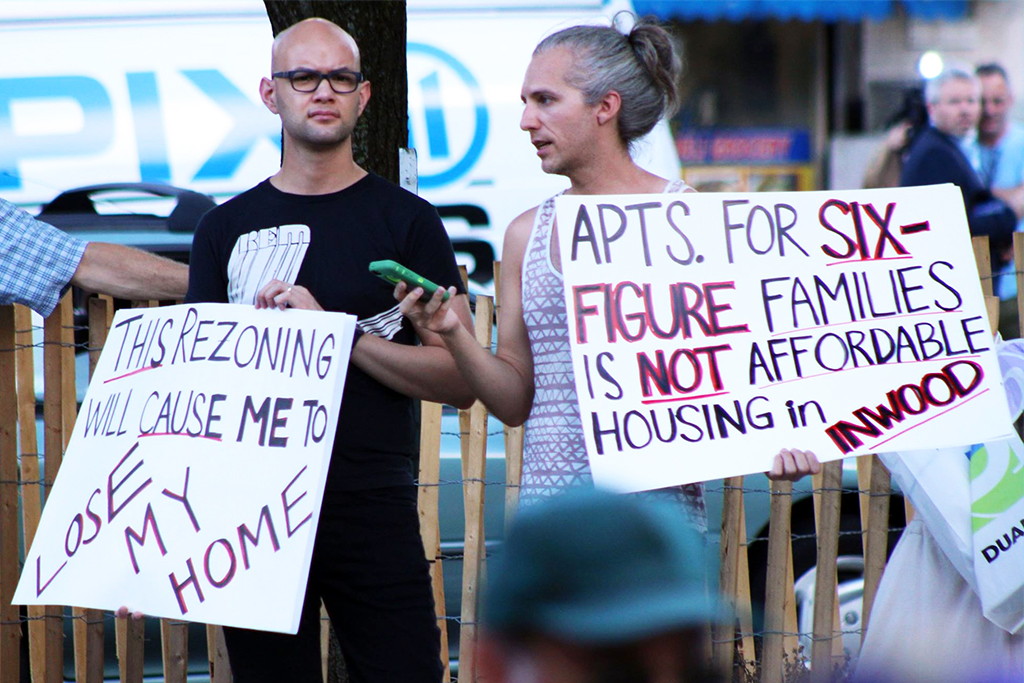
While MIH is still in its infancy, the early returns have been mixed. Inwood, for example, saw a contentious debate over affordability last year. One proposed upzoning would have yielded a 335-unit project known as Sherman Plaza, 30 percent of which would have been reserved for households making less than $62,150 per year. Under the existing zoning regulations, the developer is limited to building 144 units, none of which have to be affordable. At first glance, this infusion of affordable units seems like a coup for the neighborhood. But local opposition argued that the affordable housing wasn’t affordable enough. According to the American Community Survey’s estimates from 2010-2014, the median household income in Inwood-Marble Hill was $39,003, or $23,000 less than the income threshold established by MIH. Council Member Ydanis Rodríguez, who initially supported MIH when it came up for a vote in the City Council in March 2016, in the end refused to support this specific project.
While MIH was designed to replenish New York’s dwindling stock of affordable housing — a critical plank in Mayor de Blasio’s 2013 election victory — residents of Inwood challenged MIH and argued it was poorly calibrated to the needs of the community. Zoning’s inability to serve every interest at all times is nothing new. In the 1940s, Bronxites in Fieldston complained that the area’s zoning wasn’t restrictive enough to serve them. Thirty years later, artists in SoHo made the opposite argument by claiming the existing zoning was too restrictive to suit their needs.
Zoning is and has always been a reflection of New York. It isn’t entirely democratic — money and power have always held sway — and zoning has been stretched and manipulated in ways its original authors could never have imagined. As a tool to guide development, it has been hijacked by builders hungry for more square footage and residents eager to preserve their neighborhood’s character at the cost of shunting development onto other areas of the city.
Zoning endures because it is neither as authoritarian as eminent domain nor as permissive as the free market. It’s a blunt instrument that projects certainty but is nimble enough to be amended when it misses the mark. The authors and researchers responsible for the 1961 code went to great lengths to divine the future city. They collected data, processed IBM punch cards, projected population growth, predicted future land-use configurations, and accommodated contemporary principles in architecture and urban development. Despite these earnest efforts to get it right, they got much wrong: population declined, manufacturing jobs disappeared, and New Yorkers quickly grew tired of slab towers and windswept plazas. Rather than junking the code, the City Planning Commission approved special districts, broadened the usage of incentive zoning to include additional public benefits, issued design guidelines for bonus plazas, and continued re-mapping and adding to the underlying code to reflect the changing demographics and industrial mix of the city. With an exacting precision — FARs spelled out to the decimal point and use-groups designations so discerning that the code permits pool halls in C2 districts but not table tennis halls — and, at the same time, a recognition that the future is much less certain than it appears, the zoning code can be a serious tool for planning the future of New York. But zoning still gives New Yorkers the opportunity to push back when they think it gets something wrong.
The views expressed here are those of the authors only and do not reflect the position of The Architectural League of New York.


Comments