We are celebrating 15 years — and counting — of stories that are deeply researched and deeply felt, that build a historical record of what the city has been.
We are celebrating 15 years — and counting — of stories that are deeply researched and deeply felt, that build a historical record of what the city has been.
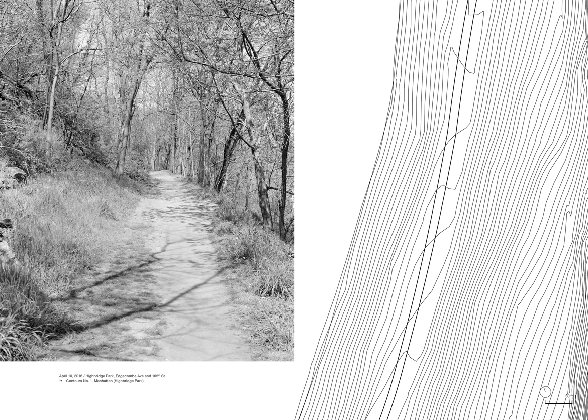
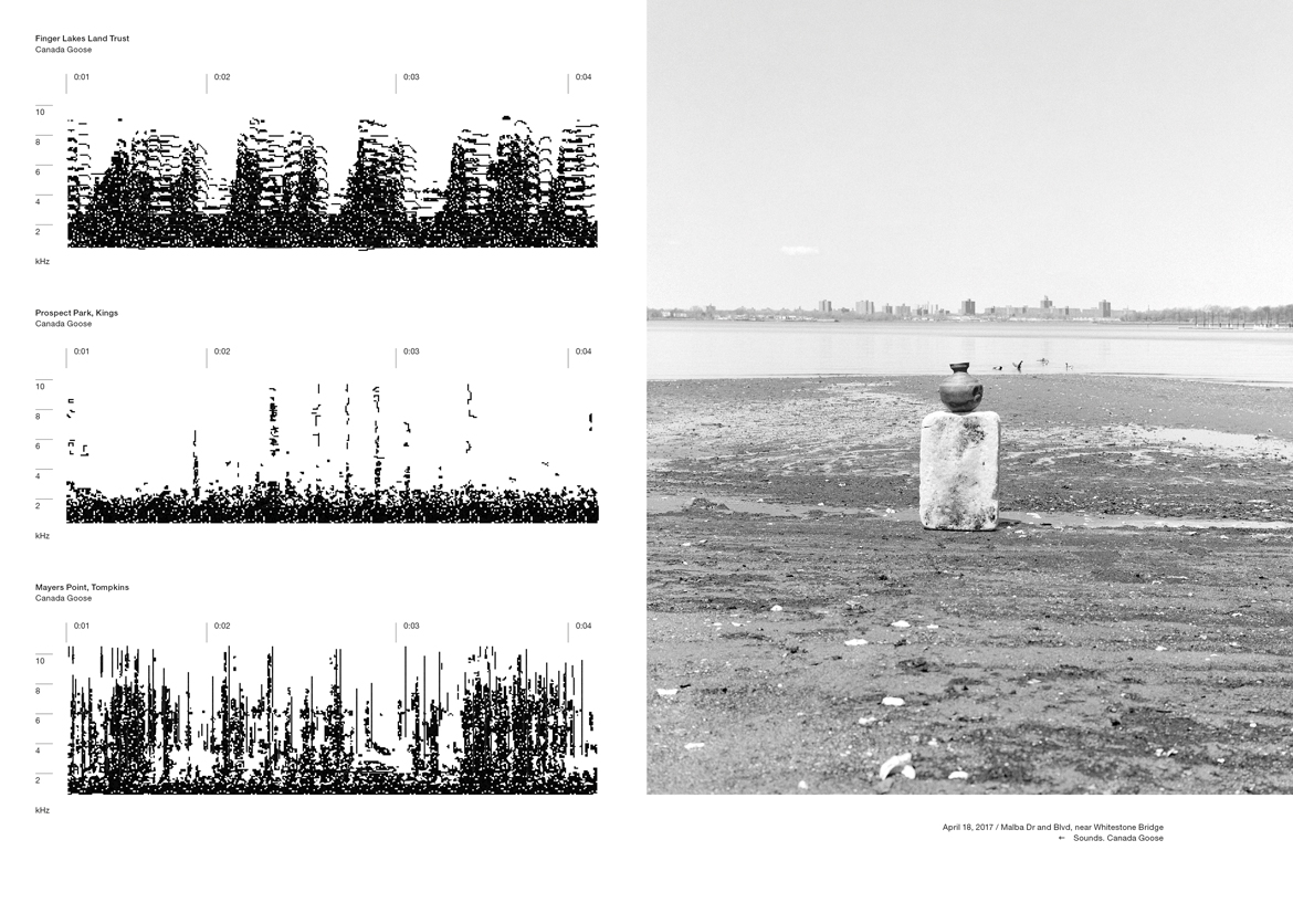
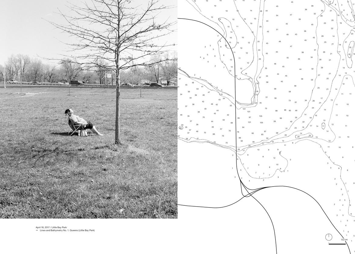
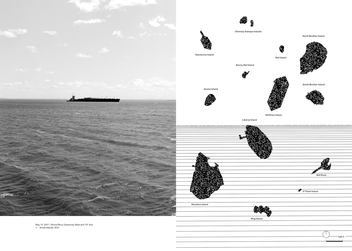
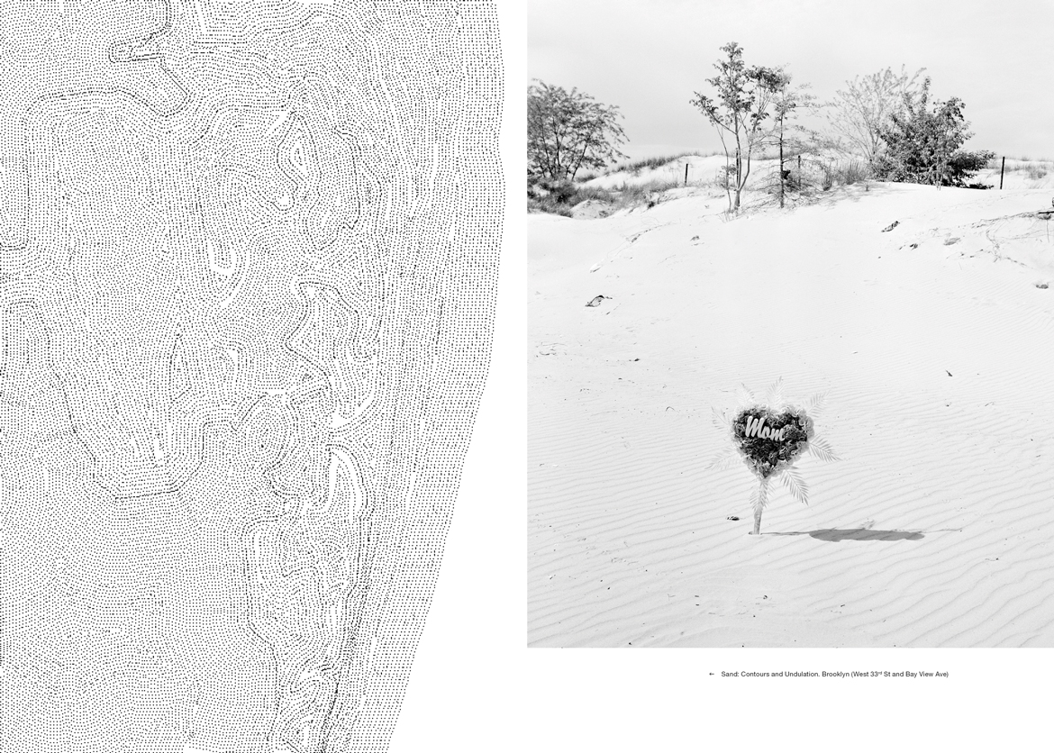
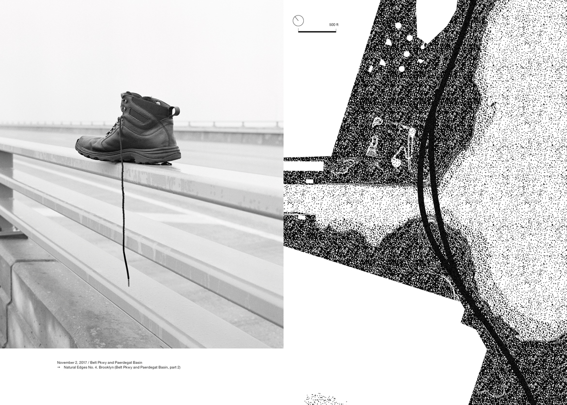
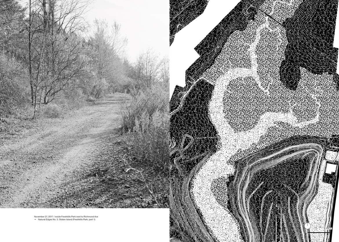
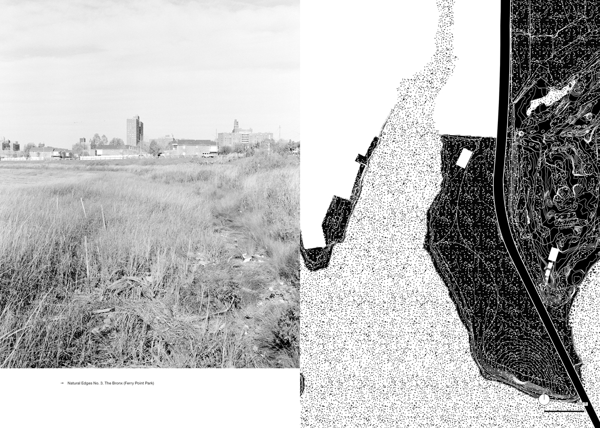
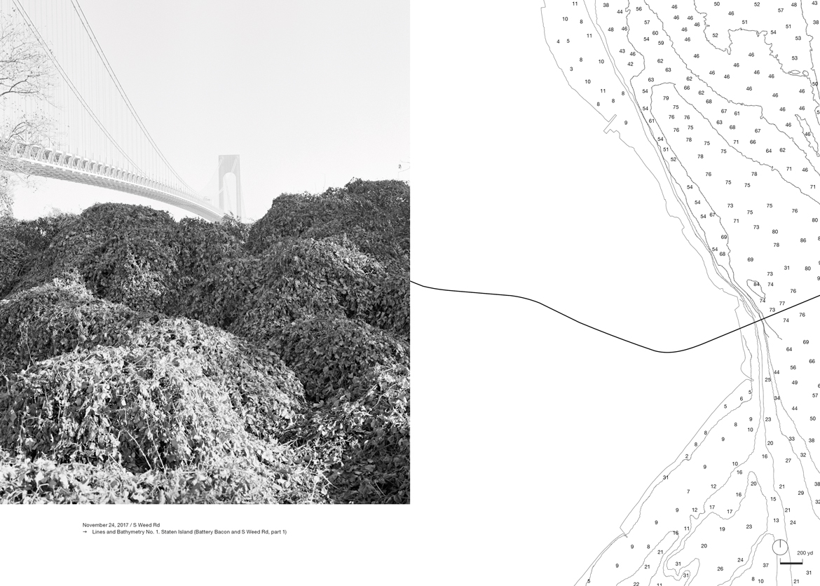
Is there anything we have not seen of New York City? If so, where and how would we see it? Over the course of two years, Antonio Rovaldi walked the perimeter of the five boroughs, seeking out the areas skipped over by photography books and Google Street View. The artist walked, looked, listened, and made more than 600 photographs of the city’s partially natural edges, “the border between the concrete of the city and the green areas, the polluted canals, the lagoons, and the ocean beaches.”
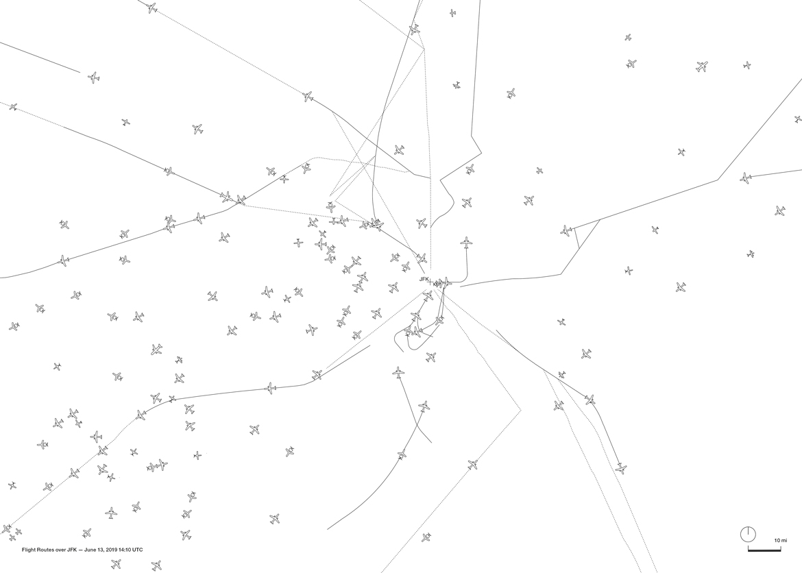
Rovaldi asked designer Francesca Benedetto to collaborate on a book, making a set of maps to complement the photographs: a guide to the city’s less familiar geographies. As much as Benedetto’s 60-odd maps catalog the city, they use the city to catalog various ways of mapping. In some images, the topography of the city’s natural edges is rendered as if viewed from space. New York City becomes the surface of the moon, but crossed by manmade infrastructures, bridges, highways, and the occasional building footprint. Also visualized below are the city’s small islands and their relative sizes, the depths of the water, the undulation of sand, the contours of cliffsides, the quacking of geese, and the paths of planes over JFK airport and Jamaica Bay. Benedetto calls her maps “quiet”: Each freezes a moment in time, or reveals the slow movement of geological time. They share a stillness with Rovaldi’s waterfront fragments. Together, they depict what the artist writes “might just be a ghost town emerging from the abyss of millions of years ago, or might be destined to suddenly plunge back into the gray ocean waters.” Or as the architect suggests, perhaps they are a guide to the margins from which we can imagine the birth of a renewed city.
All photographs by Antonio Rovaldi, maps by Francesca Benedetto, originally published in The Sound of the Woodpecker Bill: New York City (Milan: Humboldt Books, 2019). Images © Francesca Benedetto, Antonio Rovaldi.
The Sound of the Woodpecker Bill: New York City is part of the project End. Words from the Margins, New York City by the artist Antonio Rovaldi, promoted by GAMEeC — Galleria d’Arte Moderna e Contemporanea di Bergamo, winner of the fifth edition of Italian Council (2019), a competition conceived by the directorate-general for Contemporary Art and Architecture and Urban Peripheries — an organism of the Italian Ministry for Cultural Heritage and Activities, to promote Italian contemporary art in the world.
The views expressed here are those of the authors only and do not reflect the position of The Architectural League of New York.