We are celebrating 15 years — and counting — of stories that are deeply researched and deeply felt, that build a historical record of what the city has been.
We are celebrating 15 years — and counting — of stories that are deeply researched and deeply felt, that build a historical record of what the city has been.
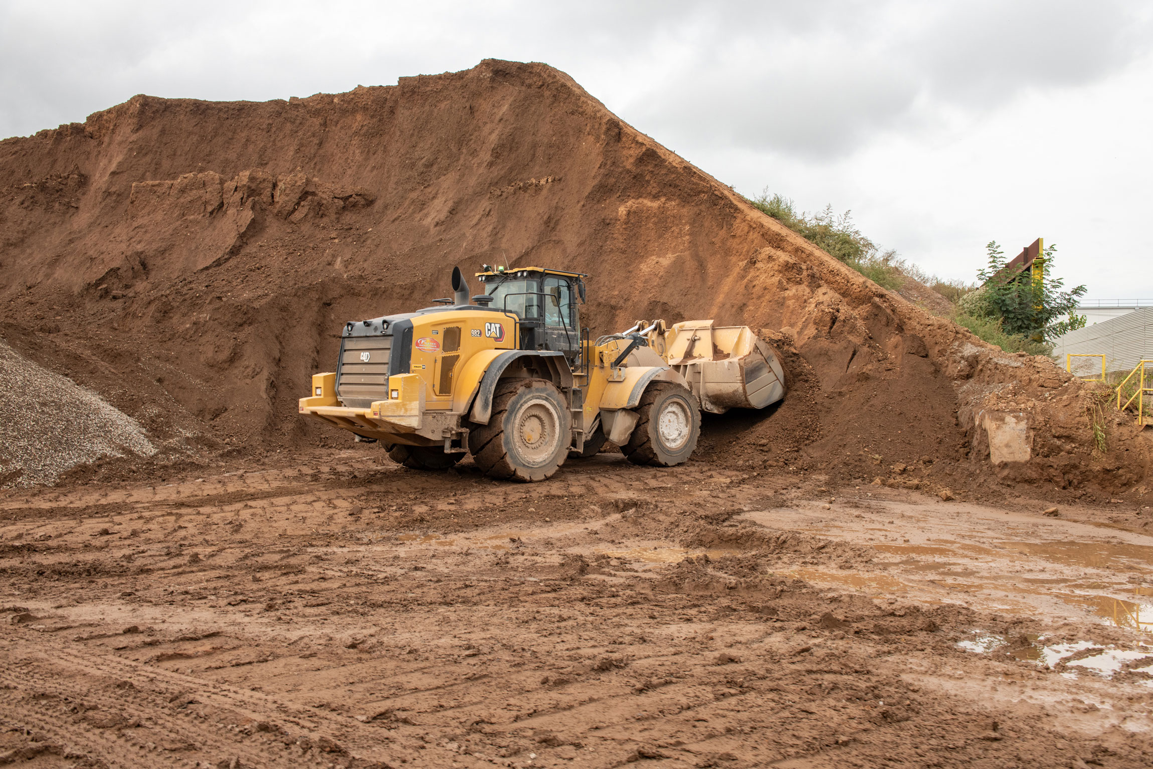
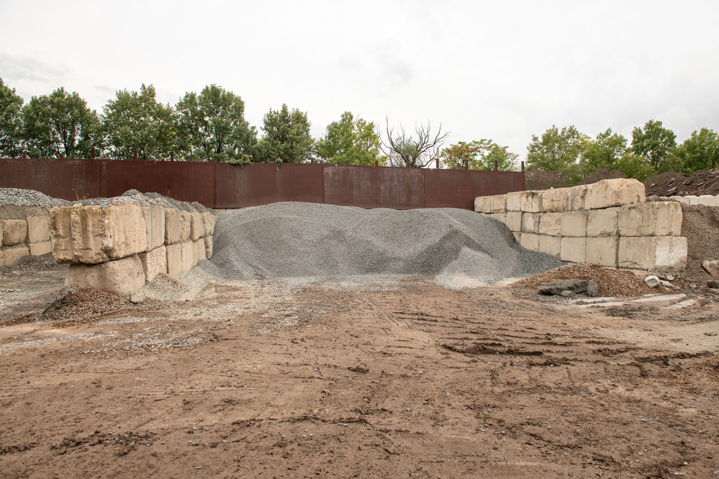
Peer through a peep hole at any one of the 8,243 currently active construction sites in New York City, and you may find a muddy mess of exposed New York soil, churned by excavators and waiting to be hauled off by beeping dump trucks in the wee hours. Thousands of tons of spoil — everything from loamy native soil to slurried schist turned up by tunnel bores — must be harvested and removed before construction can begin. What becomes of this very urban yield? In a wasteful cycle, most excavated soil leaves New York City limits in fossil-fueled dump trucks to be processed in New Jersey or further afield, only to end up back at other construction sites within the five boroughs.
Perhaps New York might take cues from cities like Paris, Vienna, Shanghai, and Tokyo, which are reorienting their urban metabolisms to minimize both material and carbon waste. Revaluing spoil could make New York’s never-ending redevelopment an engine of local and circular economy — could it also help the city meet urgent demands for waterfront fortification in the era of climate change? In the first of a two-part series, the architectural historian and architect Lynnette Widder considers the oft overlooked urban resource that is New York’s displaced substrata.
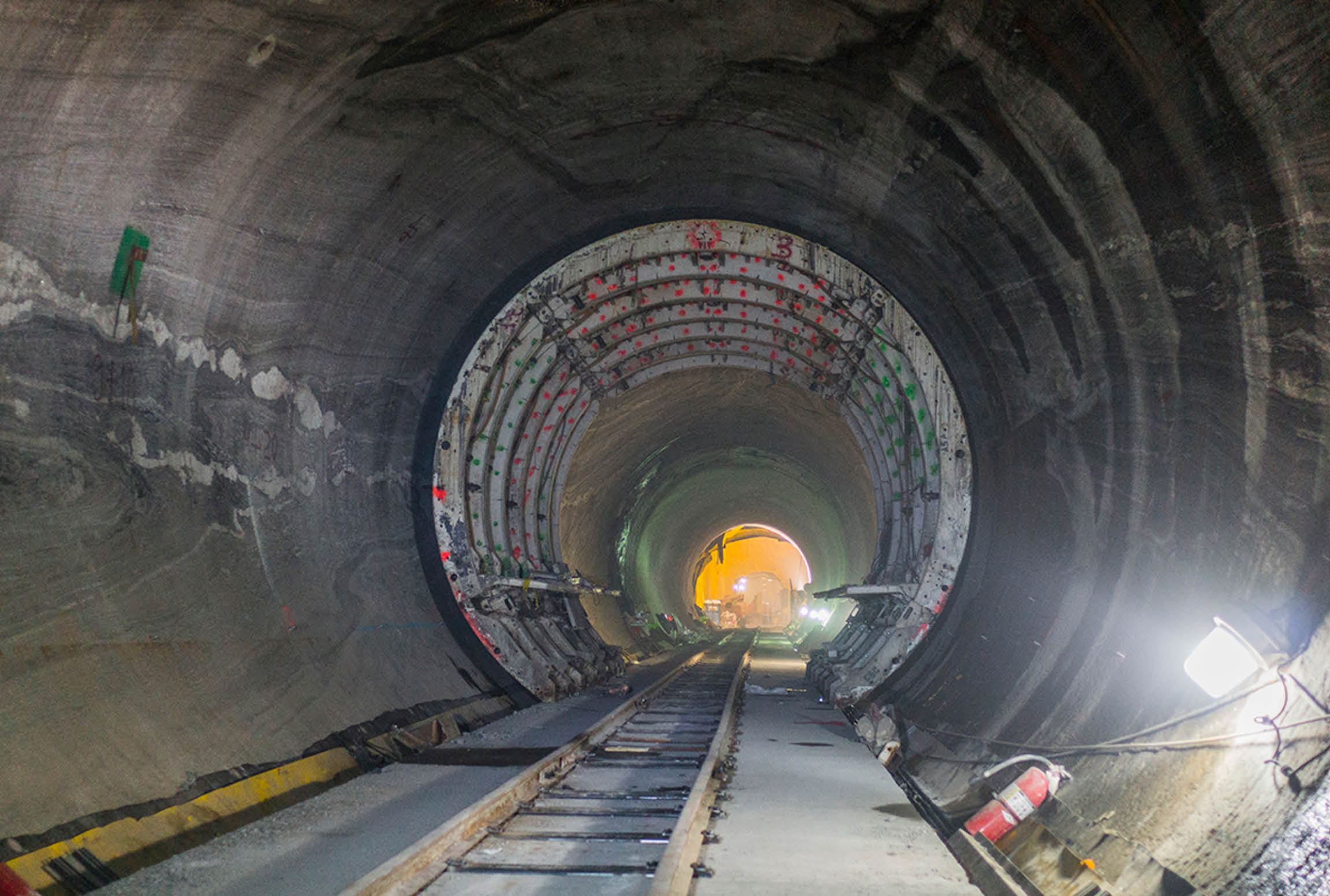
The largest construction projects underway in New York City are mammoth in scope. Consider the 1.2 million square-foot project to replace Terminal 6 at Kennedy Airport, or the grandiose Second Avenue Subway extension, its completed first phase some 64 feet wide, 100 feet deep and 1,600 feet long, with more than twice that still to come. An official interactive map of “active major construction” includes several projects spanning more than 2 million square feet. Each of these building and infrastructural projects sets in motion unimaginable quantities of material even before construction starts: “Construction and demolition” (C&D) refuse, which can include remains of a demolished structure but also pavement, broken rock, fractured obsolete infrastructure and just about anything found below ground level. That material raised from the earth, including both untouched and anthropogenic soils, is a more narrowly defined category of what an excavation company might call “spoil.”
To size up how much spoil is unearthed and moves through New York City, consider that the rule-of-thumb for tall building foundation depth in our local geology is between five and ten percent of a proposed building’s height, but not less than 50 feet. Apply this assumption to a mixed income project underway in Northern Manhattan: at 295 feet tall and with a 544,000-square-foot volume, the residential tower at Sherman Creek North Cove alone would yield more than 65,500 tons of excavated spoil, filling around 6,500 dump trucks. Now imagine multiplying that calculation across the 2,121 new buildings permitted in the first quarter of 2024 alone. Where does that material go? How does it get there? It’s not unusual, late in the evening or very early in the morning, to see mammoth beams or enormous cogged wheels riding through New York City streets on tractor trailers escorted by safety vehicles with flashing lights. But who knows whether a truckload of native New York City soil has just passed them by, whether a tanker truck is filled with slurried schist from a tunnel bore? The fact, and the fate, of displaced substrata remains largely invisible.
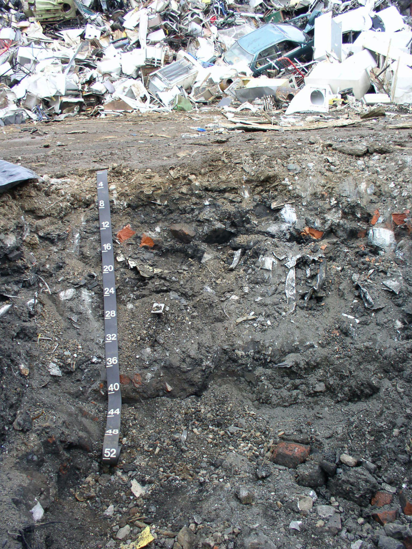
The excavation process is imprecise at best. A driver who’s paid by the truckload or a backhoe operator paid by the hour has no incentive to stop as one stratum gives way to another, to separate rock and broken concrete from compacted gravel left over from earlier construction from what in our normal parlance might be called “dirt.” What is excavated contains some proportion of anthropogenic fill: decommissioned construction or other manmade materials, usually in the uppermost strata. Below it is an impervious, biologically unproductive layer of compacted soil, hardened and compressed by years of carrying the structure above it. Deeper down is sediment untouched since it was left behind by receding glaciers some 18,000 years ago. Most material from demolition and excavation — whether crushed concrete or native rock or plain old dirt — will be determined inert, or non-toxic; but sites in New York’s former industrial corridors may also contain heavy metals, petroleum products, and other materials of environmental concern. Environmental regulations require anything deemed toxic to be incinerated or vitrified to capture harmful substances in a water-impermeable form before it is landfilled, triggering substantial costs. As more sites are remediated, however, there is less and less toxic spoil in the city.
At non-toxic sites, everything comingles during excavation, although each excavated component has different potential value. For example, salvaged gravel, rock, or sand can substitute for natural aggregate in concrete admixtures. The deepest layers, in some cases virgin glacial deposits, can be mixed with compost as an ideal top soil. All components make good, locally available backfill that can be used for stabilization after foundations have been poured. Or, as construction nears completion, these materials can be used to configure the land around a building to ensure accessibility, landscaping, and perhaps most importantly, drainage of rain away from the structure, preventing floods. As pressure for more sustainable material use practices increases, this kind of reused salvage will gain in value.
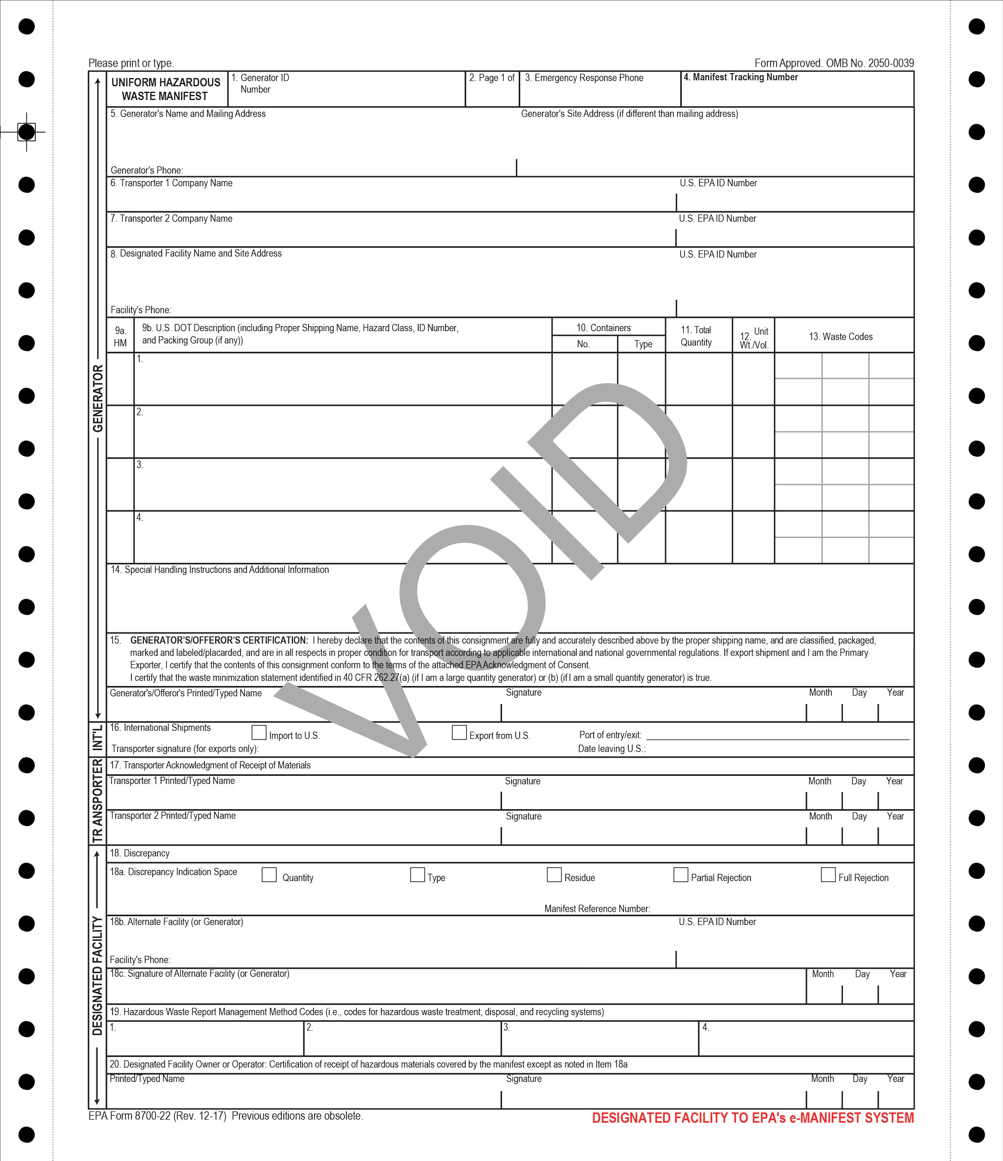
But harnessing this potential resource requires understanding the scope of what’s available — a project made nearly impossible by the complex and heterogeneous system through which New York City spoil moves. As spoil travels, information is collected on paperwork distributed across public agencies and private actors. Haulers are rewarded for the speed at which they can move material out of the way of ongoing site work. In compliance with DOT payload regulations, they quantify the material they move simply by weight. Truck drivers carry paper manifests that document, among other things, the results of environmental testing, the site of origin and the location at which their payload will be deposited. That landfill, transfer station, incinerator, or recycler will bury, burn, or sift the spoil to separate out anything larger than dirt, then move it along the value chain. Any of these possible recipients will re-weigh the trucks and their payloads upon arrival, then spot test during processing to verify that what’s on the manifest is really what’s in the truck. All this is recorded on the paper manifests, which are photocopied, double-checked, and hand-filed at each stop along the way, ending up filed away in discrete drawers, out of reach for digital data crunching. The data disaggregation is just one reason why there is no definitive number for how much soil leaves and enters the city each year. Another is profit. Relative to the costs of financing and the value of fast logistics in the real estate development process, what’s at stake is “peanuts.” No single party has seen the value in monitoring soil flows — yet.
But from another perspective, some of that spoil is a unique and irreplaceable resource well worth tracking. Dan Walsh, a geochemist who was the founding director of the Mayor’s Office of Environmental Remediation (OER), has been its champion. At the OER, from 2008 to 2018, Walsh sought to organize a system that would take uncontaminated deep strata soil deposits from excavation sites directly to nearby construction sites for just-in-time delivery. The earliest test of his idea — and still one of its largest implementations — came after Superstorm Sandy in 2012. The Rockaways had been devastated as inundation pushed northwards along the coastline, into Jamaica Bay and then inland from the open water. Images of flooded streets, a fragmented boardwalk torn from its concrete pilings, and mounded sand, as well as the terrible reports of stranded residents, amplified the inequities of impact and recovery across the city. In the storm’s aftermath, Walsh was involved in discussions on how to deal with the sand deposited far from the beaches. FEMA practice would have swept it up along with other debris, then hauled it to landfill for $350 per cubic yard. Then fresh sand, its source unknown, would have been acquired from a material yard to replenish the scoured beach. Over a weekend, Walsh got permission to segregate the drifted sand from other debris, store it on site, and then return it to its original location at the beach. That sand is now under the rebuilt Rockaway boardwalk. The savings from avoiding hauling proved Walsh’s point twice over: Local solutions that keep materials in place are better in both ecological and financial terms.
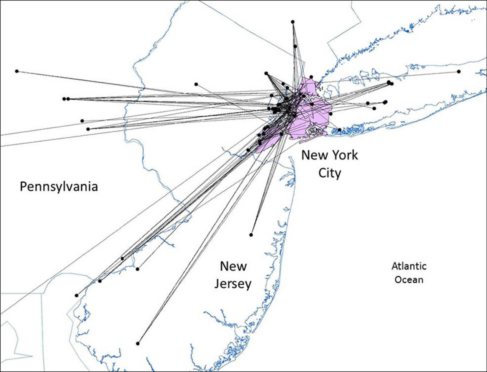
As a research scientist at Columbia University, Walsh organized a study to calculate the production and circulation of “surplus clean native soil,” using information collected and processed by various city agencies between 2009 and 2016, including 178 building projects realized within that period. From these annualized records, researchers extrapolated total annual excavation tonnage, estimated volume of C&D debris and volume of soil based on site locations, and then geolocated intermediary and final sites to average the distance traveled from excavation site to receiving location. Comparing presumed excavation depth to geological maps, the study differentiated deep native sediment from the other components of spoil. It found that nearly 95 percent of virgin soil exhumed had been hauled out of city limits, some 70 percent to New Jersey, another 20 percent to other parts of New York State and just over 5 percent to Pennsylvania. According to the study, 74 percent of that delivered soil was run through screening machines upon delivery and then resold as backfill or top soil for New York City construction projects. The locations where the re-imported soil arrived were not far from those where it had been excavated. Each of these trips carries environmental and financial costs: Miles times number of truckloads hauled times engine efficiency equals CO2 emissions and transportation dollar costs. To what end all that travel?
The greenhouse gas cost of hauling the same soil out of and back into New York is one acknowledged, quantifiable environmental impact of soil shifting. The environmental value of the virgin soil is no less meaningful. Walsh and the other authors of the study cite its many benefits: “preservation of native soil character and promotion of native biodiversity, increased potential for enhanced carbon sequestration in soil, lower rates of mining and transportation of virgin [soil] from surrounding ecosystems, and reduced ecological footprint of the city.”
Untouched for tens of thousands of years until the moment of excavation, glacial sediment offers an absolute definition of the ‘native’. It has resided in one place, undisturbed, since its deposition, exposed neither to transforming atmospheric conditions nor to biological agents. It is entirely geochemically pure. This native soil is a geological and archeological resource, an invaluable component of place-compatible climate adaptation measures. Using it to remediate despoiled sites, cap toxins, raise topography against sea level rise, or re-establish place-specific biological communities would avoid the dangers of cross-contamination or of inadvertently introducing new pests. The soils currently used to fulfill these needs in New York City — many supplied from the same sites to which excavation spoil was delivered for processing — meet existing regulations. But regulations are designed to guard against the worst, not to promote the best possible outcome. The kind of just-in-time efficiencies that Dan Walsh achieved at Rockaway Beach after Sandy are still aspirational. But there are other precedents.
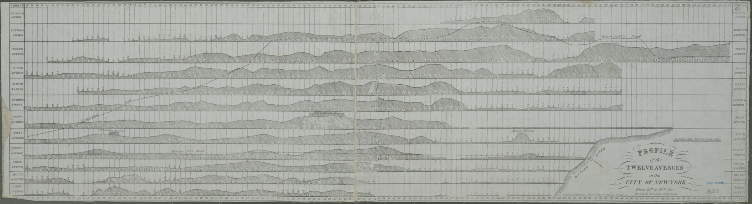
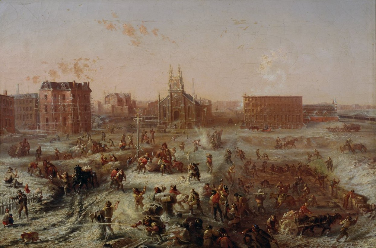
The contemporary topographies of New York City — inclines along Manhattan avenues so subtle that only bikers or joggers notice them, coastlines in all boroughs wide and flat enough to support multi-lane highways, narrow residual slips of marsh — owe far more to engineering force-of-will than to natural geology. The 1811 Manhattan grid plan translated into an enormous, 60-year cut-and-fill project. Subway, railway, and infrastructure building tunneled and contoured the city over and over again. Massive rock outcroppings were pick-axed, and the resulting rubble used to infill valleys. The plan was revised as the landforms were. An 1850 sectional drawing of the avenues records different profiles than what is experienced today.
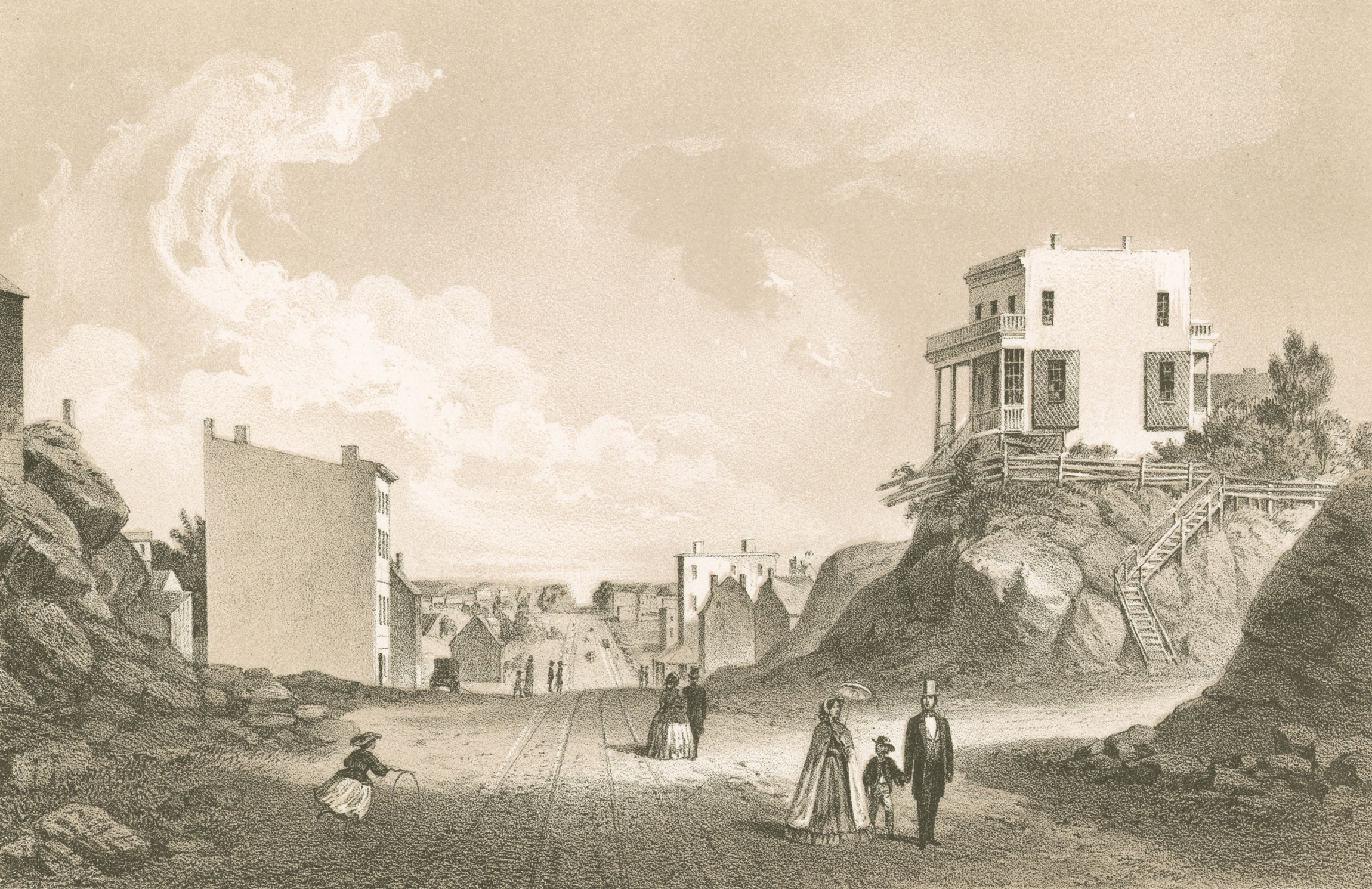
The East Side in the 1840s saw some of the greatest transformation, its variegated terrain smoothed into a gradual incline. Imagine the effort involved in chopping and hauling bedrock outcroppings entirely by means of animal and human labor. It stands to reason that the distance between the sites of excavation and redeposition was kept to a minimum. Twentieth-century engineers were no less ingenious in finding nearby uses for excavated materials. As the economy changed and water-based transportation lost market share, leaving wharves obsolete, popular land reclamation projects expanded the margins of the boroughs. Rubble became a boon. Most of today’s Governor’s Island is built on spoil from the construction of the IRT subway line.
Not all spoil used in New York City land reclamation is local. The East River Drive was built on English brick. In 1940, a public works consortium of city and federal agencies configured an artificial coastline along the Kips Bay shoreline using the rubble of some 85,000 brick structures destroyed in an air raid on Bristol, which killed 1,300 people. Although not yet officially at war, the US was exporting materiel across the ocean; cleared brick rubble was used to ballast the empty ships upon return and reinvented as a valuable resource once the ship arrived in New York Harbor. (Had refugees rather than rubble been transported, some argue, many more lives could have been saved.)
Today, calculated at a standard 6,000 bricks for each small rowhouse typical of Bristol’s fabric, there may be more than 500 million English bricks, or 1.3 million cubic yards, behind the steel caissons that keep the river from the foundations beneath the FDR. The roadway was completed in 1941, a plaque commemorating Bristol’s gift to New York installed in 1942 and, by 1945, to judge from letters in the City of Bristol’s archives, the episode more or less forgotten. In 1974, the roadway was decked over to build Waterside Plaza and the memorial plaque was re-installed there.
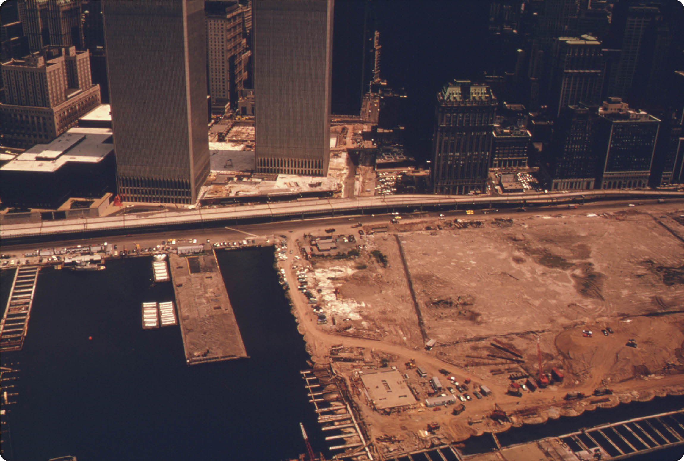
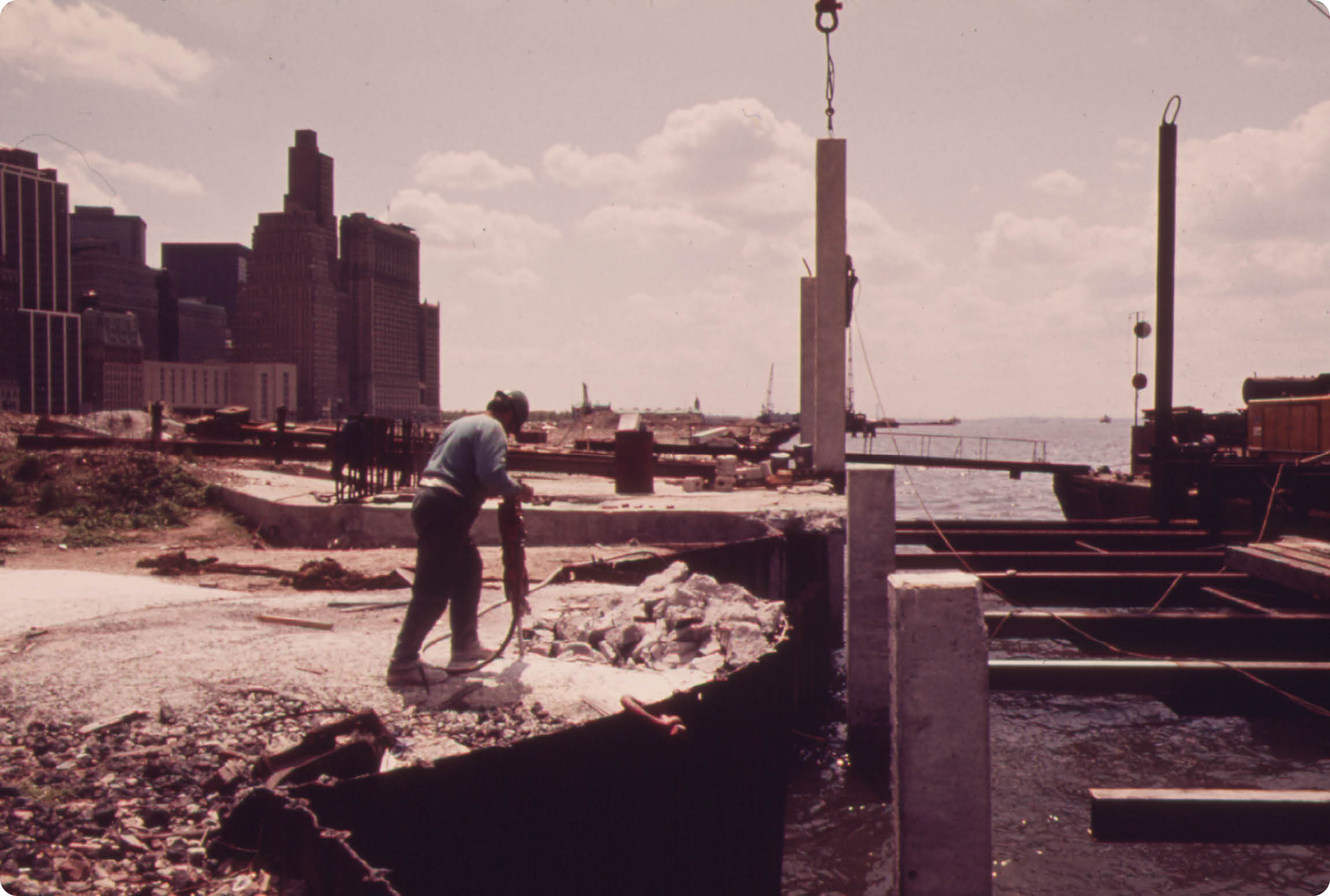
No less impressive in scope was the shifting of demolition and excavation material from the vainglorious World Trade Center site to the riverfront directly adjacent. The story goes that one morning while shaving, Guy Tozzoli, the Port Authority engineer in charge of the project, had the idea to shift spoil from cost liability to land reclamation asset. But the idea was better on the balance sheet than it was practicable on the ground. To move the C&D debris and excavation spoil would have required 100,000 truckloads bound for New Jersey landfills or as many barges to drop their loads at sea. The project tender documents foresaw excavation of 1.2 million cubic yards of spoil, more broadly defined, and an additional 45,000 cubic yards of bedrock, an effort requiring 1.25 million hours of labor. Those numbers excluded demolition of the 26 buildings on the site and removal or relocation of existing infrastructure for waste and drinking water, electricity, traffic regulation and communications.
To add another layer of complexity, engineers assumed that excavation would hit water at three feet beneath ground on at least half of the site, where the original riverbed had been infilled over time. Still, landfilling on site proved almost as technically complicated as casting foundations for the towers. This required excavating and trashing the remains of countless rotted wooden piers and building so-called cofferdams — steel cells filled with sand barged in from Long Island — to contain deposited fill. By the time the spoil shifting was complete, the new shoreline projected 700 feet into the Hudson. Fifteen years later, two of the total 23 reclaimed acres became the temporary site of Agnes Denes’s Wheatfield. In 1982, With the city economy resurgent, the land subsequently reverted to developers.
As industry left the city, waterfront properties became desirable for residential use and values rose enormously. Twenty-first-century climate vulnerabilities may reverse that trend, as reclaimed land proves the most likely to flood. There’s some irony in the fact that the very first stretch of highway built on reclaimed land along the East River is now the site of the first large-scale regrading and hardening efforts to transform Manhattan’s coastline into a bulwark against storm surge. Despite the risks, the city’s coastline continues to be reshaped by shifting soil for profitable development. Brooklyn Bridge Park, just across the water from the “Big U” (one such adaptation project), acquired more than 40,000 cubic yards of fill from the Long Island Rail Road tunnel project connecting Penn to Grand Central Station.
Diverting waste to reclaim coastal land is not an unmitigated good. Among many other devastating impacts, 15 years of Civil War in Beirut resulted in a crisis of waste disposal. The expedient response, beginning in 1978, was to use the debris as landfill at Normandy Bay — this played perfectly into the hands of Fouad Awada, an urban planner who had long wanted to use land reclamation to create a margin for highway construction not unlike New York’s East River Drive. With general adoption of the strategy, the city’s urban expanse increased 80 percent between 1994 and 2013, a rate that far outpaced population gain. Flooding, gentrification, and increased vehicular traffic are all associated with Beirut’s reclaimed land and its development. Rubble from the 2006 Israel-Lebanon conflict was also turned to landfill, presaging what may well happen again in Gaza, and in the world’s other quickly proliferating conflict zones.
On the other hand, cities like Paris, Vienna, Frankfurt, Shanghai, and Tokyo are foregrounding sustainability and offer positive use cases for spoil — retraining their “urban metabolisms” to maximize the reabsorption of valuable resources and minimize the evacuation of waste. In those cities, initiatives for comprehensively measuring, or at least estimating, soil and construction flows are well-established and yield more data. Paris and the Ile-de-France region offer a particularly valuable study, in part because the city’s aggressive waste and environmental targets have made for good data and better logistics management. Paris produces 37 million tons of inert construction waste annually, 67 percent of which is soil. The large amount of soil from the ongoing expansion to the RER commuter rail has produced a more forward-looking collaboration between the municipality of Sevran — not far for the Charles de Gaulle airport — a local construction product manufacturer, and a hauling company. Together, they co-sponsored a factory that turned tunnel spoil into compressed earth block for masonry construction. By incorporating workforce training and collaborating with local businesses, raw earth construction for both interior and exterior applications gained traction. Know-how, advocacy, and implementation of raw earth in the context of circular construction in the Ile-de-France is substantial. Demand, as conventional wisdom says, results in supply.
Construction and demolition waste has established aftermarket value, but soil is the by-catch of C&D, like dolphins in the canned tuna industry. Unlike dolphins, soil has never featured in movies or TV shows and is not broadly understood as ecologically valuable. But so long as the value of soil goes unrecognized, the infrastructure for making the most of this resource remains under threat. At present, spoil takes up space at every point along its journey from excavation to reuse; the intrinsic value of soil is marginal compared to the cost of the space it occupies until it can be sold off again. Upon leaving an excavation site, it needs a place to wait for the results of testing; then, once the load is cleared, it sits elsewhere until it can be sifted to the particle diameter desired; then it will sit again, safe from eroding wind and water, until it is purchased and can be brought to the site where it will be reused. High demand for soil at the end of the value chain means material flows quickly through these stages. But presently, the demand is lacking, cooling the system as a whole. Because space is at a premium in New York City, soil haulers and transfer stations can only occupy the margins. For the facility that accepts the spoil, time on site is decisive: so-called tipping fees are paid upfront by the excavation contractor or the agency boring a railroad tunnel, and so the longer a given payload sits, the less financially viable the receiving sites become.
The present infrastructure functions well inasmuch as it makes the removal and delivery of a vital resource — soil, spoil — seamless, if not entirely invisible. Processors are by and large outside city limits, landfills out-of-state. But as resources grow more critical, is invisibility the most desirable outcome? As properties are reallocated to higher uses — whether a greater public good or a more profitable form of development — transfer stations within city limits may well be forced out. If these facilities leave, the city will have lost the potential to create a more local, circular native soil economy.
The views expressed here are those of the authors only and do not reflect the position of The Architectural League of New York.