

_19_-_Basketball_Courts.jpg)
.jpg)
Series
Cleaning Up?
An exploration of what it means to live in, build on, and design for a city of pervasive toxicity.
We are celebrating 15 years — and counting — of stories that are deeply researched and deeply felt, that build a historical record of what the city has been.
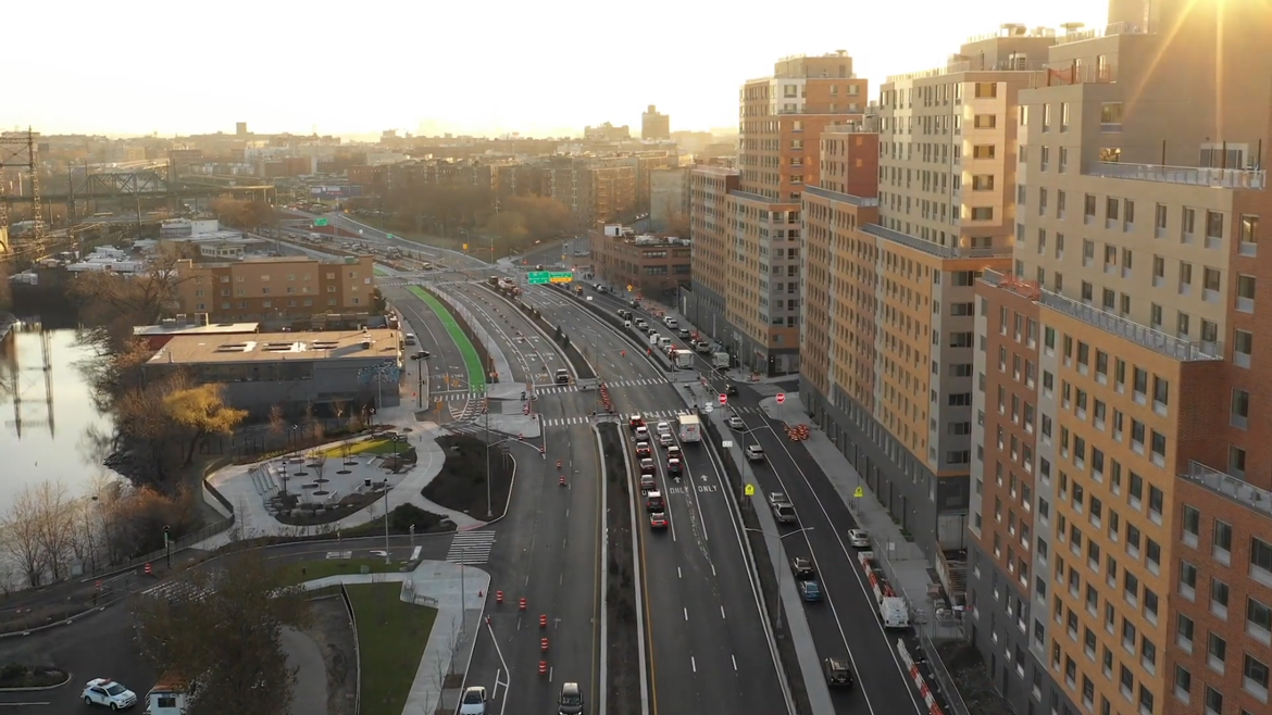
New York City has come a long way from the days of palpable smog and the “air inversions” of the 1950s and ‘60s that killed hundreds of people within just a few days. Not for us are the more recent stay-inside events of Mexico City or Beijing. But if belching smokestacks, at least here, belong to another century, blue skies belie a host of particles, no less insidious for being less visible. The city’s clean air still shuttles carbon emissions into the atmosphere, with short- and long-term damage to earthly systems. More locally and immediately felt are the effects of pollution hotspots: Where highways and freight traffic concentrate, so do incidents of asthma, cancer, and now Covid-19. Air pollution — the greatest threat the city’s environment poses to the health of its residents — is like any other of the city’s environmental stressors: It is unevenly distributed, and its harms are manifold. We don’t all breathe the same air.
If the pandemic brought a hyperawareness of the stuff in the spaces between us, it has also brought a new urgency to cleaning up the air. With the possibility of federal funding, calls for tearing down urban highways are gaining traction from Dallas to Syracuse. More than electric vehicles, congestion pricing, or green infrastructure, the dramatic move of dismantling, capping, and otherwise mitigating polluting and racist infrastructure promises not just cleaner air, but the redress of historic wrongs. Yet concentrated harms also require focused solutions. Community mapping endeavors have only recently created precise knowledge of how particulates are distributed in New York City. Blanket measurements did not register local or temporal variations, and residents who feel their worst impacts want bold and precise remedies, not blanket measures. Here, Clarisa Diaz seeks out the city’s air pollution hotspots, and speaks to organizers about what’s in the air, where, and what it would take to make it right. – MM
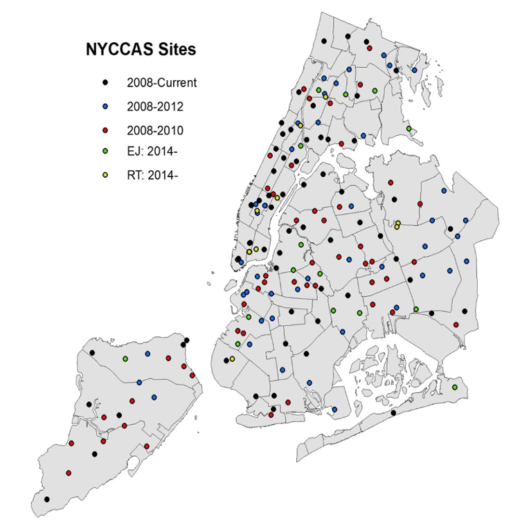
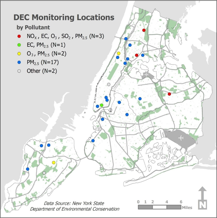
It may be hard to believe, but before 2009, New York City’s air quality had never been mapped on a neighborhood level. In compliance with the federal Clean Air Act, the State’s Department of Environmental Conservation (DEC) had operated up to 25 monitoring sites across the city at any given time, but only for the purposes of capturing ambient air quality, or background levels which don’t account for specific sources of local pollution. Then, in 2007, the New York City Department of Health (DOH) tasked Dr. Holger Eisl, an environmental scientist at Queens College, with researching and engineering the city’s first specialized instrument for measuring air quality. “The DOH asked us . . . to come up with a methodology to really collect the data and give the stakeholders in the city a better understanding of what the air pollution problems are in New York.” The system that Eisl and his team of scientists came up with — the New York City Community Air Survey (NYCCAS) — has since become the largest urban monitoring program in the United States. Initially, NYCCAS added 150 air monitoring sites across the city’s neighborhoods, dramatically increasing the amount of data that could be captured for a fuller picture of the city’s air quality. The program is frequently referenced by other scientists and urban planners across the country, and provides data to inform proposed policies such as congestion pricing.
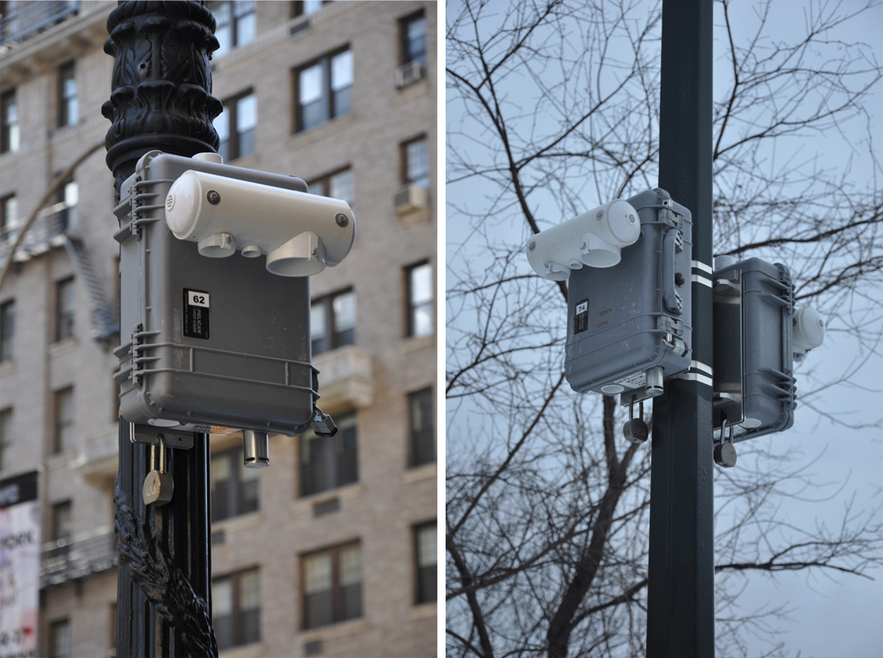
To collect more robust data and improve neighborhood coverage, Eisl distributed monitoring sites widely, segmenting the city into a 300-by-300-meter-square grid. “We know from emissions inventories, and a bunch of studies done by the DEC and Environmental Protection Agency, that the key sources of air pollution are traffic and building density. And so, we could characterize each of these squares by high, medium, low traffic and building density,” says Eisl. Instruments for measuring air pollution are mounted on lamp posts, each ten to twelve feet in height, in order to capture more accurate and granular measurements of air quality at the pedestrian street level.
“When you measure air pollution, you can do it in two different ways: you can measure it through filters or you can measure it in real time,” Eisl explains. “You can compare it to when you go to a doctor to get a blood test; they take your blood sample, then they look at your blood chemistry. That’s what we’re doing with our filter analysis. We have less data points but we get very rich data.” For two weeks every season, over the past 13 years, Eisl’s team has returned to each monitoring site to collect their instruments’ filters to send to the State’s labs for analysis. The filter tests measure fine particulate matter, or PM 2.5, as well as black carbon and a number of other gaseous pollutants such as nitrogen oxide (ozone and sulfur dioxide are measured only during the summer and winter, respectively). Volatile organic compounds (VOCs) — which can make the air stink — are not currently measured, but Eisl hopes to change that in the near future.
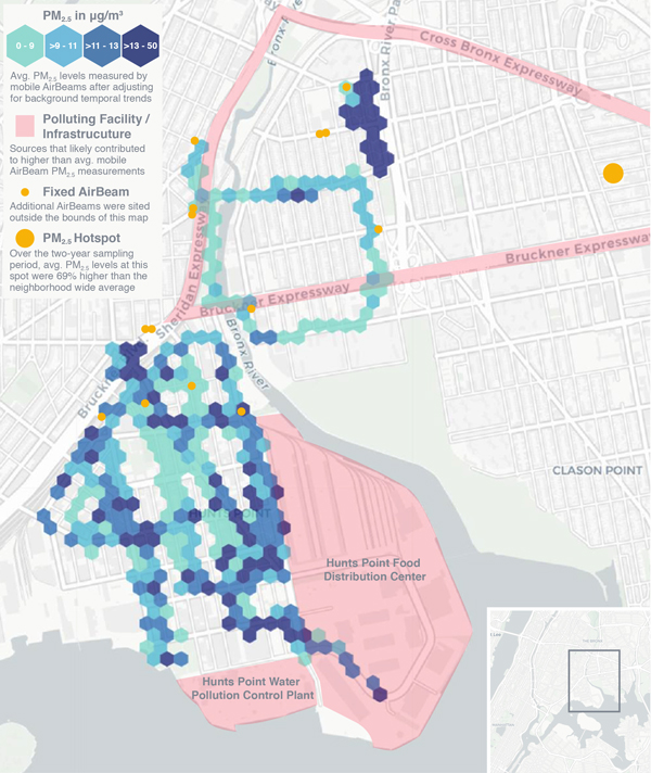
NYCCAS’s findings from 2009 to 2017 revealed that PM 2.5 levels in the city declined by 30 percent, and they continue on this downward trend. In a general sense, air quality in the city is improving. However, NYCCAS does not take into account more localized and diurnal air quality patterns, or how air quality changes throughout the day in specific locations. Certain hotspots in the city consistently suffer from air pollution: neighborhoods bordering heavy traffic, highways, bus depots, waste transfer stations, peaker plants, and industrial zones. In areas of the South Bronx, Williamsburg, Long Island City, and Sunset Park, for instance, elevated levels of air pollution result in high rates of asthma, cardiovascular disease, and cancer among local residents; and as the Covid pandemic has shown, poor environmental conditions burden residents with pre-existing conditions that make them more vulnerable to illness and death. “It literally is fighting for your life and it is fighting for the future of life,” says Dariella Rodriguez, Director of Community Development at The Point CDC in the Bronx.
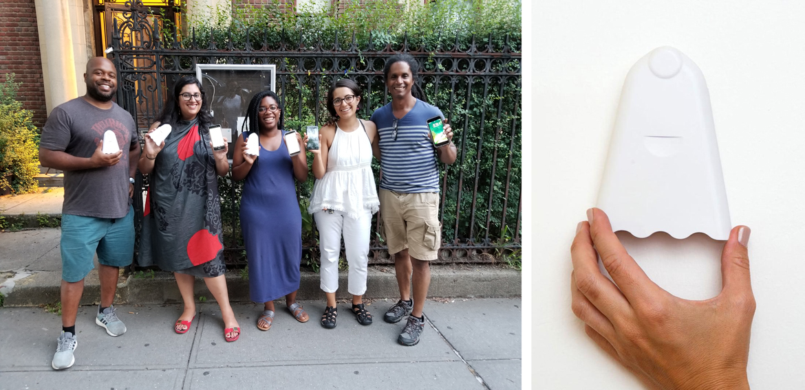
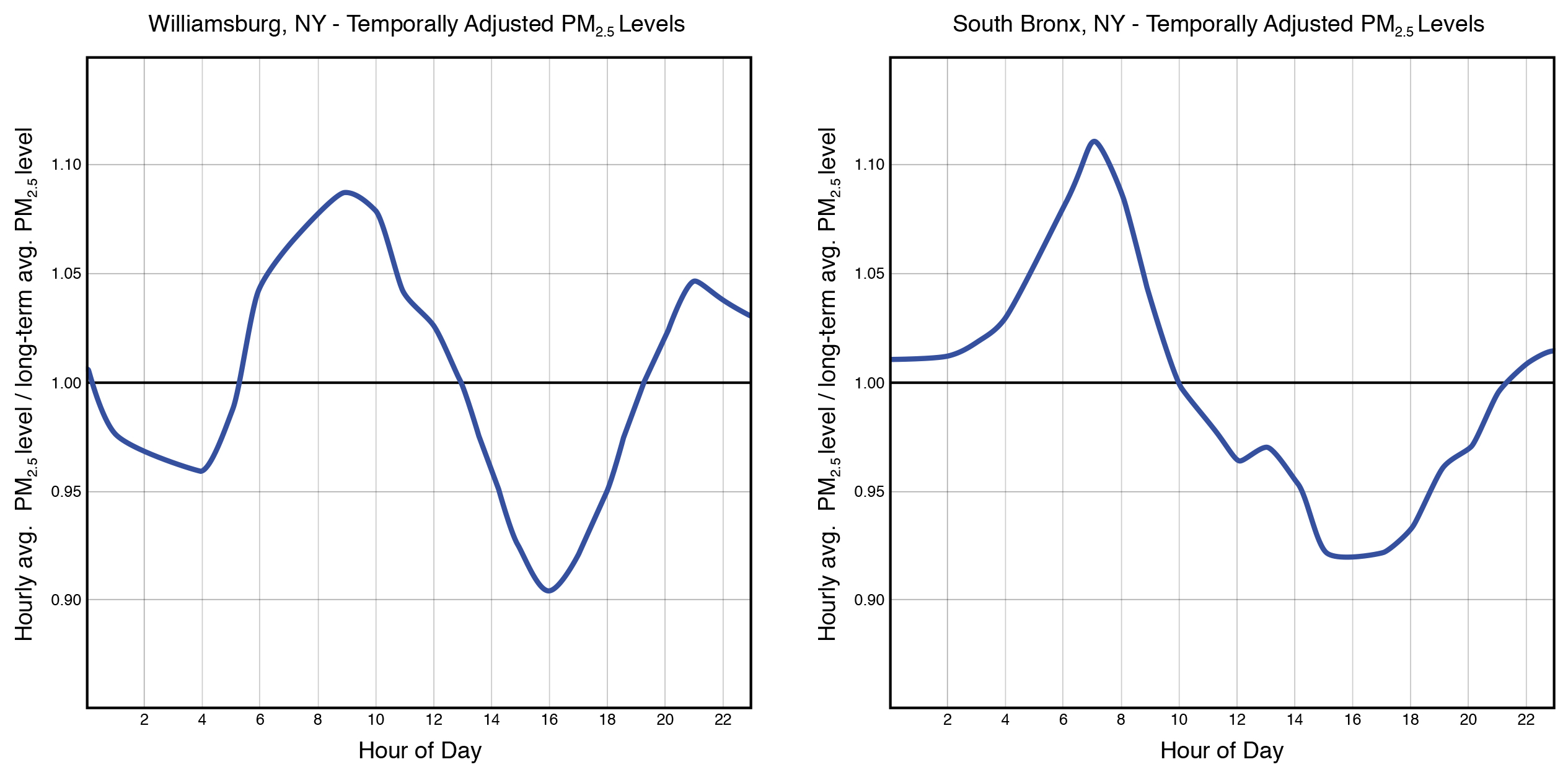
The Point CDC is one of six community-based organizations in the Bronx and Brooklyn involved in the New York City Environmental Justice Alliance’s Community Air Mapping Project for Environmental Justice (CAMP-EJ). This grassroots air quality monitoring campaign, led by low-income communities of color, launched in 2018; together with Eisl’s team, participating groups have been measuring, mapping, and contributing localized data while learning more about their own exposure to air pollution. Residents, primarily youth volunteers, use a citizen-science toolkit that Eisl’s team created based on their initial air quality measuring instrument, though participants use less expensive, hand-held equipment. “What I designed, that instrument cost nearly $15,000 apiece. Instead, we used AirBeams, which cost $200 dollars apiece. We got schools involved and other volunteers to do personal monitoring,” says Eisl.
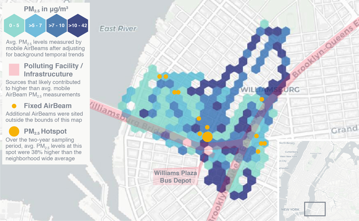
The collaboration focuses on communities in Los Sures, in the south end of Williamsburg in Brooklyn, and Hunts Point in the South Bronx. A recent report of CAMP-EJ’s findings shows that hyperlocal readings of PM 2.5 concentrations in Los Sures and Hunts Point are 20 times higher than readings from state-run monitors, pointing to traffic congestion twice per day — around 7 am to 8 am, and around 8 pm to 9 pm — as the leading cause of poor air quality.
El Puente de Williamsburg, a long-standing community organization, had already been organizing activities to bring attention to local air pollution, such as a flash mob along the East River waterfront during which group members displayed a sign showing the area’s levels of PM 2.5 air pollution. “Initially it was about raising awareness, because a lot of people in our neighborhood were not even aware that this is an issue,” says Leslie Velasquez, Environmental Justice Program Manager at El Puente. “I think a lot of that is just because people are so used to living around pollution that they don’t even think of it as being a problem.”
Data collection in Williamsburg is targeted at finding daily peaks in pollution around parks and schools where young people tend to be outside. According to Velasquez, La Guardia Playground, for instance, “is directly across from our Williamsburg Leadership Center, and it’s literally adjacent to an on-ramp of the BQE and just a bunch of different busy intersections. We found it’s one of the most polluted areas in our neighborhood.” But while PM 2.5 is a good barometer of general pollution levels, the AirBeams do not analyze airborne contaminants such as nitrogen oxide (NOx) and black carbon, which typically indicate that pollution levels may be far worse. “I know black carbon is in our neighborhood because I can literally see it,” describes Velasquez. “On our building, there is a fine film of black soot over everything.” Eisl confirms the importance of measuring such pollutants: “I would rather focus on VOCs, gaseous pollutants especially NOx, and black carbon — because black carbon is a good indicator of truck traffic. Trucks are a big issue both in Williamsburg and in Hunts Point, and we do not really address that.”
In Hunts Point, residents’ efforts to map the air quality of their neighborhood were organized through CAMP-EJ in partnership with Youth Ministries for Peace and Justice (YMPJ) and The Point CDC. Dariella Rodriguez has worked for both organizations and is an active leader in the project. “Young people came back really saying, ‘It smells. It’s toxic. I don’t feel good.’ The air quality issue is connected to quality of life beyond whether you have asthma or not,” says Rodriguez. “The infrastructure in our community tells them every day that they don’t matter.” Twice weekly, teams of five young people walk the route of the catchment area around their neighborhood, using a pair of AirBeams to take measurements. Team members validate each other’s readings, keep track of time, and document their findings. Performed in the morning, when traffic is heavier, the whole routine lasts about 45 minutes.
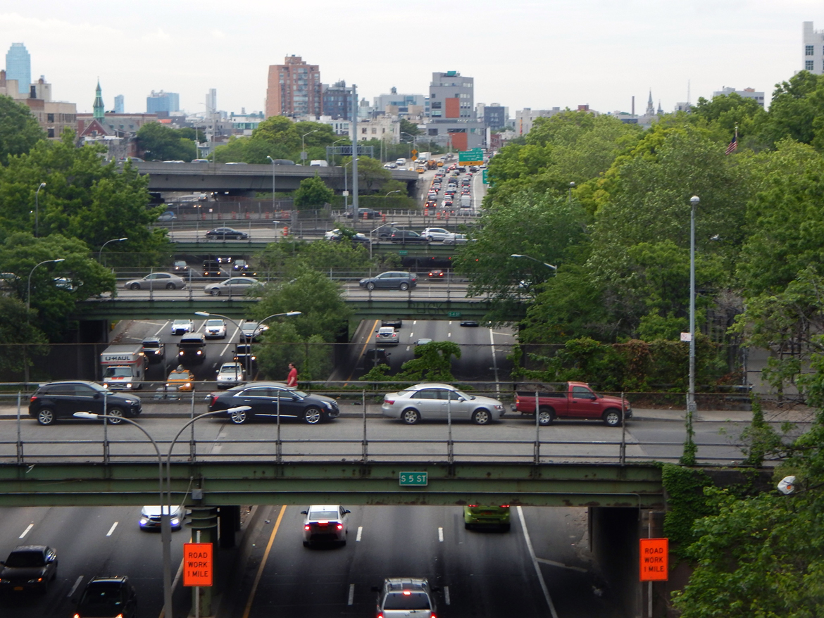
Community groups and experts agree that truck traffic is the primary culprit of polluted air for residents in both communities. A portion of Los Sures is adjacent to the Brooklyn-Queens Expressway; Hunts Point is enclosed by the Bruckner Expressway, and rife with warehouses and storage facilities. During the height of the Covid pandemic, air pollution in New York City as a whole was cut in half. But even as large parts of the city were shut down, truck traffic did not cease. “There was still traffic on the Cross Bronx. And then as soon as you made it down towards the West Side Highway and FDR Drive, it was empty. But there was still traffic here,” describes Rodriguez.
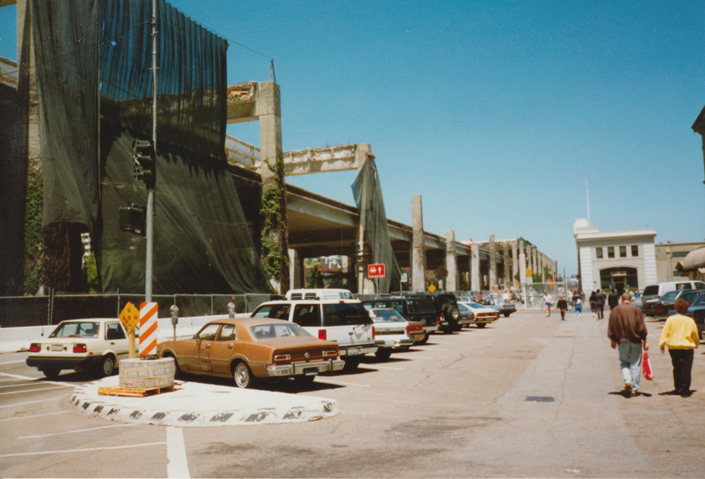
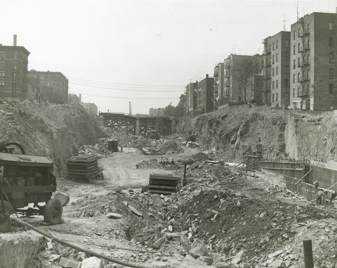
For communities like those in the South Bronx, intertwined environmental and racial injustices span decades — the result, in part, of urban planning policies which placed highways near housing. If the pandemic brought no respite from traffic locally, it has provoked a dramatic change in the national conversation about connections between planning, public health, and environmental justice. In December 2020, US Senate Democrats introduced the $435 billion Economic Justice Act, which includes $10 billion for urban highway removals. This initiative borrows from the Congress for the New Urbanism’s Highways to Boulevards program, which has successfully worked with communities to remove urban highways across the country, most notably in San Francisco.
But when a highway is removed, where does the traffic go? “There’s never been Carmageddon,” says Ben Crowther, who leads the Highways to Boulevards program. “What happens instead is that drivers adapt their behavior, they seek out multiple different routes. Some of them will switch modes: They’ll go to public transit if it’s available, cycling if the distance is short enough. The final thing that seems to happen is that people will reconsider the necessity of the trip altogether,” Crowther explains. “The good thing in terms of air quality is that, because you’re dispersing traffic, the threshold of pollutants that are being expelled from cars falls below the dangerous level at any one given area.”
For Rodriguez in the South Bronx, solutions to the “Toxic Triangle” — an area bordered by the Cross Bronx and Bruckner Expressways, as well as the Sheridan Boulevard (until recently, an expressway) — will require bold action. “When we talk about infrastructure, why can’t we be radical about that? They ripped out entire communities to build the Cross Bronx,” says Rodriguez. “They ripped out entire communities to create Central Park. So why can’t they rip out a highway if it didn’t work? It’s going to take bold, intense action in order to really create equity and justice for communities that have been ignored for way too long. It puts the ease of transportation for some over the livelihood of others.”
“We can’t bring down the Bruckner. It’s there, unfortunately,” says Fernando Ortiz, a community organizer in the Bronx and urban planner with the New York City Department of City Planning. But there may be other ways to offset air pollutants, through redesigning and greening spaces underneath and adjacent to highways. “Under the Bruckner, there’s a lot of space. How can we make this infrastructure greener, so that people aren’t walking under a concrete, unsafe, dark space — more like walking through an urban garden. It’s about reimagining the Bruckner,” says Ortiz, referring to a project he’s working on with The Point CDC called the Bruckner Underpass Greenway (BUG). Ortiz stresses that it’s important to mitigate pollution at its source and not somewhere else nearby. “Adding a new park a few blocks away, even if you can make it past the trucks and the sketchy part of Hunts Point, doesn’t address the problem at the site.”
In Williamsburg, the Brooklyn-Queens Expressway (BQE) presents similar issues as those found in the South Bronx. “The BQE has been a long-standing, thorny issue of what do we do with this extremely polluting piece of infrastructure that was also constructed by this notoriously racist urban planner,” Velasquez explains, referring to Robert Moses, who planned the Sheridan, Bruckner, Cross Bronx, and Brooklyn-Queens Expressways. But beyond the immediate displacement of residents, destruction of neighborhoods, and exacerbation of segregation that these highways wrought upon their construction, they have also posed serious health problems for generations of residents. Efforts to redress the negative impacts of New York City’s highways have been minimal. “A lot of people have been suggesting that you can’t just fix the BQE in Brooklyn; you need to look at it from the perspective of the whole area it runs through,” Velasquez continues. “Fix it in a real way that’s substantial and actually mitigates pollution — not just focusing on making sure the BQE doesn’t fall. I feel like that’s what they’re doing now, just the bare minimum . . . If you’re going to repair it, really systemically repair it, and make it less damaging.”
A proposal to cap a 2.4-mile stretch of the Cross Bronx Expressway and place parks atop decks covering its sunken portions has been gaining attention from local advocates, as well as the area’s congressional representative, Ritchie Torres, who is calling for redesigning and perhaps even removing the highway altogether. This has been done before in the Bronx. After decades of advocacy campaigns to both reduce truck traffic and provide access to the Bronx River waterfront, at the end of 2019, New York State’s Arthur Sheridan Enhancement Project converted the former highway into a large surface road and reconfigured ramps to the Hunts Point Market food distribution center to help keep trucks off of local roads. But according to residents, this transformation didn’t really take their input into account.
“After many years of engagement, they finally had a public meeting with different options so that the community could give suggestions and feedback,” says Rodriguez. “The options that they presented were the ones that were created before the community even gave ideas to them.” Rodriguez explains that once the community voiced their concerns with both the proposals and the engagement process, they were shut out of the decision-making process completely. “A lot of things were hidden: ‘You can’t take pictures. We can show it to you.’” At public presentations, images were “super zoomed-in or super zoomed-out. It was so intentionally difficult for us to be able to impact the process.”
For many Bronx residents, the Sheridan Boulevard was much more than just a highway removal project; it was about their livelihoods. “We’re talking about our air here. I’m not talking about it because it takes me ten minutes longer to get home,” says Rodriguez. Ultimately, residents believed that access to the Bronx River — along which two public parks, Starlight Park and Concrete Plant Park, have opened in recent years — was never really intended for them. “It wasn’t for us. Starlight Park is on one side of the Sheridan . . . It’s a gorgeous, beautiful park that was recently renovated. [Before], there was this disgusting blue bridge: that would be the only way for you to cross over. Now, these [new] buildings are there and now three crosswalks can exist.” For Rodriguez, improvements along the Sheridan have come at the expense of making the community’s needs and desires. “That should be a community land trust. There should be something that communities could vote on right now, to say: This is the kind of stuff we want in our neighborhood and this is the stuff we don’t want in our neighborhood.”
Real change can happen fast — with the right resources. Following the implementation of NYCCAS monitoring, Manhattanites lobbied the City Council to halt the usage of bunker fuels, the cheapest and dirtiest of industrial fuels, in building boilers. “Once we published [our findings] in the New York Times, people got up in arms in Manhattan,” says Eisl. “These rich people realized that air pollution doesn’t recognize socioeconomic boundaries, you have it everywhere.” A local law phased out these boilers, and buildings switched to using different types of fuels rather quickly. According to NYCCAS, by 2015, the city’s levels of sulfur dioxide, a byproduct of burning bunker fuels, dropped by 84 percent; by 2017, levels had dropped by 96 percent. Mandates for reducing building emissions are now making bunker fuels in the city’s building stock almost non-existent. But back in the South Bronx, Rodriguez argues that “we cannot be the roads for trucks. We cannot be housing waste. We cannot be last in line for green spaces. We cannot be at the [mercy of the] developers’ pick of where it’s worth it. It’s our community that we’ve been living in.”
As a neighborhood’s physical conditions improve, it becomes an attractive target for gentrification. But development could still keep legacy residents centered in the community. “A holistic plan includes policy on anti-displacement; there should be development without displacement,” says Rodriguez. “A lot of times we’re being asked to share our stories, share our experiences: share, share, share. Who are you? Can I know where you’re from, because if you’re not from here, what drove you to do this work? What is motivating it? Whenever people come, and they teach us with the goal of giving us a tool that we can then use ourselves to be autonomous, that’s really helpful. Then it’s like a trade: I learned something; I can use it.”
“This idea of citizen science, of doing hyperlocal monitoring, is becoming very popular with academic and government institutions,” says Velasquez. “There are a lot of instances where this isn’t being done in a grassroots way, like they’re not really allowing the community to lead. Reflecting on El Puente’s collaboration with NYCCAS and the City, Velasquez describes the roles and motivations of different stakeholders. “The City and academic researchers have a different agenda than we do as a community-based organization. We’re very focused on using the data for advocacy.” For El Puente, citizen science supports community action. Based on their findings, the group has developed a five-point action plan for cleaner air and community wellness, including specific strategies such as the establishment of a local resiliency and public health emergency task force, and a community-led redevelopment of the BQE.
“We really need tailored interventions to mitigate these specific sources of pollution in the community,” says Jalisa Gilmore, a former research analyst at the NYC-EJA and co-author the CAMP-EJ report. “We already know that transportation is a big source of air pollution. So what we really need to see [is] the City becoming more intentional about policies to mitigate that.” In addition to City and State support for continued hyperlocal monitoring, CAMP-EJ’s study calls for, among other things, green infrastructure and vehicle electrification. These are not blanket solutions, but specific and targeted actions to address areas where people are most affected by pollution. “If we know it’s a hot spot, make sure there’s only electric buses that are going through,” Gilmore continues. “I think the most important thing is really working with the communities to understand what they want, what works best for them, rather than the City just coming in. Local planning processes are important to improve air quality, but they really need to be building off the work that the community is already leading.”
The views expressed here are those of the authors only and do not reflect the position of The Architectural League of New York.
An exploration of what it means to live in, build on, and design for a city of pervasive toxicity.