We are celebrating 15 years — and counting — of stories that are deeply researched and deeply felt, that build a historical record of what the city has been.
We are celebrating 15 years — and counting — of stories that are deeply researched and deeply felt, that build a historical record of what the city has been.
Somewhat lost in the deluge of bad climate news, an analysis last summer by the Union of Concerned Scientists calculated the number of residential and commercial waterfront properties in the United States at risk of chronic inundation. In less than 30 years, 300,000 coastal homes and 14,000 coastal commercial properties face disruptive flooding. By the end of the century, the equivalent of all the homes in Los Angeles and Houston combined could be at risk. The study quantifies the “staggering economic impacts” of sea level rise by century’s end to the tune of $1 trillion in property values and tax revenue lost.
The costs are so high because, for so long, waterfront development has been an engine to create wealth. Historian Kurt Schlichting scans Waterfront Manhattan: From Henry Hudson to the High Line to show how New York became a global city by building a vast maritime infrastructure at the river’s edge. Beginning in the 18th century, the city allowed private citizens to buy water-lots off the shoreline, which they turned into piers and wharves, or filled in to support new warehouses, tenements, and factories. Over three centuries, they created three and a half square miles of real estate, oscillating all the while between private control and public oversight of New York’s “most priceless asset.”
Today, New York State ranks third in the nation in threatened coastal property values, with thousands of Queens and Long Island homes in harm’s way. Neighboring Jamaica Bay and its marshlands, residential communities, and major international airport, presents an opportunity to revisit the complex interface of land and water. Concern with the financial repercussions of floods drives policies and designs to manage risk. But inflexible strategies like flood insurance and seawalls stick to the status quo, at great public cost for a debatable public interest. The authors of Structures of Coastal Resilience suggest that rather than single-mindedly protecting what already exists, we need to understand the physical changes that loom, and plan new ways of living with the hazards of storm surge and sea level rise. Since before Sandy soaked the New York harbor, Catherine Seavitt Nordensen and Guy Nordensen have been developing designs for coastal resilience from the Hudson to the Yangtze. New techniques to understand what the future might bring underpin creative approaches to reconfigure vulnerable settlements and ecologies for that partially predictable future.
One proposal for Narraganset Bay creates new forests to protect communities from encroaching coast. On same stretch of Rhode Island coastline, Elizabeth Rush focuses on a dead tree. The image of the rampike — a tree killed by flooding salt water — haunts Rising, her account of the “new American shore.” Traveling from Louisiana to Staten Island, Florida to the San Francisco Bay, Rush brings to life the people, places, and species imperiled by higher tides. Risks to property values are real, but the loss of a father, a culture, a hummingbird species smaller than a spool of thread, are realer. Rush’s accounting is vivid, and very sad. The book attempts an end on positive note, at a 15,000-acre project to rehabilitate coastal wetlands in the Bay Area. We still have some agency to stop what we have set in motion, headed to an uncertain future that seems incommensurate with everything that will soon be lost.
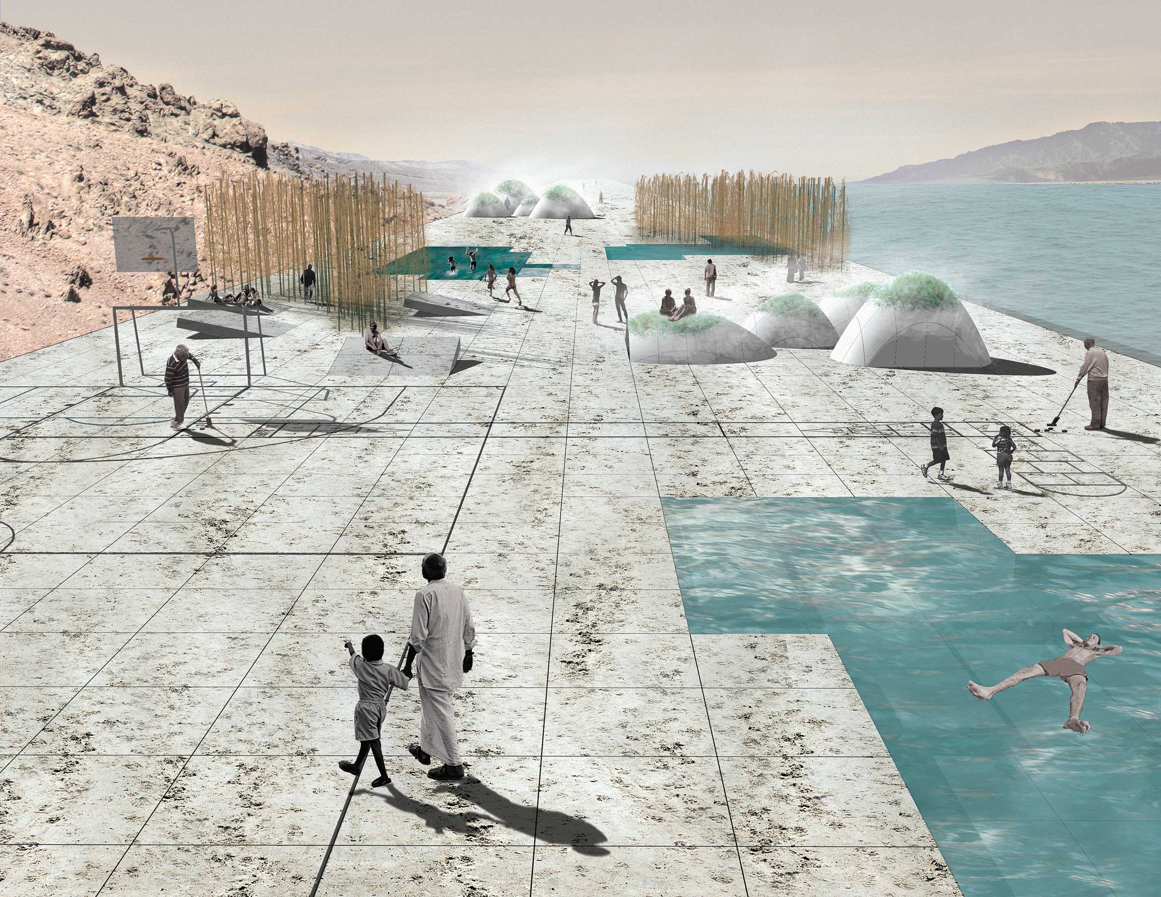
In uncertain times, another approach is to imagine an entirely transformed future. Where water is a liability, the architects of UrbanLab propose to make it an asset. A compendium of their work on water, Bowling: Water, Architecture, Urbanism focuses primarily on the freshwater systems of Chicago. Designs to put the resource to work, creating value, cloak the hardest realism in flights of the imagination. Instead of conserving retreating wetlands, the architects manufacture them in a plan to sequester rising seawater by flooding Death Valley. Glaciers melt at the poles while the arid lands of the American west overexploit what water they have access to. Is it a no-brainer, then, to desalinate the rising seas that threaten the Gulf of California, and deliver them via aqueduct to the depressions of Death Valley? Settling in new towns astride the aqueduct, designing “new relationships between ecologies and economies,” we can hold on for another century on earth. But transformation beyond bare survival necessarily hinges on accounting for values that exceed the current monetary worth of coastal real estate.
The views expressed here are those of the authors only and do not reflect the position of The Architectural League of New York.