We are celebrating 15 years — and counting — of stories that are deeply researched and deeply felt, that build a historical record of what the city has been.
We are celebrating 15 years — and counting — of stories that are deeply researched and deeply felt, that build a historical record of what the city has been.
New York City’s public transportation is in the midst of a slow-moving crisis. Years of deferred maintenance, staff shortages, and insufficient funding have left subway commuters navigating regular delays and bus passengers riding the slowest buses in the nation. Some attempts to improve this state of affairs, like increased headways and more efficient routes, have been slow to materialize. And congestion pricing, which would provide much needed funds for upgrades to the transit system, has been caught in a decades-long will-they-or-won’t-they plot. As planners and politicians push for interventions like charging infrastructure to encourage adoption of conceptually climate-friendly electric vehicles that will do little to ease congestion, effective public transportation, especially buses that transport commuters swiftly to their destination, may be the crucial piece of the puzzle for a greener, more equitable city.
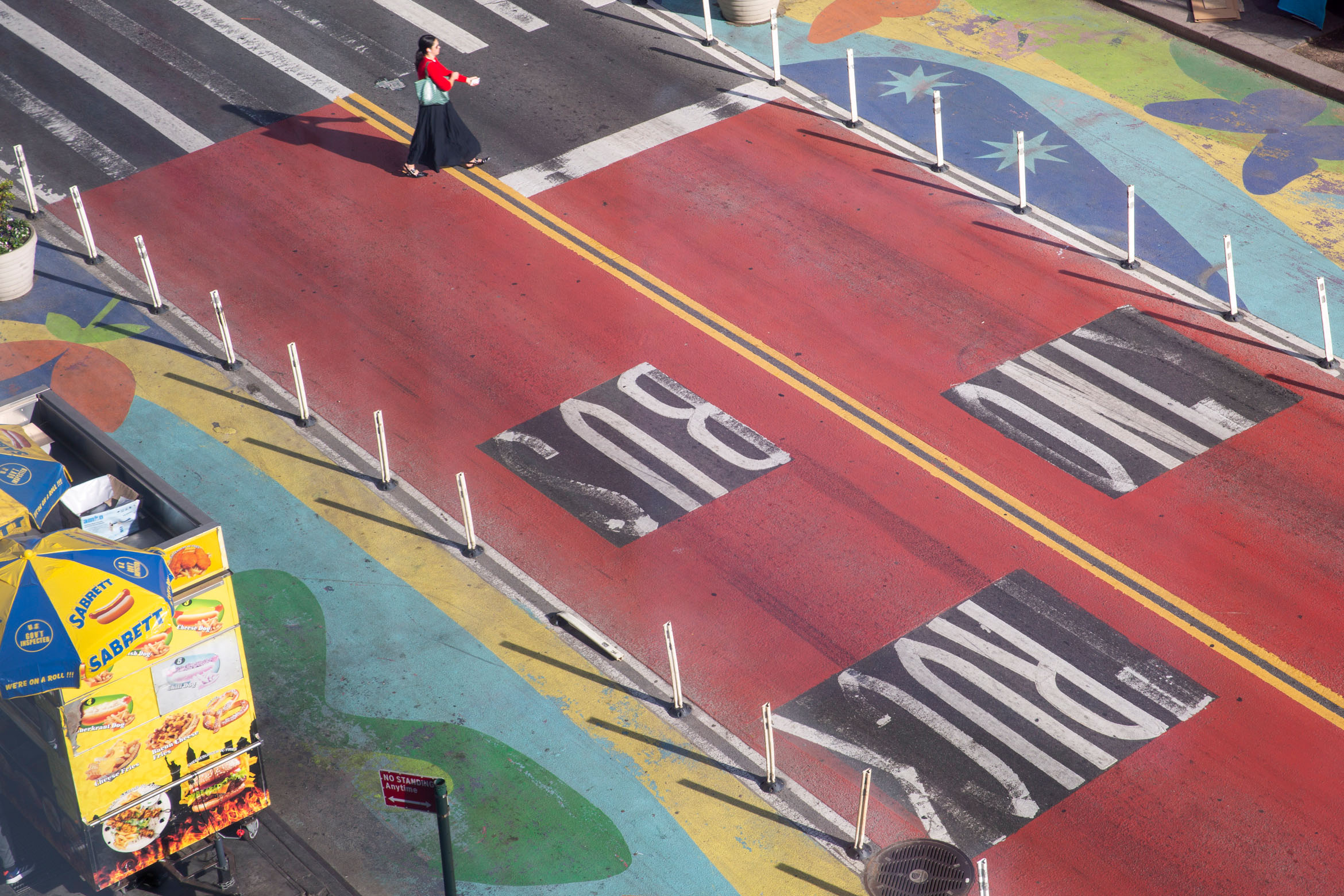
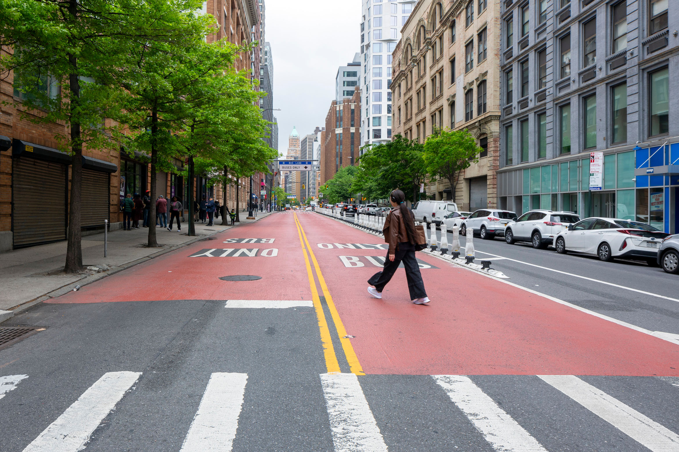
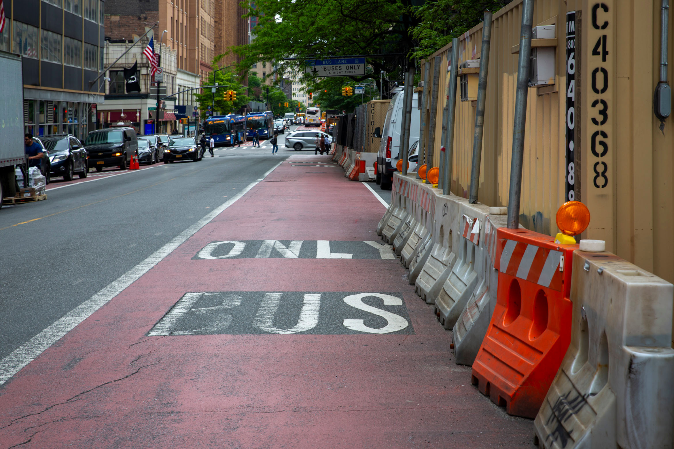
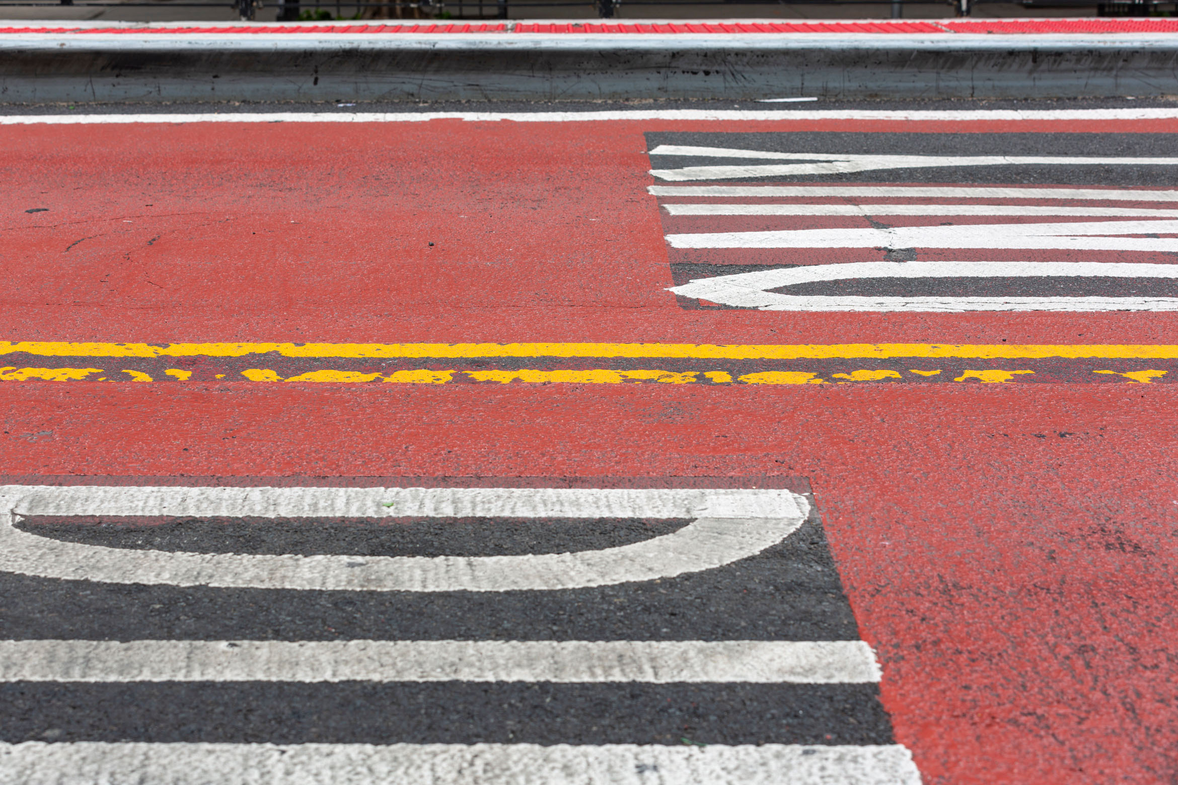
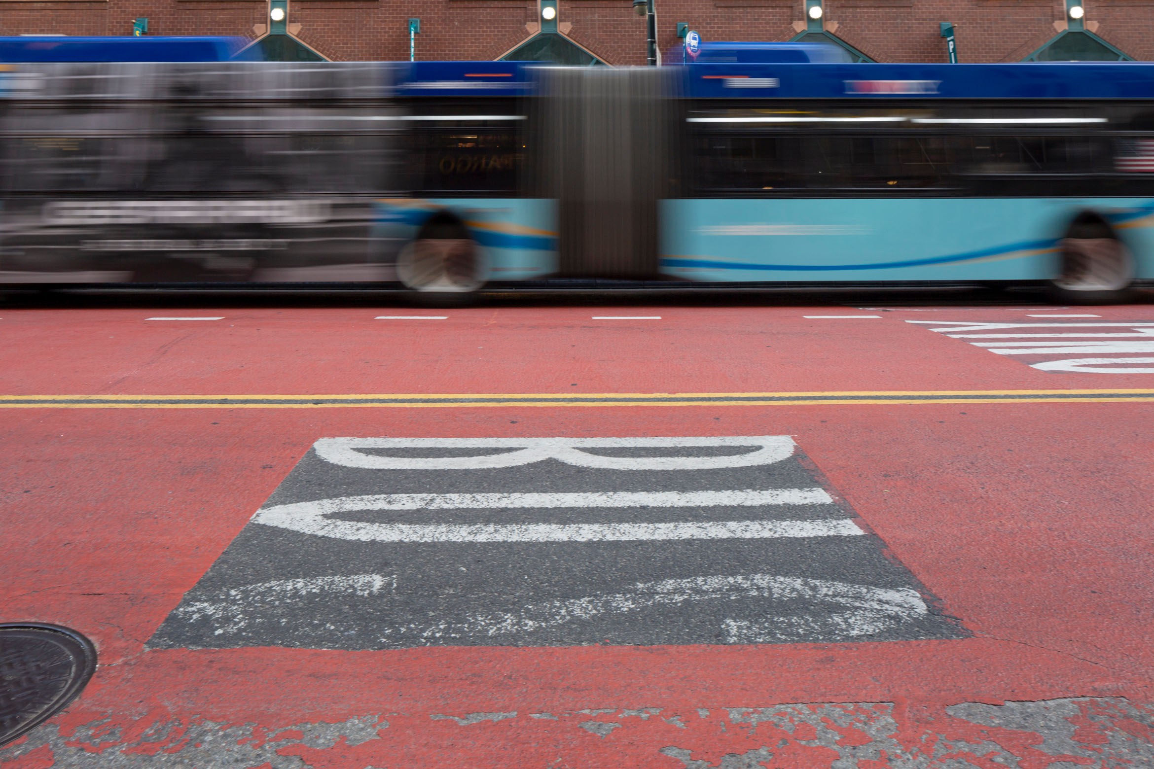
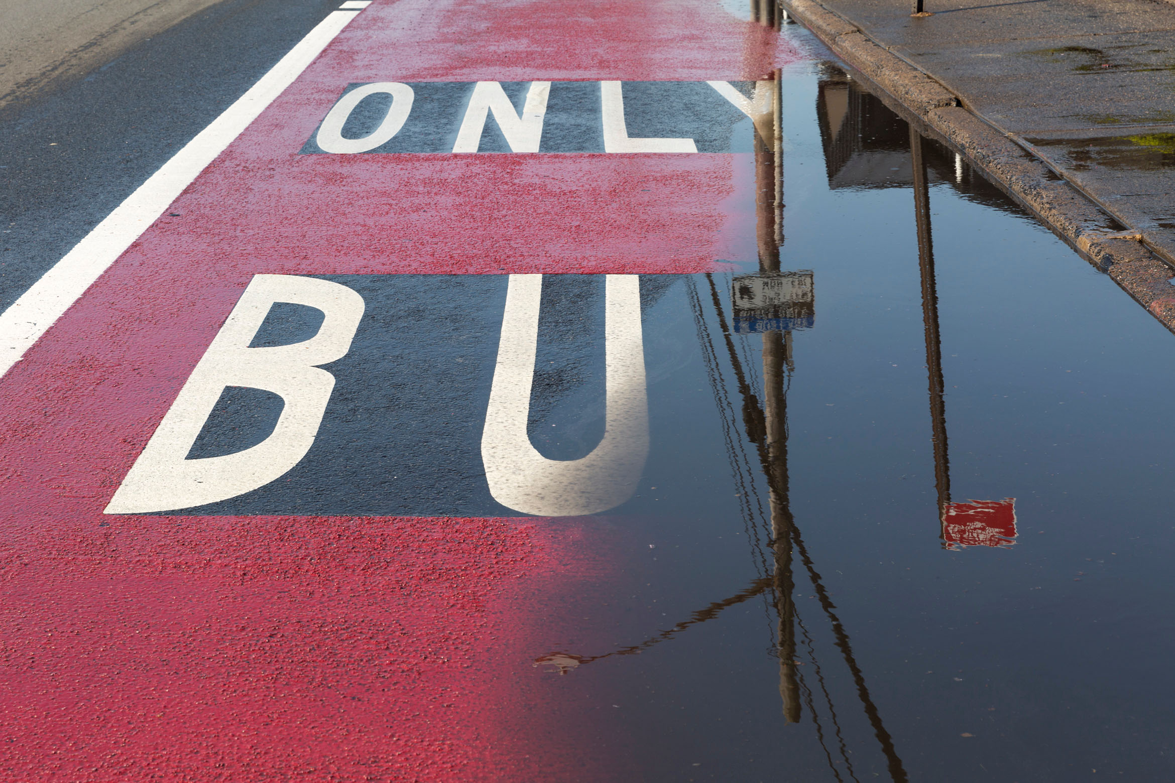
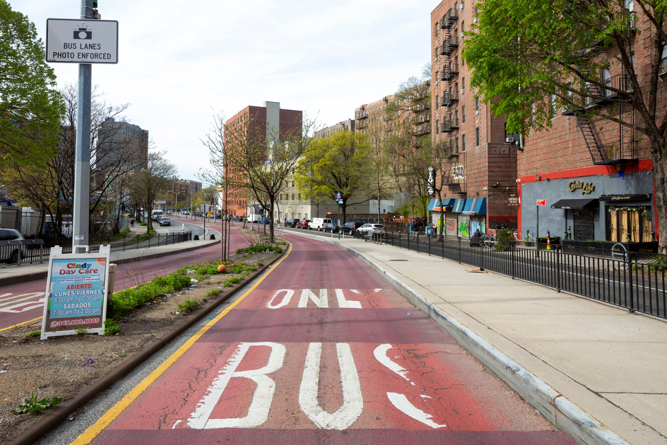
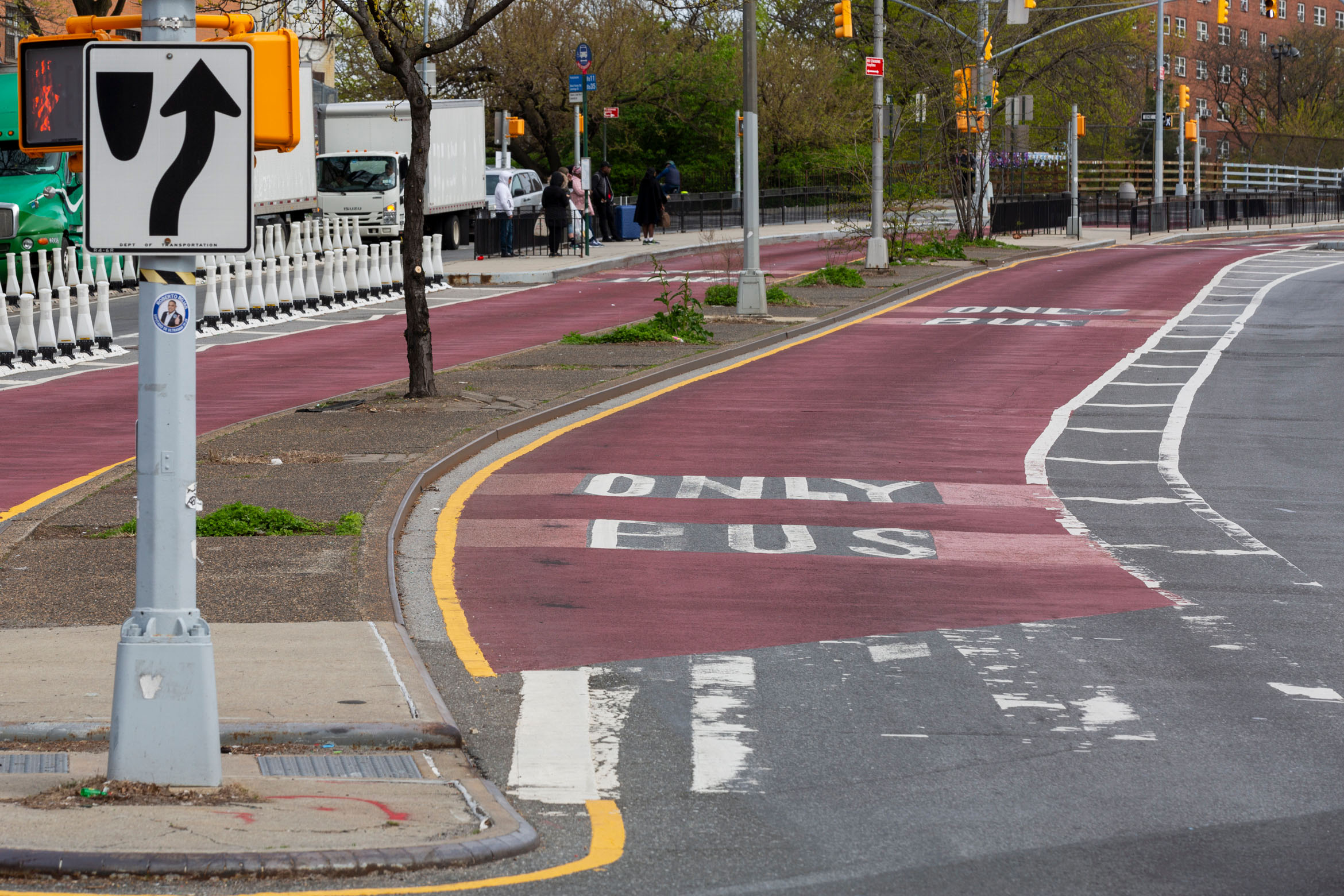
In the absence of comprehensive investments, the MTA, which oversees the City’s subways and buses, but notably does not oversee its streets, and DOT, which does, have an arsenal of tools that, deployed effectively, can quickly speed up commutes: red paint, signage, and enforcement cameras. These are the elements of a bus lane. The premise is simple — designating a part of the road for the exclusive transit of public buses — and is enforced through a range of designs. In some places, a lane is just a suggestive red painted strip, in others, a robust busway is separated by bollards. A flurry of new bus lane construction followed the passage of a streets master plan by New York City Council in 2019, but more recently, installation has slowed. Mayor Adams only built 20.7 of the 50 miles of bus lanes mandated by law between 2022 and 2023, and many of these have been undercut by the political maneuvering of wealthy neighbors and businessowners. As the city vacillates in making significant changes to its traffic patterns, John Surico surveys pavement marking practices and politics across the five boroughs, and photographer Alexa Hoyer focuses in on guidelines many drivers choose to ignore.
Each weekday, the buses of New York City carry more people than the buses in Chicago and Los Angeles combined — nearly 1.4 million in 2023. There are more than 300 routes in total. Yet buses here are some of the slowest in the nation, rarely topping nine miles per hour, about the pace of a brisk run.
Bus lanes are a design tactic to counter that. Give buses priority on the street, and they’ll sail through traffic. The hope is that with faster, more reliable buses, riders will follow. Short of larger transit infrastructure projects like new subway lines — which take years, billions of dollars, and state and federal involvement to complete — bus lanes are quite possibly the most effective way that cities can swiftly change the commutes of lots of people. If cities are serious about reducing car trips, a key source of carbon emissions, then bus lanes may play an outsized role in the years ahead.
The first time that buses received “exclusive” access to a slice of New York City street was on May 20th, 1963. On Livingston Street in Brooklyn, between Flatbush Avenue and Boerum Place, a large white sign had a message for motorists. Starting that day, if they entered the curbside lane westbound from 7 am to 9 am and eastbound from 4 pm to 7 pm on weekdays and Saturday, they would be towed by traffic enforcement agents. (A similar setup appeared on Staten Island’s Victory Boulevard.) Yellow stripes and white dashes signaled a newfound prioritization of passengers on the B41, B45, and B67 bus routes.
The idea of creating a lane reserved for bus traffic in New York City was that of Traffic Commissioner Henry A. Barnes. Other major cities had successfully deployed the new road designs, he said; New York was playing catch-up. But, he added, the experiment would be limited to streets where buses already outnumbered automobiles. Together, the routes in Brooklyn and Staten Island saw 440 buses during rush hour every day.
Today, the buses along those same numbered routes on Livingston Street serve 50,000 daily riders, and the street has been reconfigured again. In 2024, the Department of Traffic — now the New York City Department of Transportation (NYCDOT) — finished converting the southern half of the corridor (that rush hour curbside lane and a traffic lane) into a 25-foot-wide, two-way bus lane. Loading, parking, and driving for private cars and trucks is contained to the north, westbound side. Concrete pedestrian islands, special traffic lights, and white bollards delineate what is for bus riders and what is for everyone else.
New York City buses are still 800,000 regular passengers short of their 2018 figures. The Covid-19 pandemic scrambled work and travel patterns for riders, but it also placed a renewed emphasis on their plight. Compared to the general populace, bus riders lean older, foreign-born and low-income — demographic slices that largely mirror those of frontline workers. When the pandemic struck, bus ridership didn’t plunge as deep as that of the subway, and it has recovered faster since. Bus riders had to keep moving.
“As New York City emerges from the difficult days of Covid-19, our commitment to faster and more reliable bus service has never been more important, as buses serve a critical role — both in communities hit hard from the pandemic and by essential frontline workers,” said then-NYCDOT Commissioner Polly Trottenberg. This sentiment helped resuscitate a city-led plan to speed buses up along corridors with some of the highest ridership and worst speeds. It included a bevy of new bus lane designs.
For years now, transit officials have been tinkering with the right mix of measures to design something functional for bus riders — with the ultimate aim of luring more, perhaps even a few sitting in the cars next to them in traffic — building off work that started back on Livingston Street in 1963. The result is a hodgepodge of different stylistic approaches to the bus lane, each one evoking a larger story of mobility in the city. But how that all unfolds — and what comes from it — depends on the battleground.
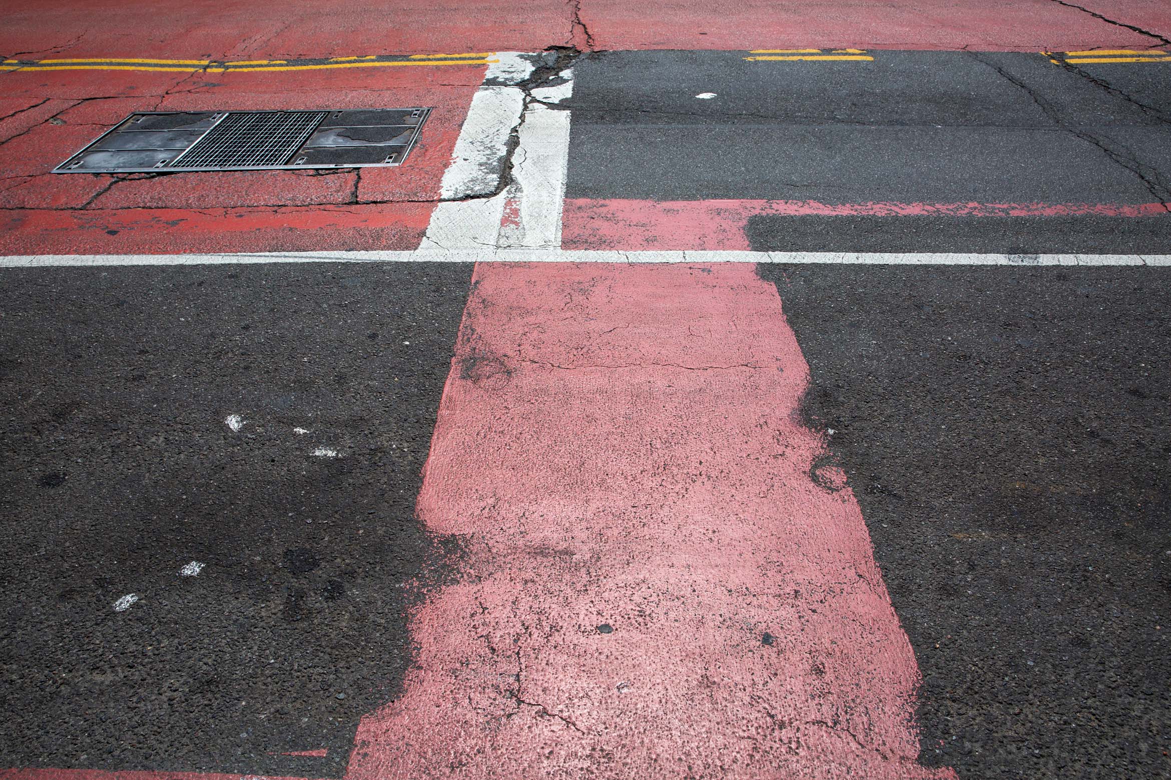
In 2007, the year that Eric Beaton started at NYCDOT, the City painted a bus lane red for the first time. Agency crews laid down epoxy material on 57th Street in Manhattan, as part of a pilot program to more visibly signal to drivers that the lane wasn’t in name only. It was removed two years later due to concerns of durability and visibility, and replaced with a more resilient, and now standard coat.
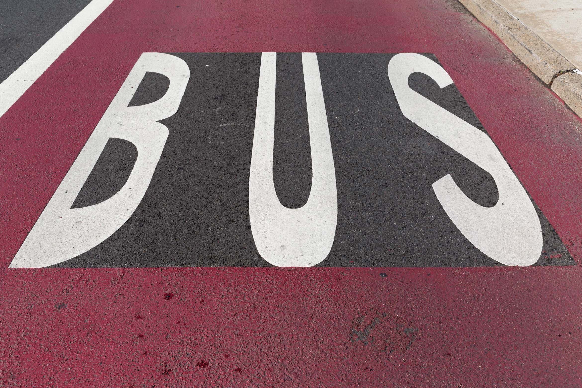
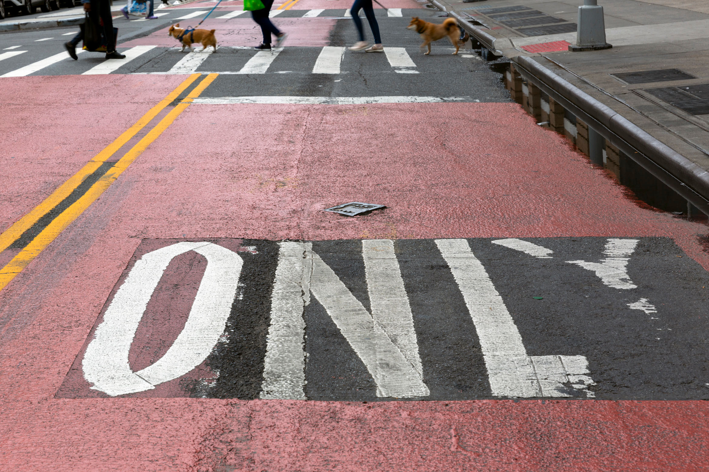
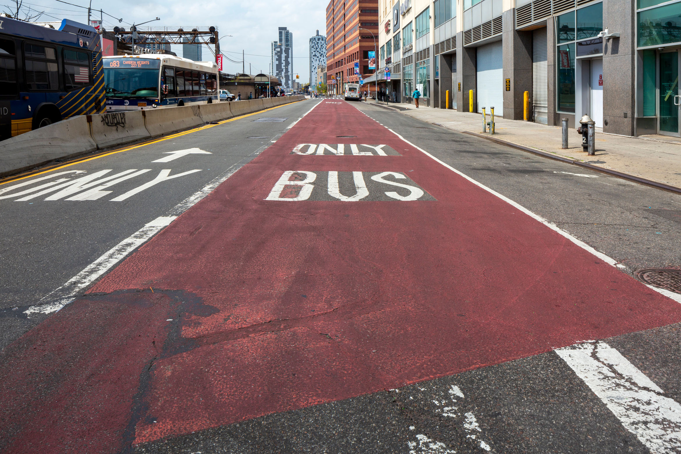
“We had a limited toolbox then,” said Beaton. “But we figured out a few things.” Painted red lanes, with the words “BUS ONLY” stenciled in white, would soon become staples of the streetscape. (Even though it would take over a decade for the Federal Highway Administration to adopt it as a standard practice nationwide.)
Beaton, the department’s Deputy Commissioner for Transportation Planning and Management, now oversees that “toolbox,” common planning parlance for the diversity of design interventions that the city can deploy to effect change. He dissected his agency’s step by step thinking when it undertakes what it calls “bus priority” projects. First are the street specs, namely its width. (“A couple of feet can really change what you can do,” Beaton said.) Next is land use. Density — be it commercial or residential — is considered when deciding the direction of the intervention. Off-street capacity for parking or loading helps determine what can be moved elsewhere; alternative routes like highways or arterials are mapped out.
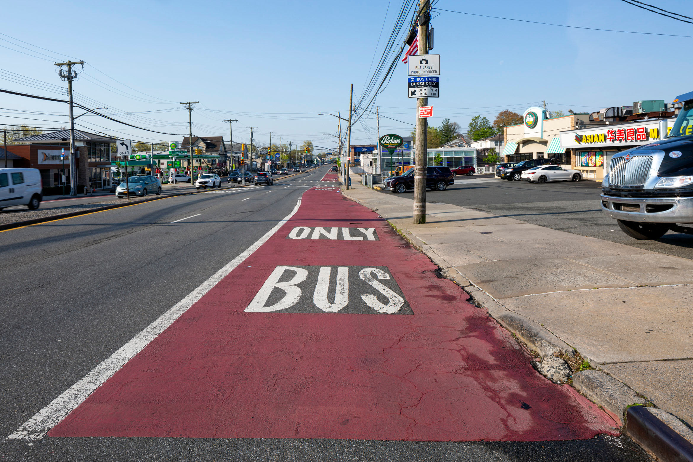
Hylan Boulevard, on Staten Island, is a north-south corridor which runs 14 miles near the shore. It is 60 feet wide, with two travel lanes and a parking lane in each direction. The streetscape is emblematic of the borough, with stretches of strip malls pocked by parking lots. There is ample room for trucks to unload or cars to park.
That backdrop brandishes a bus lane that is painted red on the north and south curb lanes of the boulevard, serving local, express, and Select Bus Service (SBS) routes. It’s operational during rush hour, abetted by automated enforcement cameras affixed to overhead signs and poles. It lacks physical protection, but with the area’s abundant parking, stopped cars are less of a concern; even if confronted with one, bus drivers have enough room to maneuver around them. A recent bus ride saw few drivers blocking the lane; in fact, our speed surpassed the ETA predicted on Google Maps.
Would the same design succeed in a denser part of Brooklyn or Queens? Maybe not. But it works on Staten Island. “You can think of streets as being comparable, but every one is a little bit different,” Beaton told me. “We really look at each zone’s space. That’s why you see a number of different designs. We’re trying to make every bus lane fit the individual context.”
And that context changes. The story of a street is one of incrementalism. It gradually adjusts to respond to emerging trends or demands, Beaton said. Second Avenue in Manhattan, is a recent example of that. SBS service, with a curbside lane that flips to parking outside of rush hour, began there in 2010. But whatever gains that brought slowly evaporated over time, and as online delivery spiked. Now, that bus lane is often blocked by trucks. A new proposal will put metered parking closest to the curb, with the traffic lane next to it converted into an “off-set” bus lane, painted and likely outfitted with cameras with the same sidewalk bus stops, and the curb retrofitted to metered parking. (The bike lane on the other side of the avenue, which is now one of the busiest in the city, will be widened.) It’s slated for implementation this summer.
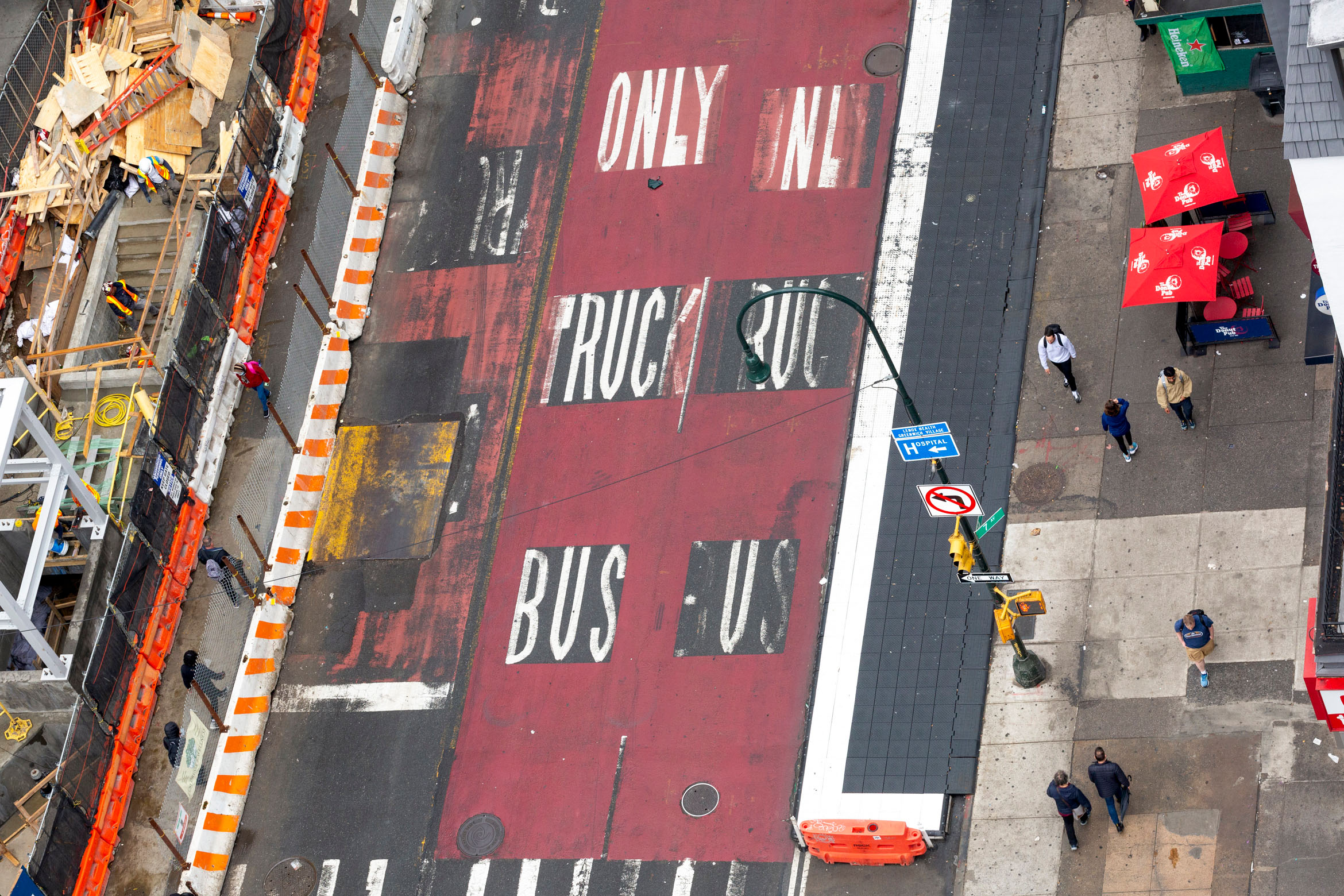
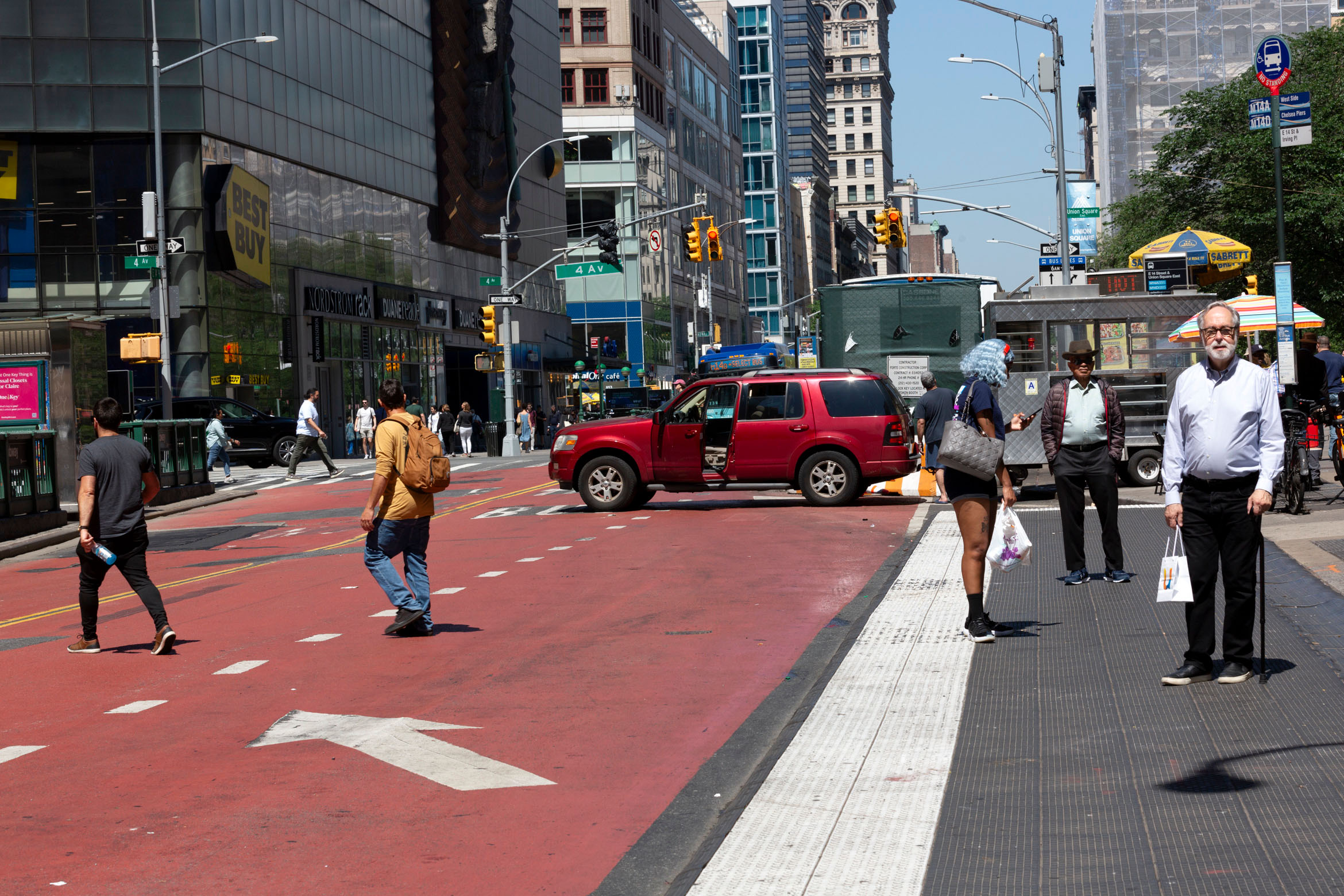
14th Street from the Lower East Side to the Meatpacking District historically had little infrastructure for buses. M14 buses often found themselves mired in traffic, delaying its then roughly 14,000 daily weekday riders. But the prospect of a years-long service shutdown on the L train, which snaked underneath 14th Street, pushed the city to implement its second ever busway in 2019, which limited portions of the busy thoroughfare exclusively to truck and bus traffic. (Brooklyn’s Fulton Street was the first, implemented in the 1970s.) Signs and cameras nudge automobile drivers to turn off the street at each crossing, with that red paint once again reminding one of the rules.
Today, the M14 glides down 14th Street almost as fast as the subway. It’s a much quieter block than in pre-pandemic days: pedestrians walk across the street with ease, without waiting for the light, and cyclists use it as a de facto boulevard. The busway is said to have increased speeds by as much as 24 percent. (But still, the route faces post-pandemic realities: although faster, the buses now carry less than half the passengers that they did in 2019.)
Similar designs have since popped up further uptown, and in Flushing and Jamaica. “It’s a treatment that obviously is not appropriate on every street that has a bus, but in these really busy places, it has made a very dramatic difference,” Beaton said. “There’s a theme to this of more visibility — of accommodating the other uses that reasonably need to be there, and of dedicating the space to actually make it work.”
The state-run Metropolitan Transportation Authority (MTA) operates the buses in New York City. But NYCDOT controls the streets they run on. It’s a web of governance that makes it confusing to pinpoint who is responsible for what. Bus lane cameras? That’s MTA. Bus lane design? That’s NYCDOT. Service improvements, like greater headways and new routes? MTA. Service amenities, like bus shelters and countdown clocks? NYCDOT. (When I reached out to the MTA for comment, I was quickly deferred to NYCDOT.)
MTA officials vocally support faster buses, but the best way to do that — repurposing street space to optimize their travel — falls on the city’s transit agency. It’s common courtesy for planners to present transit projects to local elected officials and community boards as part of the engagement process. It also lessens opposition later. But in this hyper-local arena, the interests of private car drivers, property owners, businesses, and others have as much, or usually more, weight than that of bus riders, who are often unaware of meetings or unable to attend.
Unless City Hall decides to push for a project, this balancing act can stymy a design’s ambition or timeline. For local transit advocates, the story of Fordham Road exemplifies this vulnerability: a NYCDOT plan to upgrade an existing slow bus lane to a busway was distilled to an offset lane with more cameras, after local business owners and cultural institutions found an ear with City Hall. Scenarios like this have made progress touch and go: In 2023, under Mayor Eric Adams, the city installed just 7.8 miles of bus lanes across the five boroughs. This was over 20 miles short of the target prescribed by the NYC Streets Plan, signed into law in 2019.
Installing new bus lanes has proven difficult, to say the least. Take Downtown Jamaica in eastern Queens, the city’s busiest bus hub. On an average day, 45 routes pass through a few blocks’ radius, picking up or dropping off riders at the Long Island Rail Road and subway terminal there. It’s the exact sort of place where buses are a lifeline: commuters, filing in from north and southeast Queens or Nassau County, converge at mass transit that can whisk them away to all points west.
In 2021, the DOT installed busways like on 14th Street, along Jamaica and Archer Avenues, a parallel set of corridors where buses were slugging along not much faster than five miles per hour. Now, only buses and trucks can enter certain stretches, and gaps are patched up by curbside bus lanes.
Originally, the restrictions on Jamaica Avenue were in effect 24 hours a day, seven days a week. But after pushback from local businesses, City Hall limited it to 6 am to 8 pm. (Archer Avenue’s busway stayed intact.) This didn’t go as far as some elected officials would’ve liked: a letter to NYCDOT from the Queens Borough President and local Councilmembers called for the restrictions to be pared down to just rush hour. “People cannot access our local businesses,” said one Councilwoman at a hearing with NYCDOT.
The busway on Jamaica Avenue has netted only a minor increase in speeds during peak hours, while the “priority” on Archer Avenue is repeatedly plugged up by cars and trucks. A deficiency in human-led police enforcement — especially considering that NYPD vehicles often intrude on bus lanes — has underpinned a gradual switch from deploying personnel to cameras.
A bus lane is a built reflection of the surrounding neighborhood’s political struggles — a series of often uneven trade-offs amongst local democracy’s motley crew. This is something advocates like Jolyse Race, a senior organizer with Riders Alliance which represents bus riders, must deftly consider. What is politically feasible is perhaps just as important to keep in mind as what would make transit faster.
“The protected bus lanes are better but offset bus lanes are fine — at least you’re prioritizing the bus,” Race explained. “But you’re still folding to car drivers that make double the amount bus riders do, as well as business improvement districts and the community boards that are not necessarily representative of the community a lot of the time.” Busways are the loftiest of ideals that organizers aim for, she said. Her preference is lanes running down the center of a thoroughfare, a design trademark of what’s considered true bus rapid transit (BRT) in many major cities.
BRT is often seen as the gold standard for bus lane design: a system with a speed and ease that warrants its own moniker. In Curitiba, Brazil, buses have picked up passengers waiting in glass tubes placed in the middle of streets and moved with full reign over certain corridors since the 1970s. More affordable than a shiny new metro, BRT has more recently emerged everywhere from Indianapolis to Istanbul.
New York City has BRT in bits and pieces. Some of them can be found on the Bronx’s Edward L. Grant Highway where multiple lanes of speeding traffic were sliced up in 2020, moving buses inward and close to “floating” bus stops, often outfitted with plantings and benches, while pushing space for traffic, parking, and cycling outward. This allows buses, which can make up over two-thirds of the roadway’s usage, to run virtually unencumbered.
Because it was a wider road, competitors for curb access — like trucks, local businesses, private car owners — had less to contend over. The mid-pandemic project enjoyed support from local officials and City Hall, too. That’s the sort of formula that Race must calculate when she’s launching a campaign to add bus lanes on Flatbush Avenue, for instance. (That project has been underway for some time.) “It’s all politics,” she said.
Steady progress creates a certain amount of path dependency. Once bus lanes are in, they cement changes to the streetscape — literally and figuratively — and can often be difficult to undo, outside of more granular tweaks. (This flexibility is part of what make buses more attractive to advocates, relative to rail.) People get used to them. After just a few months, one struggles to imagine what came before.
But a bus lane needs buy-in to work; if it lacks protection or enforcement, it’s nothing more than a street with some paint on it. For JP Patafio, who has operated buses for over a decade for the MTA and serves as a vice president for the Transport Workers Union, caveats — be it from community boards or City Hall — act as a chilling effect on what’s possible. “What that does is it makes bus lanes into a jigsaw puzzle. They don’t really work,” he said in an interview. “But if you take to a bus operator and ask them about a bus lane, they like it.” He paused, before clarifying: “When it works.”
In late April, state lawmakers in Albany approved a budget with the largest increase to New York City’s bus service in decades. Five express and thirteen local routes will run with more regular frequency, with a $12 million infusion of funds for more buses and drivers. One of the criteria in their selection was whether they already had a dedicated bus lane.
The expansion came in anticipation of the rollout of congestion pricing, the first in the nation (but not in Europe and Asia) system where motorists would pay $15 to enter Manhattan below 60th Street, in an effort to shore up — and expand — a beleaguered mass transit system. MTA officials expected an increase in daily ridership of up to two percent, which doesn’t sound like much, but at New York’s scale that’s equivalent to around 100,000 new subway and bus riders a day.
The plan was set to go into effect on June 30, and buses, in particular, were expected to play a star role. A new slate of projects announced by NYCDOT in May, ahead of the congestion pricing rollout, included a potential busway on 34th Street and bus lanes on 96th Street in Manhattan, to swiftly shuttle straphangers from the outer-boroughs onto subways or into Manhattan itself. Their calculation follows lessons from London, a city that doubled down on service and bus lanes for its renowned bright red double-decker Routemasters when congestion pricing debuted there in 2003, which many transit observers cite as a key reason for the nearly 5 million bus trips they now see there every day.
But now, it faces a hazy future, if not fatal demise: in early June, Governor Kathy Hochul — its most vocal advocate until late — shocked transit advocates and commuters abound when she announced that she would “indefinitely pause” the impending program, citing concerns that the charge would knee-cap the region’s post-pandemic recovery. What that means for the $1 billion in projected annual revenue, dedicated to fund amenities like new all-electric buses and station elevators, is unclear, let alone the new bus lane projects promised. But beyond that, perhaps the greatest legacy of the plan’s cancellation is the chilling effect that it could pose on the future of transit in New York City writ large.
Advocates already had reason to remain skeptical: A 2019 law required the Mayor to build 50 miles of “new and improved bus lanes” in his first two years in office, but his own agency reported that less than half of that was complete. (Staffing, supply chain issues, and, of course, politics are cited as the main culprits for the delay but advocates primarily point to a lack of political will.) Any push to truly prioritize buses on the streets of New York City will entail expanding the “toolbox” of what’s possible to establish pride of place on the street; to one day see BRT here, or even more regular busways, require real teeth — and political grit — to operate, beyond just paint and signage. And the events that unfolded in recent days don’t exactly spark hope for that.
But then again, after 1963, red bus lanes didn’t arrive in New York City for another 40-some years. In the following decade, the city witnessed an explosion of design interventions far bolder than what was seen in the decades preceding it. (In fact, most of the projects I visited for this story were installed within the last five years, at least in their current state.)
New York now finds itself at a familiar juncture. Even with its most ambitious plans tabled for now, the city still faces down what feels like urgency on all fronts: a generational plea for climate readiness, a charged focus on equity in commutes, and some of the worst traffic in America. So what will the streets look like in the next five years? Or ten? And, perhaps more bluntly: who — or what — does this city want to be to the riders who make it work every day? Change can appear slow, but then move fast, much like the bus itself. That is, of course, if it’s given the space to do so.
All photos copyright Alexa Hoyer
The views expressed here are those of the authors only and do not reflect the position of The Architectural League of New York.