We are celebrating 15 years — and counting — of stories that are deeply researched and deeply felt, that build a historical record of what the city has been.
We are celebrating 15 years — and counting — of stories that are deeply researched and deeply felt, that build a historical record of what the city has been.
Much ink has been spilled on creative strategies for repurposing disused infrastructure in cities around the world, from the High Line, New York’s poster child for urban reclamation, to its Parisian forebear the Promenade Plantée or Chicago’s recently opened The 606. Much less has been written about the activity beneath these elevated structures and their still-active counterparts. When successful, these spaces encourage flow and accommodate overlapping uses and interest. More often, they sit unused or avoided, dividing or isolating communities with their imposing presence, lack of lighting, and the constant noise of the roads and rails above. But, as anyone who has watched skateboarders dominate the Brooklyn Banks or attended a World Cup viewing party under the DUMBO arch can attest, there is an abundance of productive ways to activate these underutilized spaces for the benefit of the surrounding communities and the city at large.
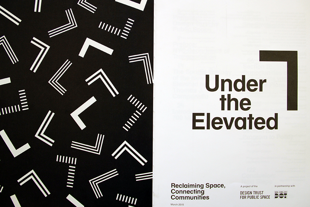
Earlier this summer, the Design Trust for Public Space released the results of a two-year study that investigated ways to reclaim and redesign spaces beneath our bridges, roads, and rail lines. In collaboration with the NYC Department of Transportation and a number of community partners, the Design Trust and their team of project fellows evaluated the existing conditions and uses of a variety of “el-spaces” and imagined creative yet practical design and programming possibilities that both expand access to desirable public space and respond to community need. We recently sat down with four of the project fellows — Neil Donnelly, Graphic Design Fellow; Susannah Drake, Urban Design Fellow; Chat Travieso, Participatory Design Fellow; and Douglas Woodward, Policy Fellow — to hear more about Under the Elevated. –V.S.
What is Under The Elevated?
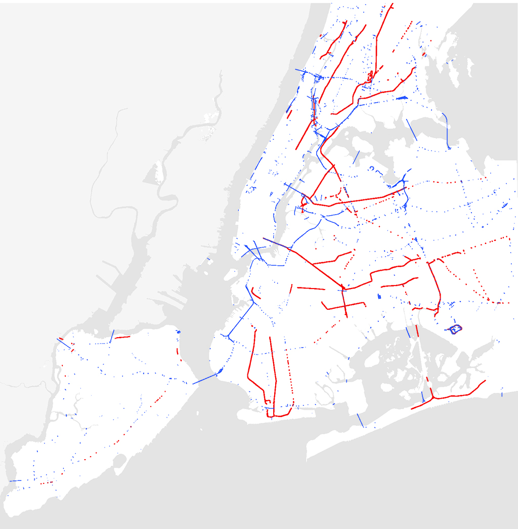
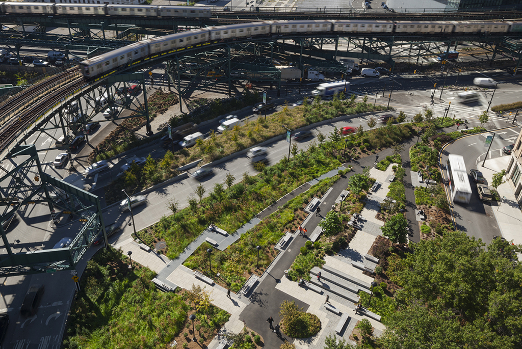
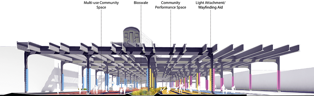
Under the Elevated is a project initiated by the Design Trust for Public Space to look at the 666 miles of space underneath elevated infrastructure in New York City. Those spaces present tremendous opportunities to make safer, more ecologically productive new open spaces that positively contribute to the city.
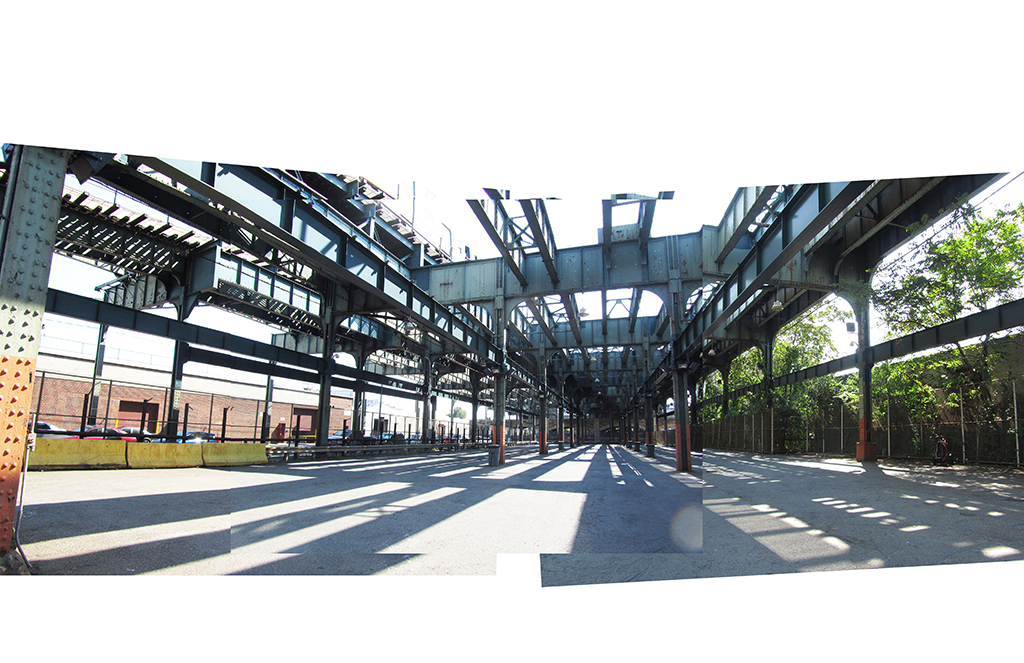
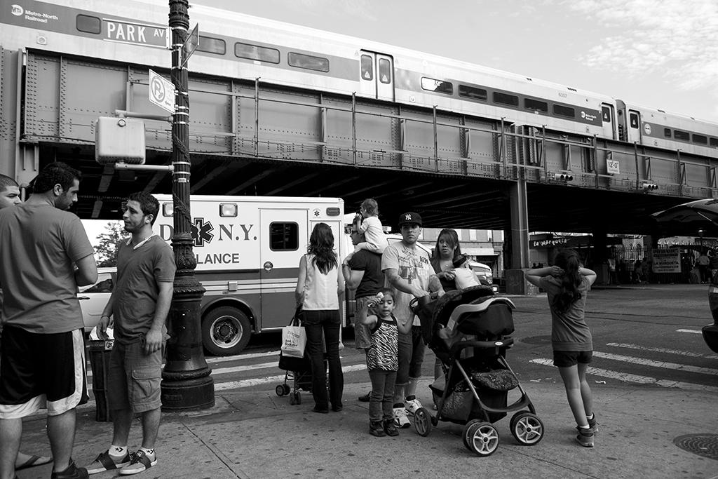
The elevated is a romantic, decaying infrastructure that’s vanishing. The spaces underneath those that remain are completely underutilized and represent a real public space resource
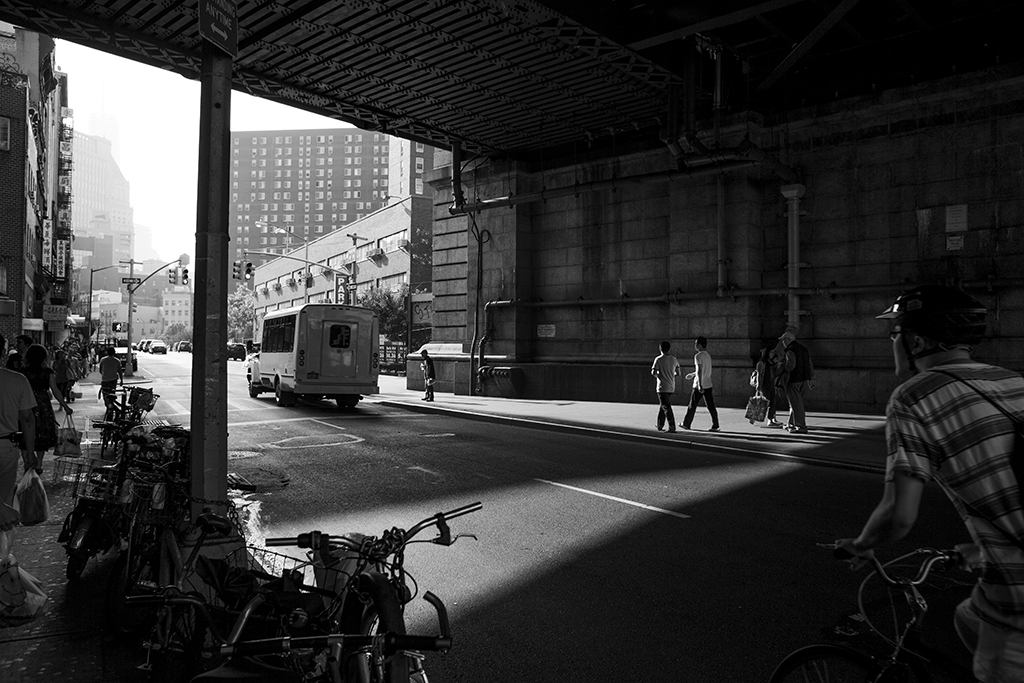
And then there’s the flip side. The general public usually perceives elevated spaces as an eye sore or a divider, somewhere you don’t want to go because it’s dangerous or dark or loud. So that was also a challenge for us: how can we change the general perception of these spaces?
What was your process for selecting sites and identifying need?
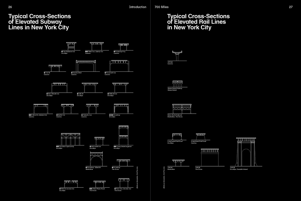
It started with just figuring out how to investigate this question. The scope is so huge — we’re looking at almost 700 miles of elevated — so it’s not possible to investigate every single space. The initial step was to identify prototypes that represent different typologies and to do community outreach. I was the Participatory Design Fellow on the project, which included doing a lot of that outreach and finding our community collaborators. Those collaborators filled in the blanks on the history of these spaces and the informal and cultural activity in these spaces that we should look out for.
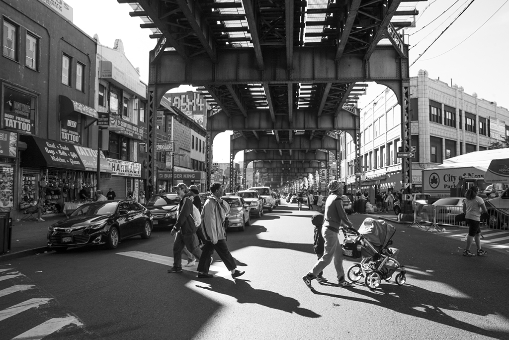
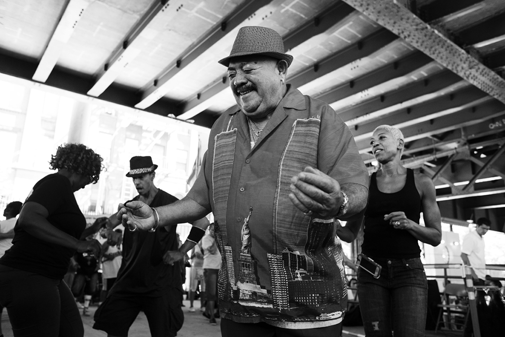
That involved a lot of empirical observation. We saw people playing board games, sitting on boxes, shucking corn, selling seafood, salsa dancing. Some people just had their spot and they would always be there.
All of us were interested in intervening, but doing so without crushing this vibrant activity already happening in many of these communities. We spent weeks, if not months, assembling a massive list of potential sites, visiting them, and grouping them into different priority categories.
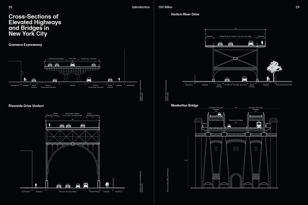
We were looking at bridges, highways, elevated rails, and then also the points of intersection of these different modes of transportation, like landings and transportation hubs. We also wanted a geographic distribution of these systems across the five boroughs, so we tried to achieve a representative geography as well as representative typologies across different types of communities. Staten Island doesn’t have very many elevated structures so we ultimately decided not to include it in the study.
We also looked at the operations of different agencies. Our partner on the project was the NYC Department of Transportation, but we were also examining spaces controlled by the MTA and other entities. We wanted to unpack who owns what within the different cross sections of the city and what agencies you have to go to if you want to do a project within different typologies. We then looked at how we could support the vision of existing initiatives included in the City’s OneNYC plan, such as electric taxi infrastructure or improved storm water management.
As the Urban Design Fellow for this project, I was charged with how to reconcile some of the standards inherent in working with government agencies with the particularities and personality of a place. We wanted to help communities figure out how they could work with these agencies, but also have the agencies recognize how they could help the community.
Can you talk more about that ecosystem of ownership that exists? Who are some of the players, at the municipal, state, federal, or private spheres?
We met with the Department of City Planning. We met with the City and State Departments of Transportation. We met with NYC Parks. And we also met with the MTA. We wanted all of them to be comfortable with the idea that there might be something happening. There’s the idea of getting the community involved and wanting change, and then there’s the aspect of getting the agency to accept that change needs to — and can — happen. We needed to be the bridge that helped make that process easier.
What are some of the strategies for making that communication happen across agencies? Do you feel that this kind of collaboration and engagement is easier and more welcome than it used to be?
There’s been a cultural change in city agencies. They’re willing to consider new things, but it’s still difficult. DOT, for example, is tremendously large with a huge array of responsibilities and regulations, so it’s very hard to push particular design ideas through. I’m an urban designer and planner by training, but I also worked for the City for a long time and then worked at Lincoln Center with the City approvals process. So I am sort of an expert on city bureaucracy. I came on to this project as the Policy Fellow because I felt that I could push the agencies in a way that would move things forward. By the end of this project DOT was totally on board and were happy to try to take ownership of this. But in general, there’s often a reluctance to try new things. I was a bureaucrat myself. I know what it’s like.
I think you need to understand the agenda of each agency, their comfort level, and what they can and can’t do within their existing roles in order to suggest changes that can happen. One thing that this book does is empower the community to go to their elected officials with an understanding of what to ask for and how to get things done. Communities can advocate to have electeds put money into projects for the DOT or Parks Department that positively impact their neighborhoods. Look at the work that’s happening with participatory budgeting. That’s pushing a lot of initiatives forward. I think starting to crack that code is really useful.
How did your process and the proposed design solutions respond to or work around those restrictions and overlapping jurisdictions?
One of our strategies for how to operate was to first come up with a pop-up project that took a “light touch” approach — something that didn’t require serious permitting, that didn’t touch the infrastructure, that could go up and come down quickly without any permanent change to the landscape. Once that was established, the thought was you could then turn that into a pilot project, where you might actually touch that infrastructure, move a drain, or use city power. After that pilot had been in place and tested for a certain number of years and proved successful, it could then become permanent policy. This pilot approach is something the DOT already does. Their switch to using LED light fixtures, for instance, started as a pilot before they began implementing it on a broader scale.
What were your two pop-up projects?
The first one was in Manhattan’s Chinatown under the Manhattan Bridge on Division Street. It is actually a well-utilized, dense under-the-elevated site. There’s a lot of informal activity and there’s a shopping mall under the bridge that belongs to the NYC Economic Development Corporation. Thousands of people, tourists and local residents, pass through on a daily basis. But there is this underutilized triangle of space that we chose as a site.
Our community collaborator, Chinatown Partnership, and their director Wellington Chen wanted to create a gateway to New York’s Chinatown, because it’s the only Chinatown in any large city that doesn’t have one. With the kind of restrictions we had, we couldn’t create a grand gesture, but we could create something that worked conceptually as a gateway. We decided to create a space where people can go to know what is going on in the community, a place where you get oriented. Neil and I collaborated to create this community calendar with lighting. The lighting was tough — figuring out what it plugs into, how to deal with the vibration of the trains, and what the lighting could attach to. The underside of the bridge is technically the rail, which belongs to the MTA, so we should attach it to the abutment — but it’s a stone abutment, and how do you anchor to stone while adhering to the “light touch” approach?
And what is the Boogie Down Booth?
The Boogie Down Booth was the second installation. The community collaborator on that project was WHEDco, Women’s Housing Economic Development Corporation. There’s about a mile stretch of elevated along Southern Boulevard in the Bronx, basically from the Simpson Street stop up to 174th Street stop on the 2 / 5 line, where WHEDco and the Southern Boulevard Merchants’ Association have drummed up a lot of grass roots support for expanding the sidewalks. A lot of the bus stops under the elevated there are essentially on the street; you’re not on the sidewalk. It’s a very weird and dangerous condition.
Essentially the Boogie Down Booth is a bus stop with music, seating, and lighting. We heard a lot about the need for lighting during community workshops and from the Southern Boulevard Merchants Association. It gets dark there, especially in the winter time, which discourages people from walking along the boulevard and means a lot of the shops have to close early. Then there are these directional speakers installed in the Booth that play music to cover up the noise of the train. WHEDco has a satellite organization called the Bronx Music Heritage Center that promotes and preserves the rich musical history of the Bronx, both past and present. So the Boogie Down Booth plays music from the Bronx. I just finished installing a second booth farther up Southern Boulevard, off the 174th Street Stop. WHEDco definitely wants to expand the Boogie Down Booth to other places in the Bronx, so hopefully there will be more.
How has the community responded to the two pop-up spaces?
The Chinatown piece was interesting because the community calendar didn’t work exactly as we had imagined. But it definitely did change people’s patterns and the way they experience that space. When we were deinstalling it, people in the area were asking, “What are you doing? Why are you taking this down?” That’s always a challenge for something that is meant to be temporary.
One of the things that I’m constantly thinking about — and this isn’t necessarily specific to the Design Trust or Under the Elevated — is the gap between pop-up and pilot, when you see something come down and then nothing happens for a long time. That can be really discouraging. How can there be a smoother transition between pop-up and pilot that doesn’t make it feel like something was just taken away from the community?
I think that’s a place where graphic design can help, too. Putting paint on things is an easy way to mark a space and let people know that, while there may not be something here now, there’s going to be something here again.
We got an even stronger positive response in the Bronx. We were able to form a lot of relationships up there. There was a green cart vendor, Fulgencio, and his wife Marcela who were there every day. They kept an eye on the Booth. I would come and visit and they would report back, “oh, you know, a school group came by yesterday and they all sat down and were talking about the Booth.” And then he’d tell me that the light didn’t turn on and that I should check it. There was also a deli around the corner that let us plug into their outlets whenever we had an event. Forming those personal relationships and letting people see the faces behind the installation made people appreciate it.
What we found is that when you put something thoughtful into the community that is designed in part with that community, it’s embraced. Sometimes there are fears about destruction, graffiti, or wear and tear, but when you make something with people in the community, they don’t feel the need to usurp what you’ve done.
What are the next steps for the project? Has the DOT committed to implementing any of your proposed longer-term strategies?
What the project needs to really engage people for the next step is a very big win — a big, visible project that’s a permanent improvement on the underside of infrastructure. I’d love to see a three-story Boogie Down Booth that could be inhabitable, something that actually would make people talk about the program.
As for the DOT, I know they’re gathering suggestions from community groups and individuals. But I don’t know what their plans are for the next space.
They have approached me about doing some work under the Gowanus Expressway. There’s a huge amount of underutilized space there with potential for both storm water management and both temporary and more permanent programming — light industrial use, artist studios, places where you can make noise and make a mess, while also maintaining places for vehicle storage. It seems like the Under the Elevated project may have awakened city officials to the opportunity that exists there, so rather than creating a smaller pilot project, the city is exploring a broader plan.
There are a number of different community groups that want to go ahead with this kind of project, in coordination with DOT because they’re the property owners. One of the things I’ve learned in my urban design work over the past two decades is that ultimately when you’re looking for funding or need approvals, permission of the landowner is critical. I’ve been trying to move some of these projects forward and Chat and I have had a lot of community groups approach us about doing more of these kinds of projects.
One opportunity that needs to be investigated further is to bring private entities on board, because they own some of the best spaces. For example, of 33 spaces beneath the High Line, 31 are now spoken for and are being developed, which means you can’t have the continuous public space there that you could have created three or four years ago. If government can work with those spaces the way that they have with privately owned public spaces through zoning, there’s a real opportunity for creating something complimentary to what we’re talking about with City-owned infrastructure.
The views expressed here are those of the authors only and do not reflect the position of The Architectural League of New York.