
We are celebrating 15 years — and counting — of stories that are deeply researched and deeply felt, that build a historical record of what the city has been.
We are celebrating 15 years — and counting — of stories that are deeply researched and deeply felt, that build a historical record of what the city has been.
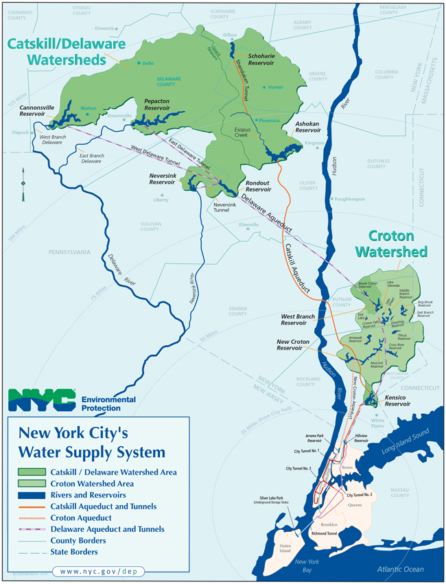
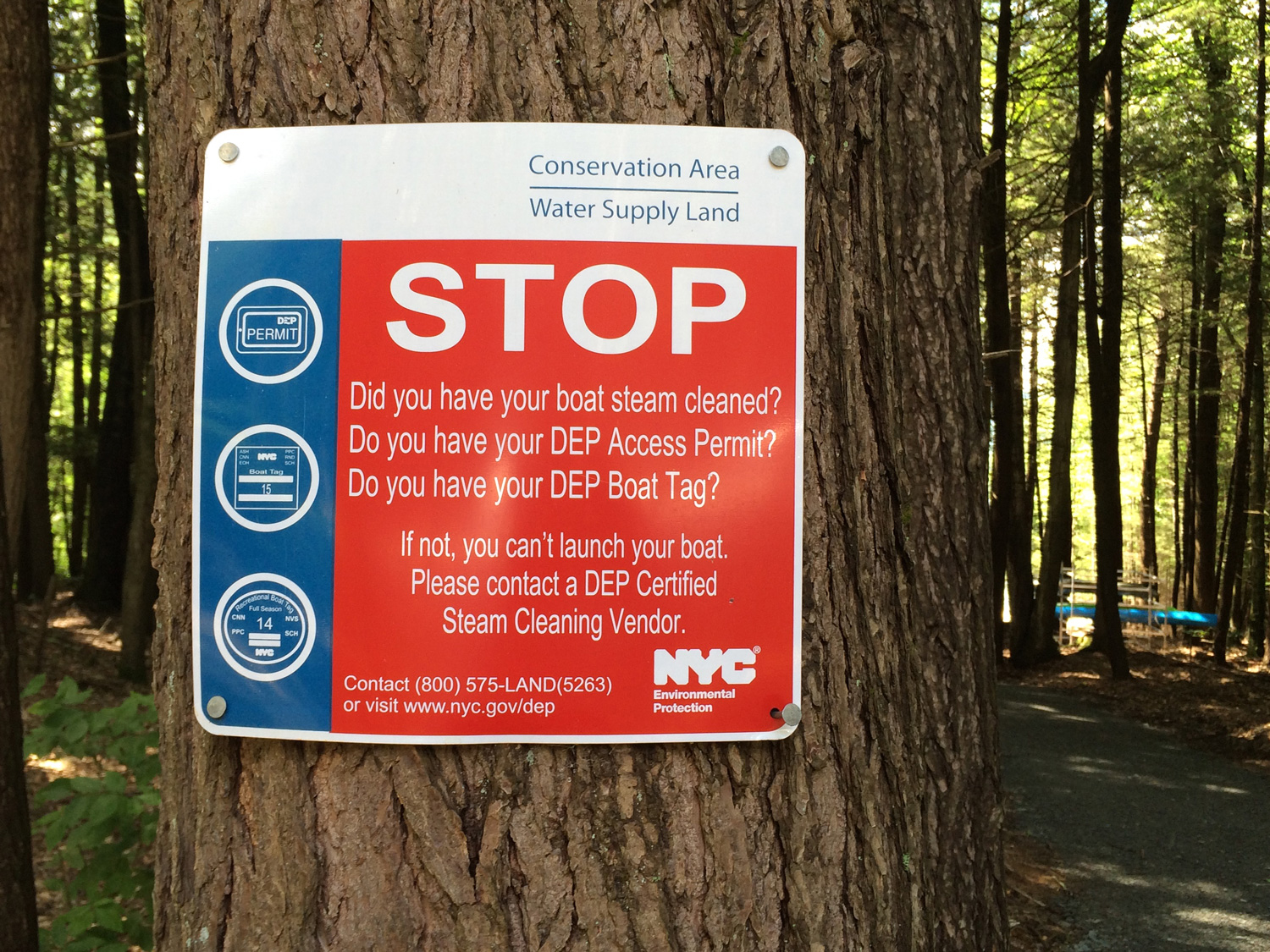
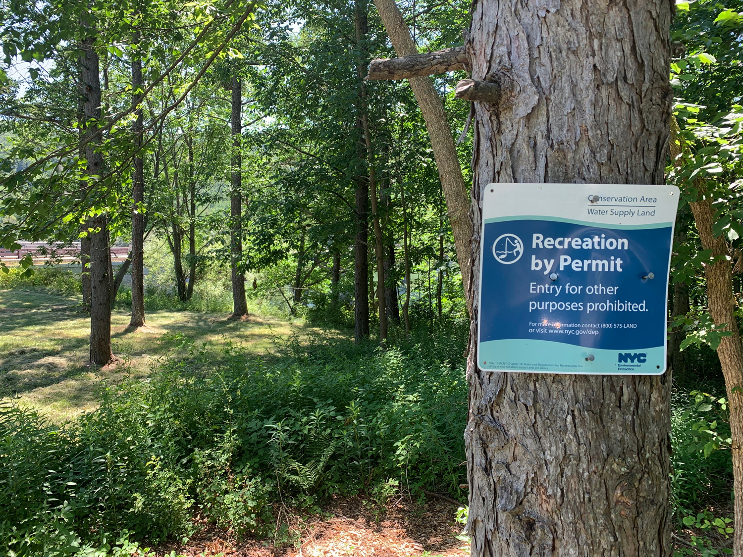
New York City tap water is often called the “champagne of drinking water.” The city’s clean, abundant water supply owes its quality to Catskills geology, and to the complex system, developed over a century, that moves water through the Catskill Mountains and the Hudson Valley across a 2,000-square-mile watershed. Managed by the New York City Department of Environmental Protection (DEP), the New York City Water Supply System is one of the largest unfiltered surface drinking water supplies in the world. It includes 19 reservoirs, three lakes, thousands of miles of pipeline — and countless exchanges between scientists, engineers, city planners, and citizens. These relationships, forged through legislation as well as infrastructure, continue to evolve, particularly as the Covid-19 pandemic has prompted many city residents to migrate upstate.
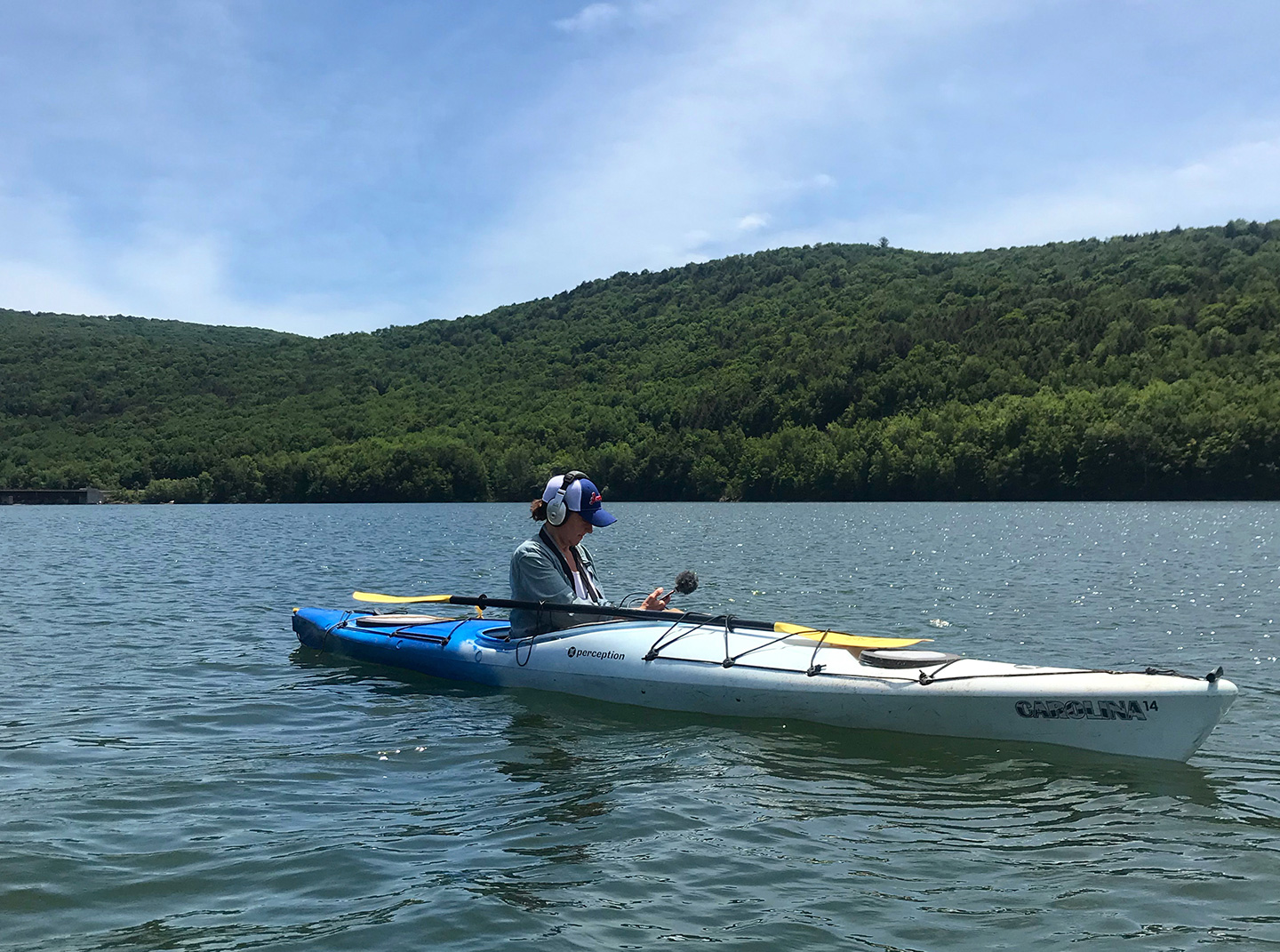
For artist and educator Lize Mogel, understanding the geography of the water supply requires firsthand experience. Her recently released podcast, Views from the Watershed, offers a self-guided driving tour of specific sites throughout the Catskills, featuring local water stewards such as stream educator and hydrologist Tim Koch and historian and gravestone restorer Marianne Greenfield exploring issues ranging from the regulatory landscape of water management to the displacement of communities by water infrastructure. The podcast — meant to be listened to in situ or from afar — builds on daylong bus tours Mogel began hosting in 2019, which similarly rely on local interpreters to speak about the impact of infrastructure on daily life along the 110-mile route. Suspended at the onset of the pandemic, the tours will resume this summer. Mogel, a Brooklyn resident with long-term ties upstate, began developing the multi-faceted project, Walking the Watershed, in 2016 to explore the bonds made by water throughout New York City and the Catskills. The work has grown to examine watershed ecology, history, politics, and economics across multiple channels (the podcast and group tours, together with participatory workshops for adults and youths), and viewpoints. Throughout, Mogel illuminates the flows of obligation and power that animate the region. – Nicole Miller
Adam Bosch, the former Director of Public Affairs for the New York City water supply, discusses DEP’s role in managing this enormous and complicated system.
I first encountered your work through your 2011 project, An Atlas of Radical Cartography. Like that work, Walking the Watershed is interested in mapmaking that elucidates social and political relationships. How does this project reshape the maps of New York City that might be familiar to us?
If you look at DEP’s map of New York City water infrastructure, you can see that the city is physically connected to multiple suburban, semi-rural, and rural communities through pipes, tunnels, aqueducts, and reservoirs through which water flows downstream. However, there’s a lack of awareness about where our drinking water comes from, especially about the social conditions that make that good water possible. Water users in urban New York City and watershed residents in the rural Catskills, where 90 percent of the city’s water comes from, are separated by distance and culture.
The City owns a huge amount of land upstate — an area that’s almost as large as New York City itself. This expands the geography of the city, the public of the city. Walking the Watershed is designed to make all of these connections visible: not only the physical connections made by water system infrastructure, but also the connections with communities that host the infrastructure, and the social and economic conditions that the infrastructure partly creates.
What led you to develop this work?
Walking the Watershed comes out of my interest in the distributed impacts of infrastructure, and a desire to more deeply understand, and make work about, the place where I live. As my practice has evolved, I’ve moved away from projects that look like or function as maps. This is because I’m less interested in merely representing a situation, and more so in engaging people directly in it. I want to entice people to visit their water supply, and the communities that care for it, in person.
Walking the Watershed explores the complexities of the relationship between the Catskills and New York City using experiential, embodied forms. I think the social and political impact of watershed issues is greater if people can “be there” in some respect, whether through a bus tour, a self-guided podcast tour, or by participating in a workshop. This project is a long-term engagement with the Catskills. It centers on building relationships and having the work come out of that.
The podcast explores the shifting balance of power between the watershed’s urban and rural constituents. Is there a site on the tour that makes that story visible?
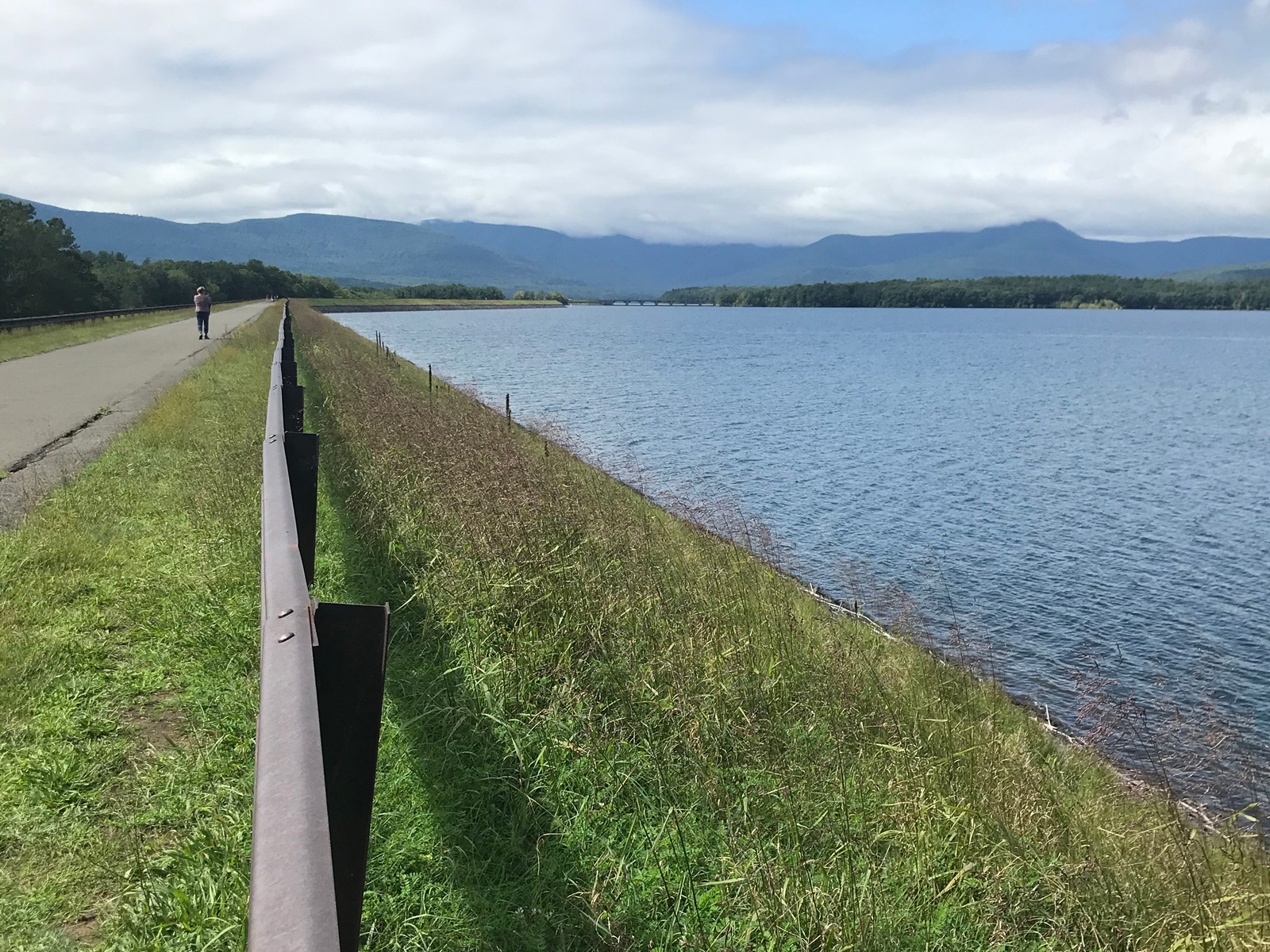
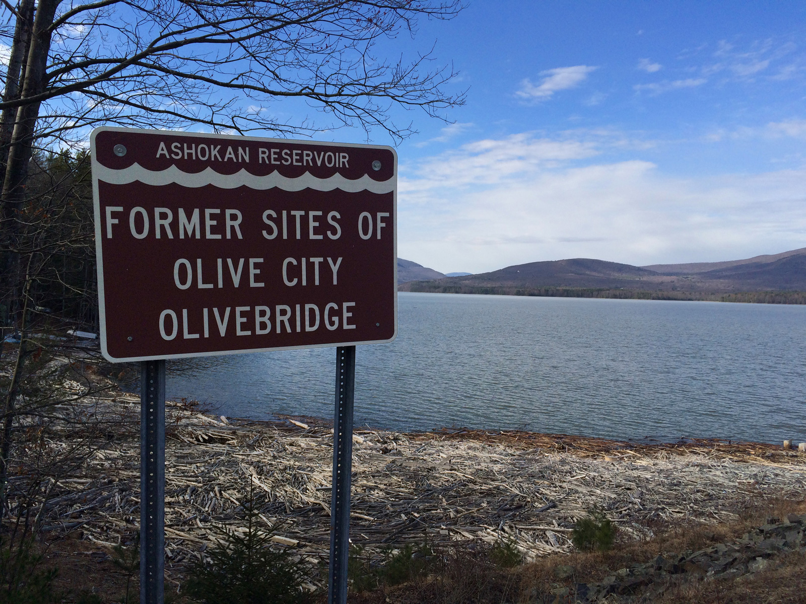
The story of the water supply in the Catskills began as an extractive relationship, although that dynamic has shifted since the 1990s. The Ashokan Reservoir is a good starting point, especially because there are recreational paths around it that make it easy to visit. It’s also the closest reservoir to New York City, and the first one built, completed in 1915. As the city expanded in the 1800s, it outgrew its local water sources for reasons including localized pollution, waterborne epidemics, and fire. Engineers tapped the Croton River to create the Croton water system, but it was clear that the city was going to outgrow this source almost as soon as it was completed. After much exploration of near and not-so-near water bodies, city leaders identified the Esopus Creek in the Catskills as a bountiful source of water. So they decided to build their next water supply system in the Catskills. In 1905, New York State passed a law informally called the McClellan Act, named after the city’s mayor at that time. This legislation created the New York City Board of Water Supply, which eventually evolved into DEP, and it allowed the City to condemn lands in order to build dams, reservoirs, and aqueducts, using what’s now known as eminent domain.
Eight communities and over two thousand people were displaced for the construction of the Ashokan Reservoir. That may sound like a reasonable number to some, relative to the millions of people the water system now serves. But for tight-knit rural communities, it was devastating. People were compensated for their homes, farms, and businesses, but not fairly in many cases. The displacement had a widespread impact, not just on the people who were directly affected, but on much of the industry in that part of the Catskills, which included agriculture and tourism. It affected the whole region. The trauma from that time carries forward to this day, and still affects the way that people feel about the city.
Historian Diane Galusha talks about the displacement of Catskills communities for the construction of New York City’s water supply.
The story you’re telling suggests a fundamental conflict between the Catskills’ right to self-governance and public health in New York City. How have watershed communities worked to maintain their autonomy against urban pressures?
A story that is as crucial as the earlier history of construction and displacement is what happened in the 1980s and ’90s. It’s less well-known because it’s a policy story, but it was a turning point for the relationship between the city and the Catskills and an important moment when the Catskills were able to gain more power.
In the 1970s and onward, key pieces of federal environmental legislation — including the Clean Water Act, the Safe Drinking Water Act, and the Surface Water Treatment Rule — affected the way that states and cities managed their water supplies. In the ’80s, the federal government required municipalities that got their drinking water from surface sources — lakes and rivers, rather than aquifers — to treat that water in various ways. For New York City, a treatment plant would have cost billions of dollars that the city didn’t have at the time. But the City could apply for something called a Filtration Avoidance Determination waiver (FAD), if it could prove that it could manage water quality at the source. So the City tried to impose new restrictions on land use in the Catskills in order to get this waiver, but these new regulations were basically unfunded mandates. For example, the City wanted to require land buffers on dairy farms around every water body, so that cows wouldn’t pollute the water supply. But in the Catskills, water is everywhere, and most farms have a stream or two running through them. Farmers couldn’t meet these requirements without taking most of their land out of commission. DEP also needed to acquire land around reservoirs and tributaries to protect the water supply. The Commissioner at the time made it clear that eminent domain was not off the table. That frightened and angered people in the watershed towns, especially because the use of eminent domain was in living memory of people who were displaced for the reservoirs completed in the 1950s and ’60s.
So, the towns in the watershed organized. And they realized that they had leverage since the City needed their participation to move forward in getting the federal waiver.
In 1997, the City and the watershed towns signed the New York City Watershed Memorandum of Agreement that laid out the mutual obligations designed to protect the watershed. How did that negotiation process play out?
Catskills leaders elected representatives to serve on what was called the Coalition of Watershed Towns, and they lawyered up. They convinced a judge to stop the process of eminent domain from going forward. The 1994 elections also played a key role, when George Pataki became governor and Rudy Giuliani became Mayor. Pataki’s election was advantageous for the Catskills because he had been a mayor and a state legislator representing watershed regions east of the Hudson River and was sympathetic to the issues. Giuliani played a role in appointing Marilyn Gelber as DEP Commissioner. Gelber, the first woman to hold the position, had a very different background from previous commissioners — she was a community planner. She was interested in building policy in a collaborative way, and this was critically important in how the relationships between the City and watershed towns changed. It began with the personal relationships forged between Gelber and the leaders of the Coalition. It moved forward because Pataki convened the various stakeholders into a difficult but productive negotiation that lasted for almost two years.
These negotiations resulted in the 600-plus page Memorandum of Agreement, which laid out a couple of important policy pieces. The FAD required that the City to protect the water supply by acquiring land around the reservoirs and the streams, which the City had originally planned to do partly through eminent domain. This land acquisition mandate turned into a voluntary program of “willing buyer, willing seller.” In a somewhat separate process, farmers and policymakers developed the Whole Farm Plan program, which paid for farmers to modernize in ways that kept cow manure and agricultural runoff from the water supply. The model for the Memorandum is one of “payment for ecosystem services.” The City recognized that the Catskills was stewarding the water supply for New York City, and it paid them to do it, through grants, investment in local infrastructure, and other programs and resources.
Former DEP Commissioner Marilyn Gelber and former Executive Director of the Catskill Watershed Corporation Alan Rosa tell stories about the difficult negotiations in the 1990s that resulted in the historic agreement between New York City and the Catskills.
One of the things that made the negotiations successful was participants’ willingness to see each other as people and not just as adversaries, and to listen to and respect each other even if they disagreed. There were some important humanizing moments. One of my favorite stories in the podcast is what I call the “Beer Summit of the Catskills.” It’s told by Marilyn Gelber and Alan Rosa, who was a member of the Coalition of Watershed Towns and became the Executive Director of the Catskill Watershed Corporation, the liaison organization between the City and the Catskills that was created by the Memorandum. In the middle of a tense day of negotiations, they all ended up at the same pub for lunch. Everyone was siloed at separate tables: the City at one table, the watershed towns at another, the State at another. Marilyn Gelber sent a pitcher of beer over to the watershed towns’ table, the watershed towns reciprocated, and it went on from there. This friendly (and perhaps strategic) gesture changed the tenor of the negotiations that day.
It’s really a reminder that policy is embedded in human bodies and is ultimately meant to serve human relationships.
Exactly. One of the points that Rosa and Gelber make is that the security of this relationship is reliant on future generations. It’s important to them, and to me, that people understand the sacrifices that were made to get it to this point, so that the relationship can continue. New York City is always going to be an integral part of the Catskills, because 90 percent of the city’s drinking water supply originates and is managed there. And now they’re further intertwined because of the impacts of climate change.
Catskills journalist Lissa Harris, co-founder of the Watershed Post, describes what happened when Hurricane Irene tore through the Catskills.
How is the climate crisis affecting the watershed?
The Catskills is flood-prone. There have been many documented historic floods, and climate change is bringing more frequent and more extreme flooding. Hurricane Irene, which plowed through the Catskills in 2011, is a harbinger of the potential future damage. The Catskills is a mountainous region with a ton of water in it already. An inch of rain falling on the Ashokan basin can add 4.5 billion gallons to the watershed ecosystem. Hurricane Irene dumped up to 13 inches of rain within 24 hours, and it destroyed a major part of the central Catskills, including parts of Margaretville and Prattsville. Lissa Harris and Tim Knight describe the impact and the long recovery in the podcast episode “After the Storm.”
Back in the day, it made sense for towns to be built alongside rivers, which provided sustenance for people and animals, and the means for small-scale industry to thrive (think sawmills). But now, if you’re living in a zone that floods every couple of years: your property values are going to be low and you might not be able to afford to leave. In Boiceville, which is featured in the podcast episode “Tough Choices,” the entire commercial district flooded during Hurricane Irene. This swamped critical businesses that serve people for miles around, including the fire station, the supermarket, and a medical center.
The City created a buyout program to supplement the gaps in federal and state aid for flood communities, because it has a vested interest in both making sure that these floods don’t disrupt the water supply, and so that watershed communities have more options. Boiceville decided that it would allow businesses to take buyouts and move, since raising properties by eight feet to meet new flood standards seemed impossible. However, as the Catskills gentrifies (which has been accelerated by pandemic-era urban migration), real estate values have risen steeply. These critical pieces of community infrastructure have nowhere to go.
We’ve been talking about infrastructure, ecology, and public policy. But this is an artwork. How do you think about the relationship between art and large social systems?
I have a hybrid and counter-cartographic practice. I have an arts background, but I’m also very influenced by geography, planning, architecture, urbanism, and much more. Walking the Watershed looks at the social and geographic implications of water infrastructure and transmits it in ways that are experiential, political, and aesthetic.
I think of critical tours as a kind of narrative and performative mapping that takes place in time and space simultaneously. It allows for a much more engaged experience of landscape and the meaning of landscape — for an embodied cartography. This has been a theme in my work for 25 years: complicating one’s experience of a place by revealing histories and narratives that aren’t often told.
All photos are by Lize Mogel unless otherwise indicated. All audio clips are excerpted from the Views from the Watershed podcast tour.
The views expressed here are those of the authors only and do not reflect the position of The Architectural League of New York.


Comments