
We are celebrating 15 years — and counting — of stories that are deeply researched and deeply felt, that build a historical record of what the city has been.
We are celebrating 15 years — and counting — of stories that are deeply researched and deeply felt, that build a historical record of what the city has been.
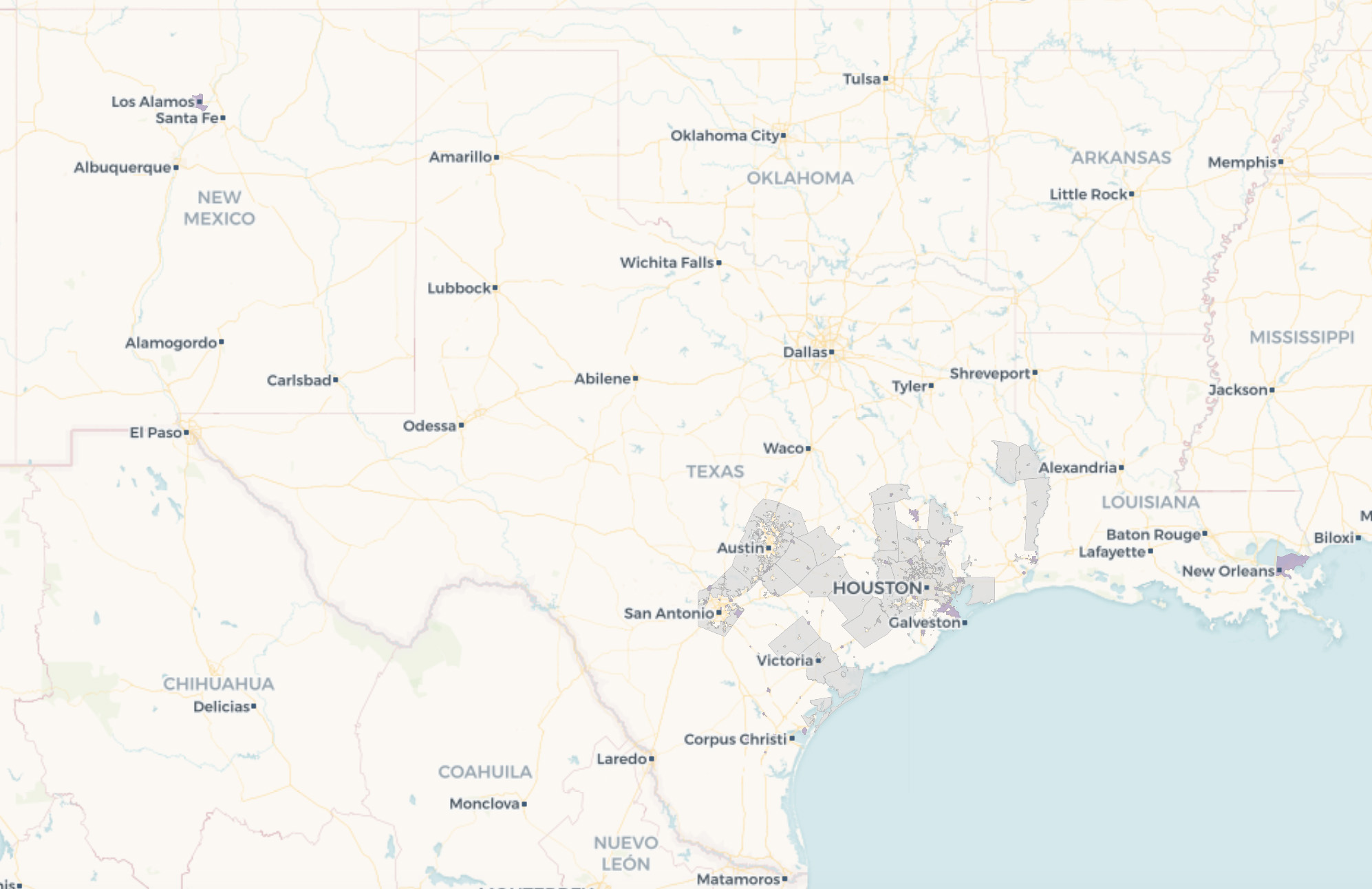
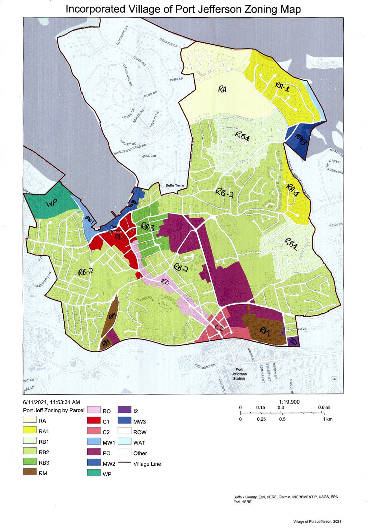
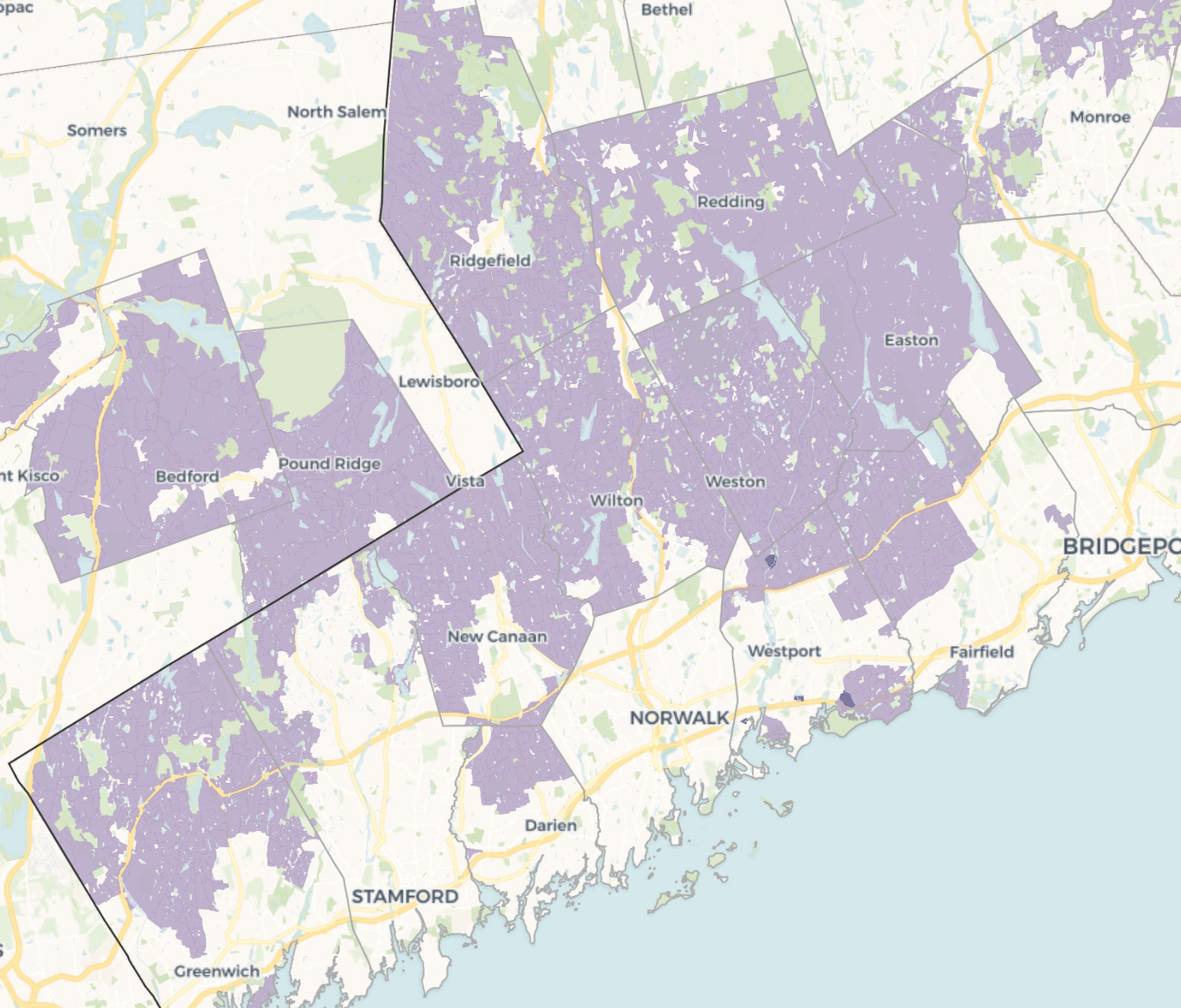
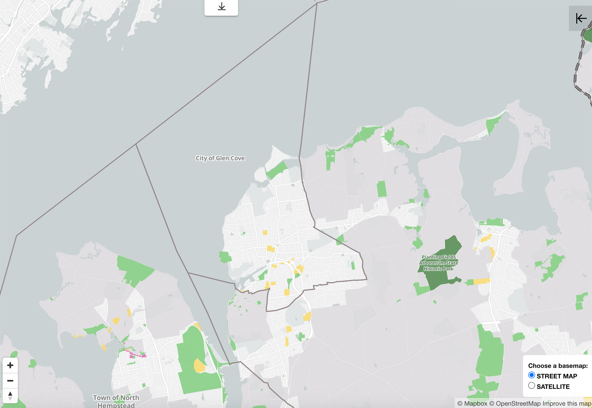
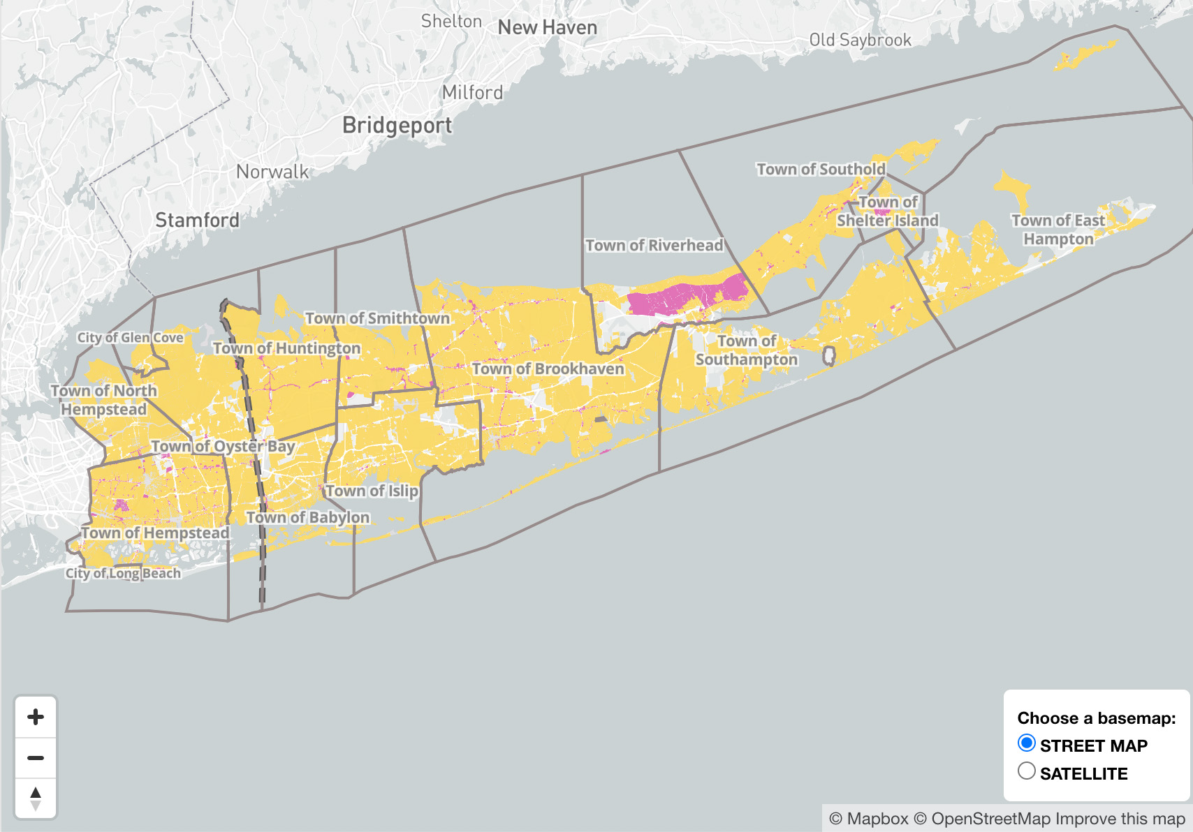
Want to build an apartment building? In many New York City suburbs, you can’t. On Long Island, 89.9 percent of land is zoned for single-family homes, while buildings that house three or more families can only be built as-of-right on 3.6 percent of zoning parcels. Large lot requirements dominate in many parts of Connecticut. You can only build a home on a lot less than a quarter-acre on six percent of the land in Darien; in Greenwich, that figure is eight percent. The New York metro region offers no shortage of examples of exclusionary zoning. Combined with practices like racial steering, they have led to a suburban geography of immense racial and economic inequality, where the majority of municipalities pass the buck on providing multifamily and affordable housing. And the localized nature of planning creates another problem: with each city, town, and village operating its own independent (though equivalent) system, it becomes difficult to compare zoning and land use across a region and coordinate efforts for reform.
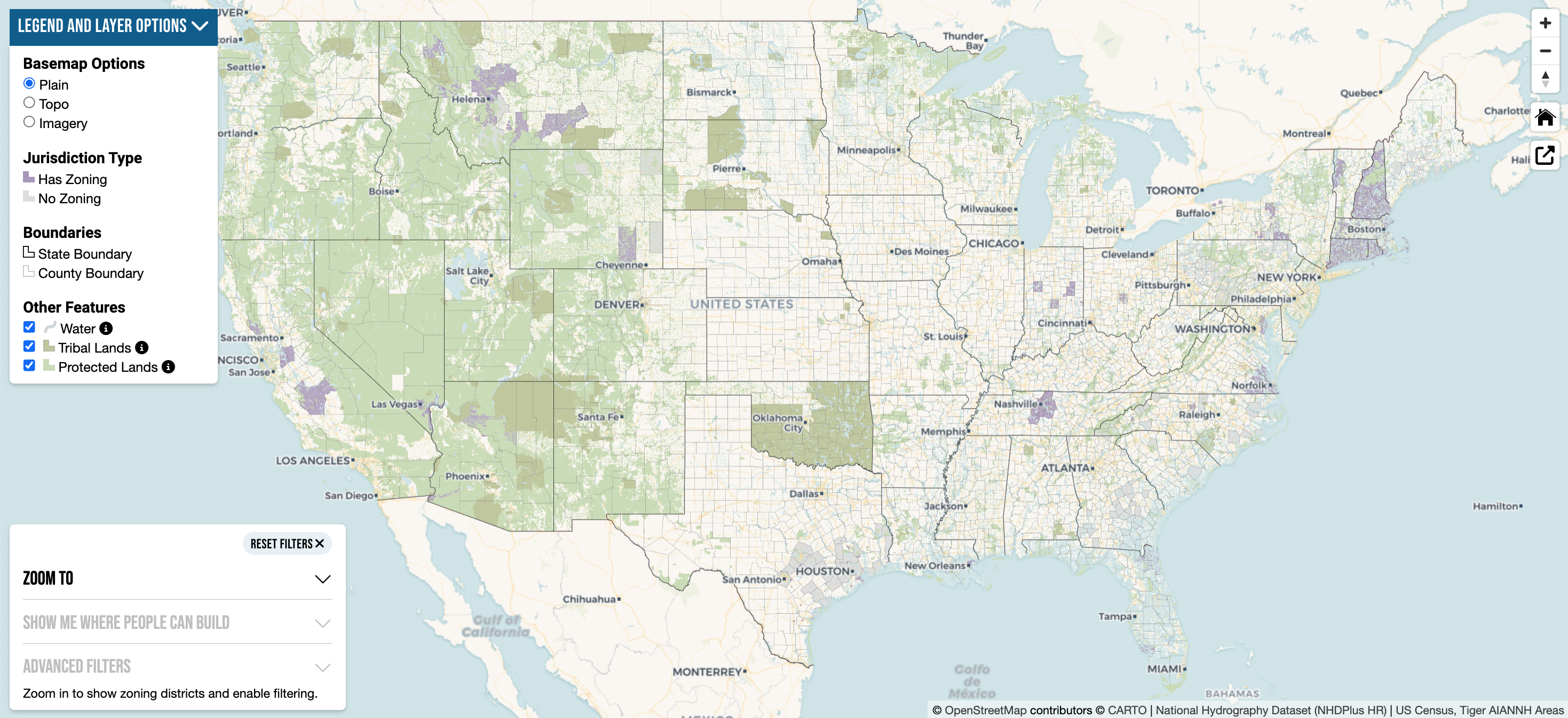
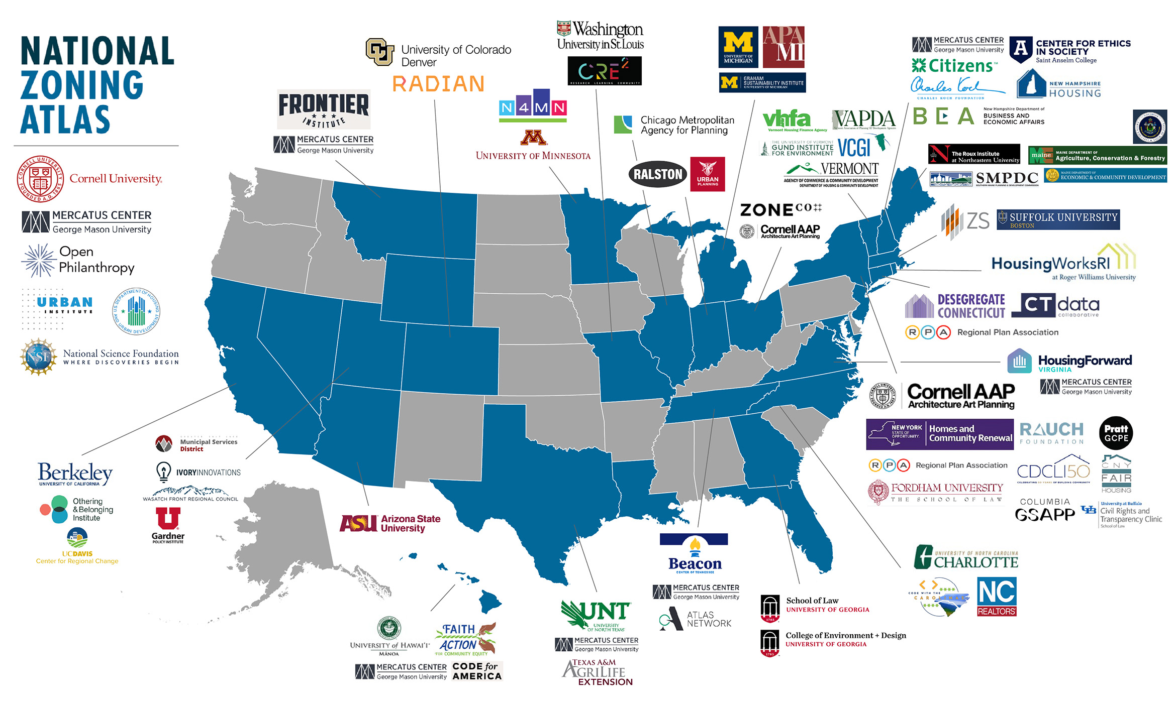
In 2021, architect, attorney, and policymaker Sara Bronin aimed to change that. She founded Desegregate Connecticut, which created a comprehensive atlas of zoning codes across every jurisdiction in the state. The Connecticut Zoning Atlas — and new research demonstrating that zoning laws constrained the development of affordable housing, created segregated communities, and, in effect, mandated unsustainable sprawl — supported successful advocacy for statewide zoning reforms including allowing accessory apartments and capping parking minimums. Bronin is now directing the National Zoning Atlas, where a team of zoning and geospatial analysts, working with scores of partner institutions, is collecting land use data from jurisdictions across the US, analyzing and mapping it to create a new tool for scholars, planners, and advocates. As more areas are put on the map, a bigger picture of the rules that govern how and what we can build is coming into view. The Long Island Zoning Atlas, launched in December 2023, has made the land use laws of over 100 municipalities easily comparable across jurisdictions. We spoke to Sara Bronin and Aline Fader, NZA’s Zoning Code Project Coordinator, about the painstaking task of mapping the nation’s land use, and how better understanding the current state of play can help us develop new rules of the game. – KR
Sara, this project developed from your work in Hartford and with Desegregate Connecticut — where you mapped the zoning of every jurisdiction in the state — which led to significant reforms statewide. How did you decide to take this work national?
You could say the National Zoning Atlas originated in our work in Connecticut to build a tool for people to understand how their community is zoned, which we thought would help inform advocacy. Once we completed the Connecticut Zoning Atlas, I heard from people from all over the country who wanted to build similar projects. So, I wrote up a methodology that explained how to analyze zoning codes, and the person who had developed the geospatial side of the Connecticut Atlas added a geospatial component. After I announced the launch of the National Zoning Atlas, we heard from more people and attracted some funding, and onboarded our first staff in January 2023.
You’re working with a lot of collaborators on this project.
To date, the National Zoning Atlas has included over 85 collaborating institutions and over 300 zoning and geospatial analysts working on the ground to understand zoning in particular parts of the country. These institutions and analysts represent a range of disciplines including planning, architecture, law, geography, information services, GIS, and public policy, among others. We’ve found that the range of participants in this project and the range of experience levels — from student employees to seasoned professionals — has given the Atlas both breadth and depth and has helped us understand how to more effectively communicate with a broader range of audiences. We know the Atlas has already been used by everyone from sophisticated city planners to reform-minded state legislators to homeowners who lobbied for zoning code revisions to allow accessory dwellings.
How far along is the Atlas?
The Atlas covers about six percent of the jurisdictions in the country, encompassing land in which 35 million people live. That is an excellent starting point. But in order to complete the country, we will need more resources, staff, and time. At this point the analysis has to be done by human researchers, and that takes resources.
What is the scale of this project: How many jurisdictions are we even talking about? And how different are approaches to zoning across different regions?
In total, there are about 39,000 general purpose local governments across the country. We suspect about 30,000 of those have adopted zoning. But the truth is, we don’t know how many have zoning, because no one has done the kind of census that we’re doing right now. We have found, so far, that densely populated New England states — like Massachusetts, Connecticut, and Rhode Island — tend to have zoning on all or virtually all land statewide. In the less densely populated West, and even in some southern states like Georgia, you see a larger number of jurisdictions that do not have zoning. From a research perspective, these regional differences could reveal a lot about the way land is managed and used in different places in the US. It might also reflect different philosophical approaches to the way we regulate private property.
There are different flavors. In the Carolinas, they have a lot of conditional use permits, which we don’t see globally. The California Zoning Atlas has reported to us that the length of their zoning codes is significantly longer than some of the other states that we’ve looked at. You see variances both in the density of the regulation as well as the way that they’re regulating.
From New York City, where zoning data is at least somewhat readily accessible, it’s easy to think that this is the state of play everywhere. But that’s far from the case. What is the process of tracking down this zoning data, analyzing it, and creating the Atlas?
For the most part, zoning texts are available online. But not always. Today, one of my analysts reached out about a town in Texas that has 325 people. They don’t have a fully staffed town hall, and so we’re trying to figure out how to get the documents. A lot of these little towns just don’t have resources. They don’t have funding to fully staff a municipal system like you have in a big city. Because of that, their code is maybe a Word document, and they might not put it online — and they might not have a proper website. I’ve heard from other teams that are having some issues around this, especially for those really rural towns where you might have a plan examiner who is part time and they’re in one afternoon a week.
Sometimes the really big ones have their own challenges. There is a county in California whose code was so big that they broke it up into individual PDFs. But in order for us to gather the whole code, we had to download 80 PDFs and then combine them. There are different challenges depending on the size and the resources that particular community has.
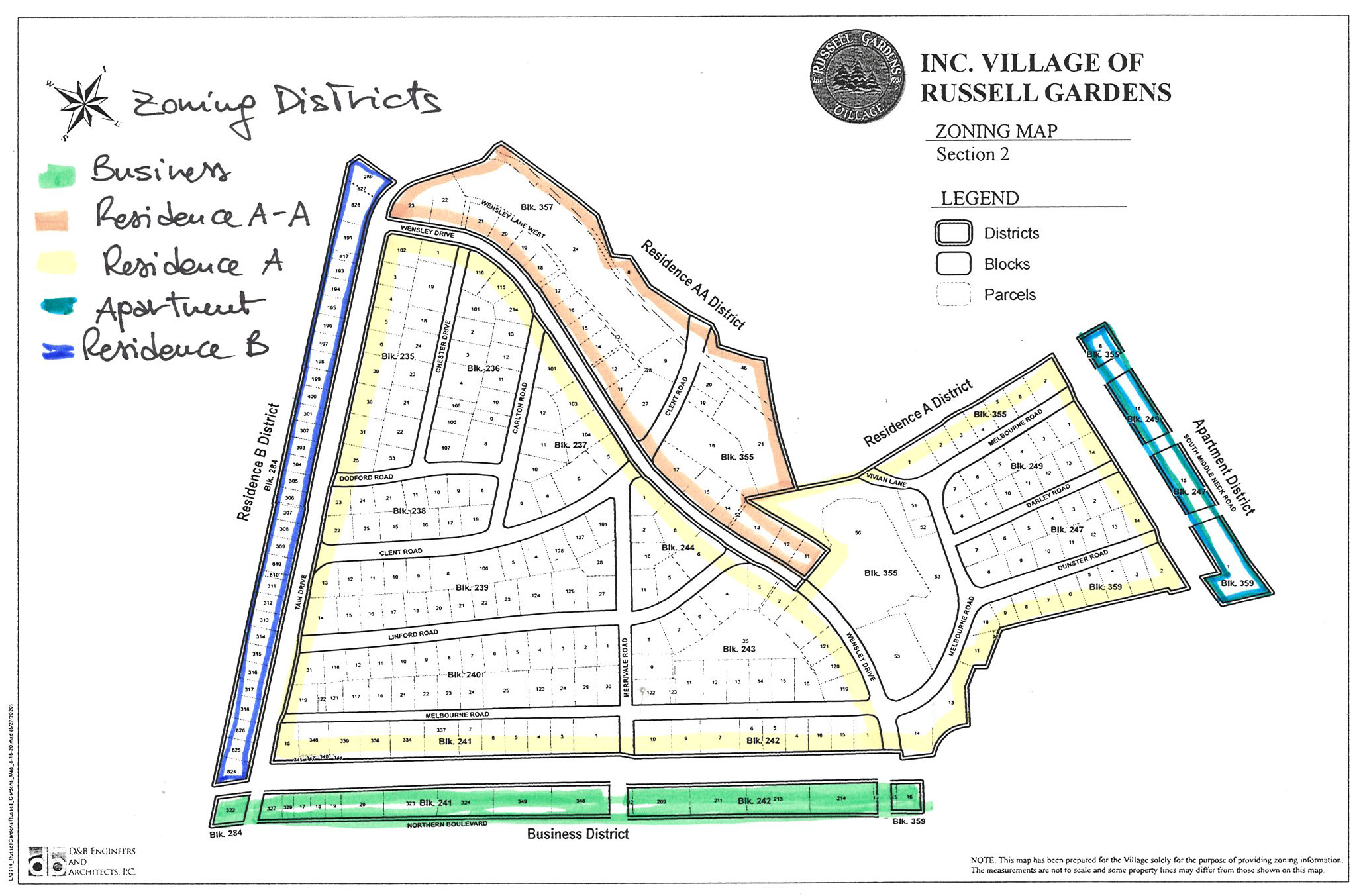
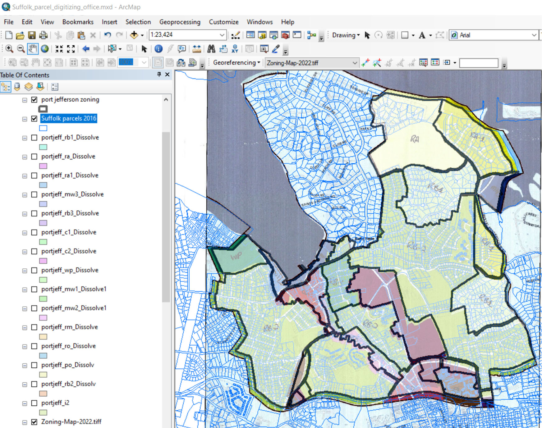
The process of analyzing geospatial information follows a parallel track. We collect as much information as we can from local governments, often requiring our analysts to clean, draw, and redraw official zoning maps in GIS to ensure compatibility. The map itself has been the product of a lot of effort — including by our geospatial and database consultant, GreenInfo Network — and months and months of reviews and refinements by our team. We hope that being able to, for example, calculate the percentage of land in your town where certain regulatory characteristics appear, is a useful feature for people who are visiting the Atlas.
It seems that there’s significant ambiguity: zoning maps might not match the text of the zoning resolution and amendments, for example. How do you handle this lack of clarity in your work?
There are tons of ambiguities in zoning. Zoning codes are all done at a local level, so each locality does it slightly differently. Basic terms are different. The district naming conventions are all over the place. Some use some very standardized language: R-40 or R-1 for one-acre residential developments. Others use all sorts of terms and local lingo.
We normally rely on the text and the methodology to guide our analysis, but if we see a serious interpretation problem, we sometimes reach out to the local planning office. A few months ago, we caught an error on a map in Wyoming. We reached out and they were like, “Oh, this is wrong!” And they ended up fixing the map. When there’s ambiguity, we have the ability to add notes that people viewing the Atlas can read.
We’ve spoken about the differences between regions, but what are some major commonalities you’re beginning to see? What kind of restrictions, regulations, and processes are shaping what and where people can build on land?
The predominant land use pattern which we see is larger lot single-family zoning. We don’t see a lot of walkable, downtown, mixed-use areas. Those are very small. Rural areas may allow a few different uses, but primarily on large lots and at low scales. At least some regional differences vary by minimum lot sizes. We’ve seen really large ones out west — obviously, they have a lot more land than East Coast communities.
Some places have surprised us. In Jacksonville, Florida, for example, there was a lot more multifamily: three- and four-or-more-family homes per lot. It had a more efficient allocation of land and uses than I expected.
In addition to minimum lot size, there are other constraints on a lot, including lot coverage, requirements, and setbacks that limit the amount of land in any individual lot upon which a building may be built. Zoning also imposes constraints on the structures that can be built, including bulk-in-area requirements, often expressed through a floor-to-area ratio, minimum and maximum height caps, and minimum unit sizes, which require individual housing units to be a certain size before they will be allowed to be permitted. And of course, there are also the use-based constraints that limit the number of units that may be built on any particular lot. Sometimes, there is an express limit on the number of units. Other times, the number of buildable units are indirectly governed by the lot and structure constraints that I just mentioned. Because by definition, if you can only build on certain parts of the land because of setbacks and lot coverage, and if you have a height cap, you will not be able to build as many units. I should also mention minimum parking requirements — which many communities have started to rethink — but which themselves require land to be used for car storage instead of buildings that people can inhabit and use.
There’s also process. Some places require that developers of housing — usually multifamily housing — undergo a public hearing process before they can get a permit. We track whether or not a public hearing is required for housing because public hearings can add costs and time to the development process. They can be required for nonresidential uses, too. I just saw a district named an “industrial” district where the only thing allowed as-of-right was single-family homes. Any other use — including manufacturing facilities and warehouses — required a public hearing. So sometimes, the name of the district lies, and you have to read carefully.
In New York City, the Department of City Planning and the Adams administration have been working to overhaul zoning in the facing of the housing crisis — allowing conversions of office spaces, allowing ADU constructions in outer borough neighborhoods. We can tend to think of affordable housing as an incredibly local problem. But when you look at the Zoning Atlas, especially in the recently released Long Island Atlas, you notice that many jurisdictions are all putting in place similar restrictions. It begins to become clear that this is actually a regional, or even national, problem.
You’re right. We all tend to think about zoning within the confines of our communities. Especially planners, that’s what we do. I was a planner for New York City Department of City Planning for over ten years. When I was there, the department started a regional planning division, and looking at the region really brought home how much of housing production is only in New York City and is not happening outside. The more that you do these larger looks, the more you see how communities are passing the buck to the next community. It’s really important to be able to say: “If we decide not to do density, who will? Where’s it going to go?” That’s something that each community has to really think about, and only looking inward doesn’t make sense. You need that regional, statewide, and even sometimes national perspective to make sense of: Where are we spending HUD dollars? Where are we spending DOT dollars? All of these questions are better answered when you can look at the regulations in larger areas.
One of the things that I like to think about is: Is this a complete community? And that’s not true in a lot of places because there are not facilities for older people or ADA accessible homes. These are questions every community should be asking: Can someone who grows up here live their whole life healthily here? Can they afford to buy or rent their own home nearby when they start their own family? Will they still be able to interact with their friends and their neighbors and have everything they need if they are permanently injured? Can they take care of aging parents without leaving the community? If people start thinking about these questions, we might start opening up conversations around density in a positive way.
You’ve spent a lot of time looking at all sorts of zoning codes. I’m curious what kind of codes you’ve seen that you feel are doing good work to promote equitable and affordable cities.
As someone who participated in the drafting of the zoning code in Hartford, Connecticut, I always like to point to it as an example of zoning that at least attempts to promote equitable outcomes. One unique aspect of Hartford’s code, for example, is that all housing is permitted as of right, as opposed to permitted with public hearing, a process requirement that, as Aline mentioned, often imposes additional costs and time on project proponents. We felt that the need for housing was so significant across the city that facilitating it through zoning — subject to certain design guidelines — would help to meet both the community’s needs for housing and the desire for development that was compatible with the surrounding areas.
From an equitable perspective, we also eliminated Hartford’s minimum parking requirement, which had been enshrined in the code since the 1950s. In a city like Hartford, where a quarter of households have no access to a car, and which, before our reforms, imposed high minimum parking requirements, there was a disconnect between the things that the code required and the way that the community was actually living. It is really important for communities to continue to reexamine provisions in their codes and to try to understand whether they are, in fact, working for the way that they want their communities to develop and the way that people actually live.
We’re also seeing states — which gave local governments the powers to zone in the first place — actively reviewing their state zoning enabling acts to ensure that local governments are producing the kinds of outcomes that benefit the state as a whole. Connecticut did that, after the Connecticut Zoning Atlas, and Montana after the Montana Zoning Atlas. You also see states like Colorado and New York, where in both cases, the governor introduced zoning reforms which were not successful last year, but which are potentially being resurrected in this legislative session. They need zoning data to make their best case.
Zoning codes aren’t simply a collection of codes and rules, they also contain language that shows what their authors value in their communities. How has this language changed over time?
Amy Dain did a wonderful report on zoning changes around the Boston area. She pointed out that a lot of the changes were made as demographics around Boston changed and there was implied fear of racial integration. I suspect that that’s true in a lot of areas of the country, which suddenly switched to this exclusionary type of zoning, which stabilized or downzoned towns that had not previously been so single-family.
She noted language around keeping the community the same, “protecting the community.” These “protection” type of terms are not very welcoming. It suggests a resistance to changing to meet the current needs or the future needs of the community.
That’s the distinction that I tend to see the most. The older codes talk about protecting. And the newer codes talk more about being open and addressing changes as they’re needed for the community, including things like climate change, resiliency, demographic changes, age changes.
Zoning is one piece of a much larger puzzle of land use in the United States. There are also historic preservation rules, sustainability measures, and more. Where does zoning fit in within a wider land use regulation framework?
Zoning is just one part of any conversation about land use. But the reason that we are focused on it in our project is because zoning writes the rules of the land use game. Until we have a thorough and deep knowledge about those rules, it’s challenging to make headway in any of the other important areas that need to be addressed. For example, we can try to improve financing of affordable housing — and we should — but if that housing can’t be built in the vast majority of American towns and cities, financing reforms will not have as much of an impact as it could.
I would just add that towns or cities that want to do affordable housing sometimes add more process to those types of developments, which makes their construction harder. No one’s going to pursue building that housing if it’s too complicated, too hard, too expensive, and takes too long. That’s why the rulebook is really important.
Indeed. Our team would argue that it’s one of the most important things that we need to learn more about.
The views expressed here are those of the authors only and do not reflect the position of The Architectural League of New York.


