
We are celebrating 15 years — and counting — of stories that are deeply researched and deeply felt, that build a historical record of what the city has been.
We are celebrating 15 years — and counting — of stories that are deeply researched and deeply felt, that build a historical record of what the city has been.
Ivan Specht is an 8th grader whose fascination with cities, public transit, and maps has led him to embark on a creative cartography project that belies his age.
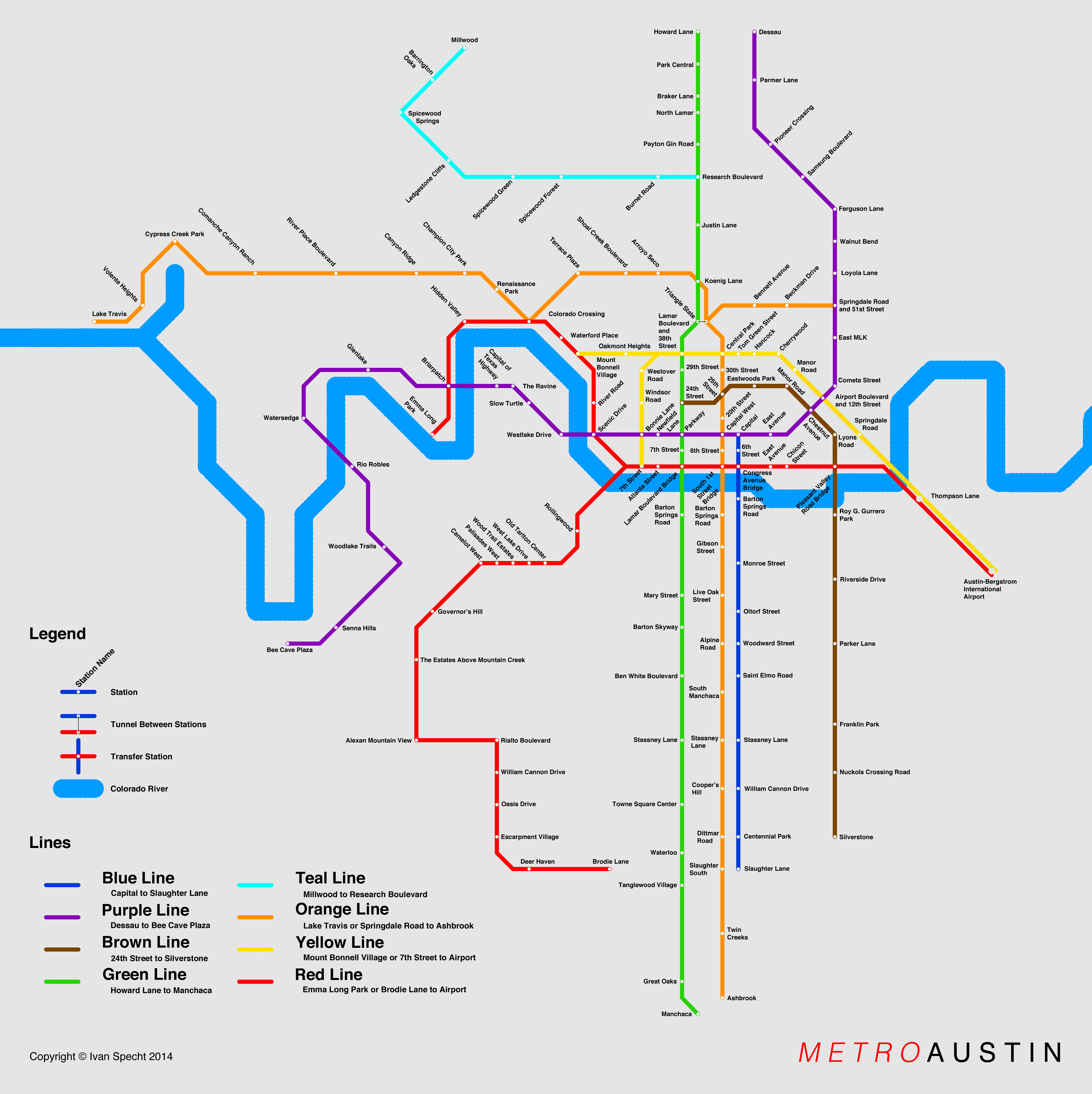
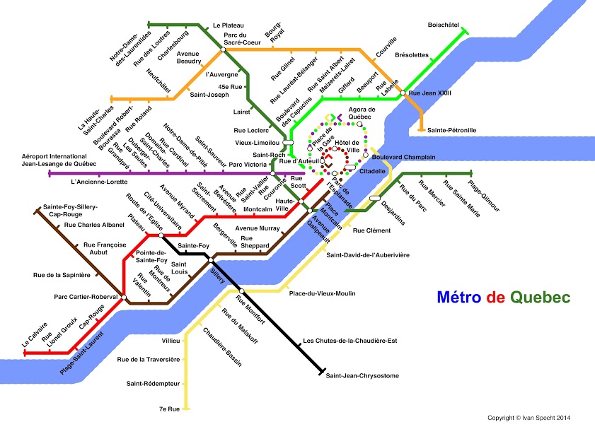
The project began as a Father’s Day gift for his dad, who lives in Austin, Texas — a fast growing city in need of new mass transit options. If there were to be a new subway system in Austin, Specht wondered, where would the lines and stations go? So he set about deciding the routes himself. The Father’s Day gift was a hit, and Specht dedicated his summer to starting a business: he would design subway maps for cities that don’t have mass transit systems and sell them as posters or T-shirts on the project’s website. Most of the cities he has mapped so far are ones he knows something about. But if you know a city that could use some imagined mass transit, he also takes commissions.
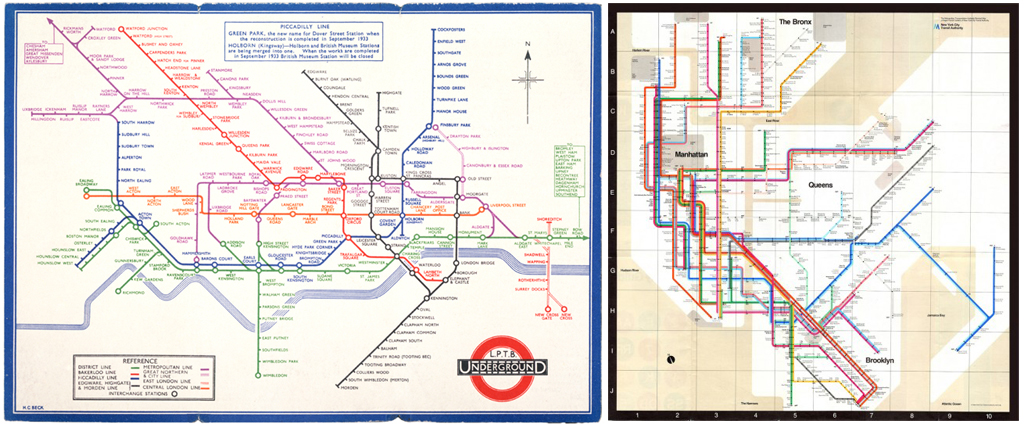
Inspired by the clean, 45-degree angles of Harry Beck’s iconic map of the London Underground — a graphic rule system that Massimo Vignelli famously adopted for his 1972 map of the New York subway system — Specht’s maps compress space and time. But even as works of imagination, their fidelity to the cities they represent should give transit planners something to think about. Specht knows Austin well enough to estimate demand: “A lot of people want to go down Congress Avenue,” he told me, “it has a ton of restaurants on it, and the Capitol Building.” With each of the maps Specht created, he first pored over street maps to choose routes based on commutes, retail clusters, and major intersections. His maps “try to concentrate the number of stops and lines in the downtown areas, and to try to get an even balance throughout the city.”
He starts with a Google map, and using Google’s MapEditor, begins to draw lines on the map as potential subway routes. He’ll then begin the mapmaking process all over again in Photoshop, tracing the lines from the Google map. The final step is to add the stations, every half mile or so.
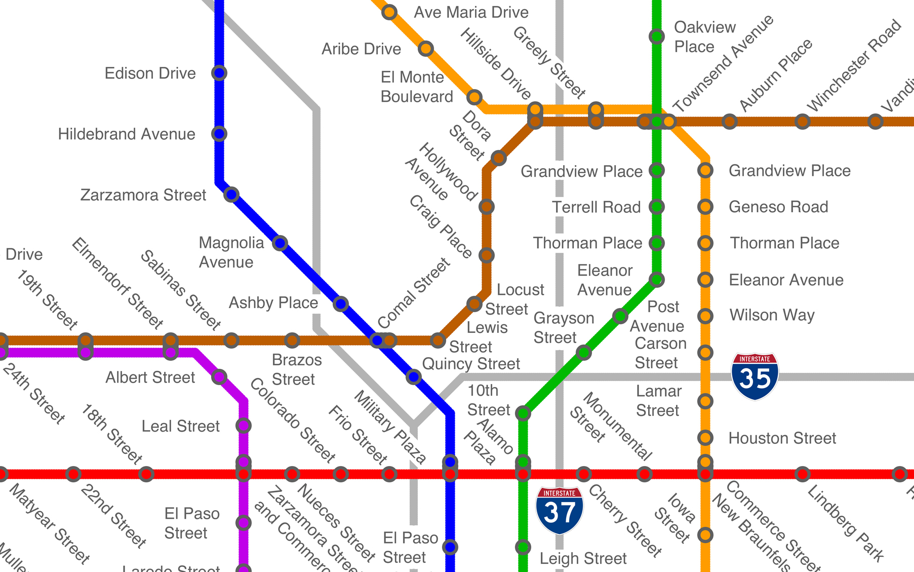
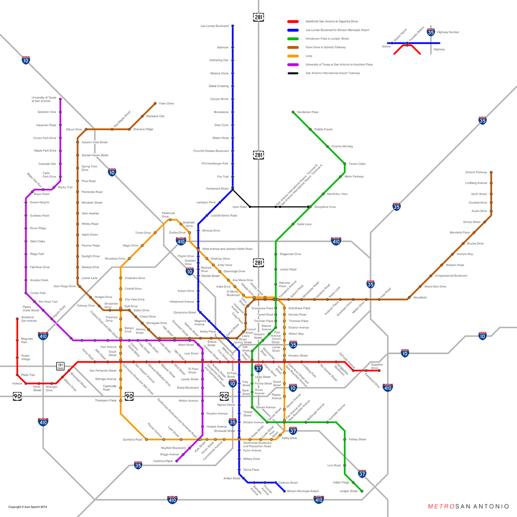
Cities where the downtown/suburban split is less clearly defined proved to be a challenge. Specht explained why he found San Antonio the hardest map to do: “It’s such a sprawling city … so it was hard to cover lot of different areas with just a couple of subway lines.” The difficult choices came down to finding the right balance between the number of subway lines and the graphic organization of the map. “If I put too many lines in, it wouldn’t be graphically pleasing.”
High on his list of transit maps that are not graphically pleasing is New York City’s own. He much prefers the Vignelli version of the New York City subway and the current maps of the DC metro and the London Underground, each of which maintains the Harry Beck rule of 45-degree angles. But he does love the New York City subway system itself, even memorizing at one point all of the lines and stations throughout the five boroughs, and travelling to each of them (with apologies to the Staten Island Railway).
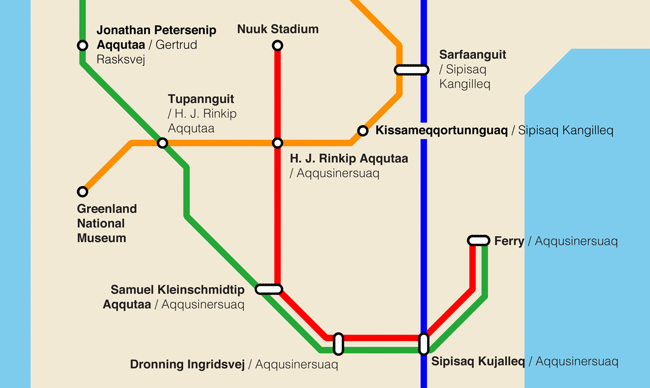
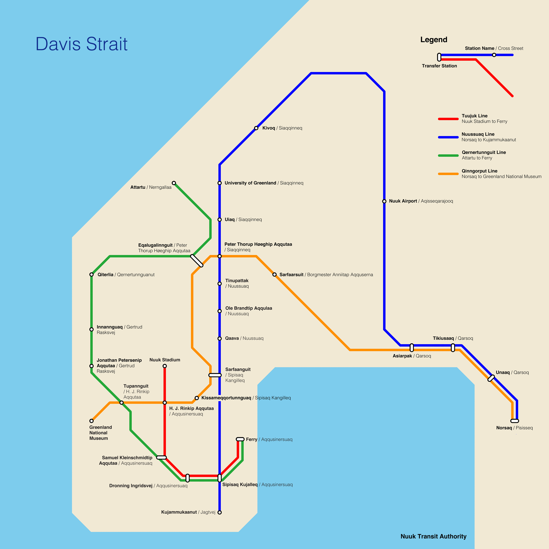
Specht has some ideas for how New York’s subway system could be improved (de-concentrating subway infrastructure in Manhattan and providing a circle line for inter-borough connections not involving Manhattan). But for now he’s more interested in making maps for cities without them. What was the most fun? The answer is easy: Nuuk, Greenland. “If you go to Google maps of Nuuk, the street names are amazing!”
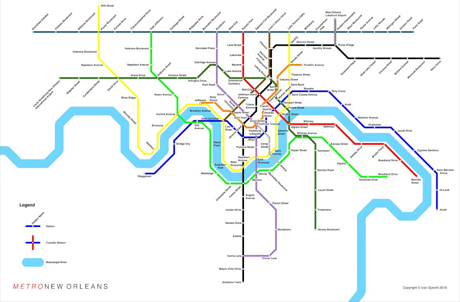
The process, which Specht hopes to continue — time permitting — has given him “a pretty good knowledge of the various cities.” When he travelled to New Orleans, a city he mapped before ever visiting, he reported being pleased that his scheme for a subway actually worked out pretty well. “It was interesting,” he remarked about driving through the city, looking around, and saying to himself, “I remember putting a subway stop here.”
All maps designed by Ivan Specht; all rights reserved.
The views expressed here are those of the authors only and do not reflect the position of The Architectural League of New York.
Comments