
We are celebrating 15 years — and counting — of stories that are deeply researched and deeply felt, that build a historical record of what the city has been.
We are celebrating 15 years — and counting — of stories that are deeply researched and deeply felt, that build a historical record of what the city has been.
To mark the fifth anniversary of the launch of Urban Omnibus, we look at themes that have emerged in our content over time and think about what those threads reveal about the needs, desires, and priorities of the city today.
Waterways are a central character in the origin story of New York City and the greater metropolitan region. The Hudson, East, Harlem, Bronx, Passaic, and Hackensack Rivers; Kill van Kull and Arthur Kill; Newton Creek and the Gowanus Canal; Jamaica Bay, the Verrazano Narrows, and the great harbor where these converge with the Atlantic Ocean: each has shaped and been shaped by the city’s development. These flows do not only speak of history; they also provide opportunities to bolster regional and local economic vitality, expand access to recreation, diversify distribution infrastructures, and improve the city’s relationship with larger ecological systems.
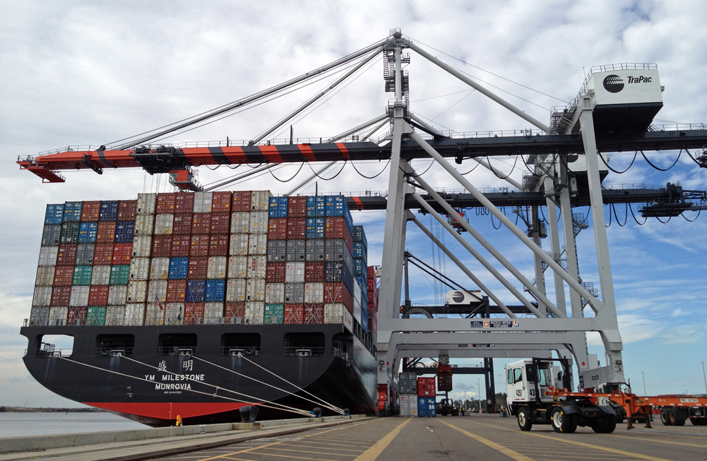
The Yang Ming Milestone, an example of a Post-Panamax ship, which ports worldwide are seeking to accommodate by widening and deepening shipping channels. | Photo: JAXPORT, Jeff Price
New York’s rise as a global city stemmed from its robust shipping industry, which peppered Manhattan and Brooklyn’s coastlines with piers served by increasingly giant ships. To maintain and expand the shipping channels that feed this industry in the region (now centered in New Jersey), New York’s waterways are frequently dredged. Dredging — scooping up and removing mud, silt, sand, clay, and other sediments from the beds of waterways — not only aids the preservation of shipping routes; the processes also remove contaminated soils, collect materials that are then used to replenish eroding habitats, and even serve as foundations for new neighborhoods. Touring New York’s dredged landscapes, Tim Maly explains how “the greatest unrecognized landscape architecture project in the world” shapes the city’s past, present, and future.
Dredging blurs the line between the natural and man-made in our waterways. This grey area extends to the city’s water infrastructure as well: the tunnels and sewers that transport wastewater, stormwater, and stream water beneath asphalt and concrete expanses. Steve Duncan’s photography and historical research expose these interconnected systems, among them Minetta Brook, which makes itself known in leaky basements, manhole covers, and memorial fountains. The burying of streams was practiced widely in the development of urban areas, but in recent years the benefits of daylighting these systems — uncovering and restoring the habitat and ecological function of the streams — has gained increasing currency for reasons both environmental and economic. Zach Youngerman highlights case studies for using daylighting as a post-industrial revitalization strategy and explores its potential for implementation in the five boroughs. And in Staten Island, the integration of wastewater treatment mechanisms into natural areas in a system called the Staten Island Bluebelt has mitigated with great success inadequate wastewater infrastructure exacerbated by a major real estate boom.
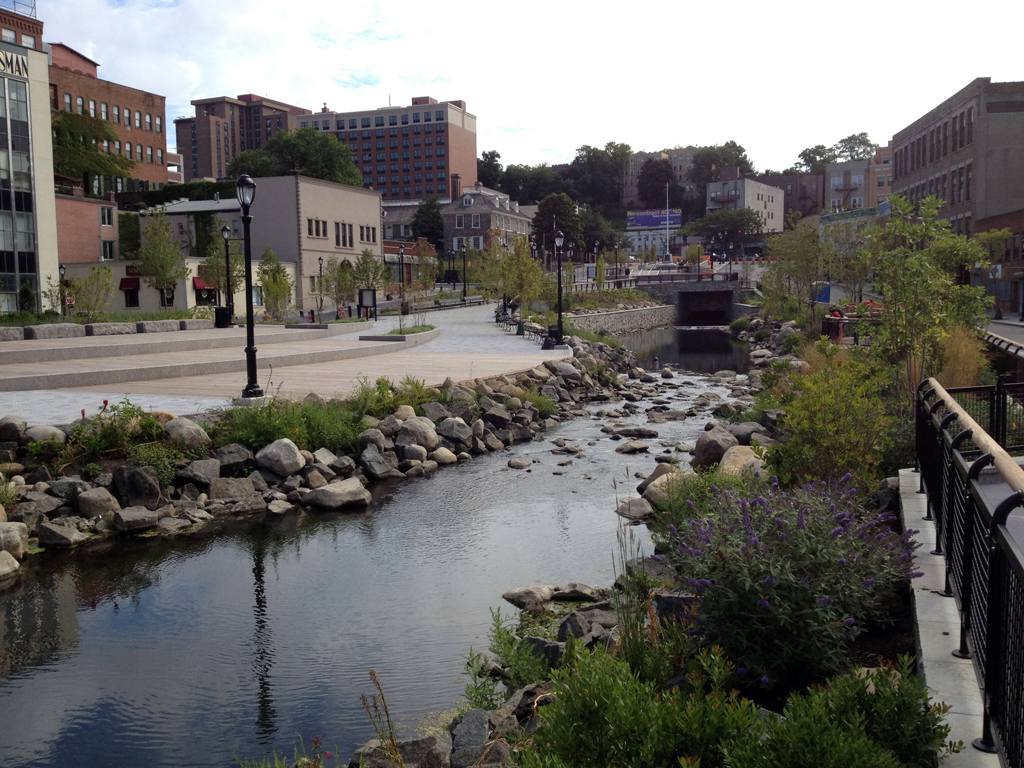
A portion of the Saw Mill River in downtown Yonkers after a daylighting project | Photo by Zach Youngerman
Our waterways also hold potential for implementing and expanding environmentally responsible practices. Michael Loverich and Nick Buccelli illustrate how tidal in-stream energy conversion — turbines installed in rivers and oceans to harness their kinetic energy — could be implemented in New York City to provide cleaner energy. And Christina Sun and Carter Craft explain how our waterways can be better utilized as goods distribution routes by replacing freight trucks with short sea shipping vessels, thereby improving mobility and decreasing air pollution.
Whether they are monitoring Panamax vessels or relatively small tugs, the Coast Guard plays an integral role in keeping our harbor safe and active. The Guard’s Sector New York is the nation’s largest operation command, and manages all the traffic from the Port of New York and New Jersey (the largest port on the East Coast). Maintaining New York Harbor’s safety alongside the Coast Guard is the City’s own Fire Department. Marine Companies 1 and 9 contribute to the FDNY’s capability to fight fire from the water and respond to disasters. We took a look at the unique stations they inhabit and their contributions to an evolving tradition of municipal and civic architecture.
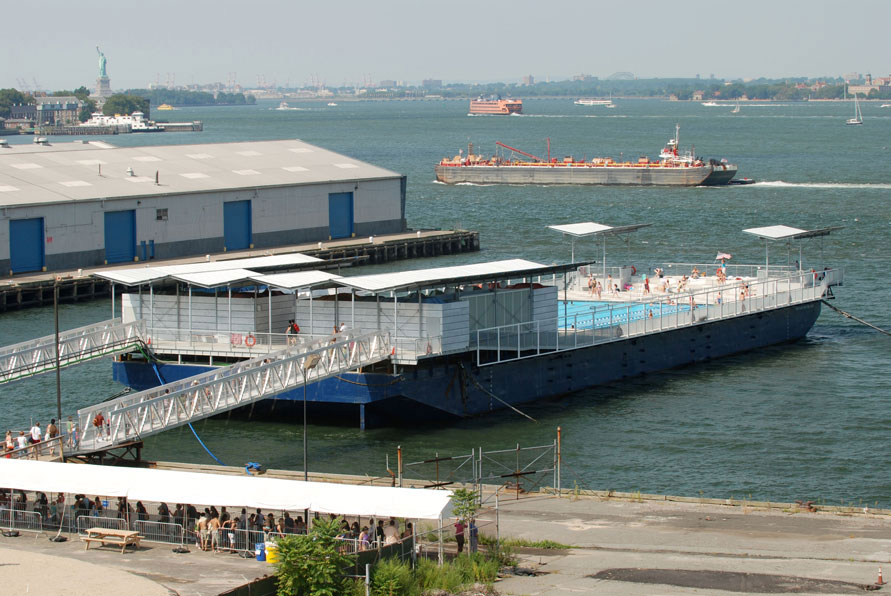
The Floating Pool | © Timothy Schenck
Public spaces and structures increasingly inhabit the waterfront, in large part due to the Bloomberg administration’s interest in reclaiming it from industrial use for recreation and transit access. This inclination extends beyond the public sector to private citizens as well: urban planner Ann Buttenwieser partnered with architect Jonathan Kirschenfield to bring the Floating Pool — a swimming pool and amenities built into a floating barge — to fruition. The pool, which calls Barretto Point Park in the South Bronx home during warmer months, provides recreation on the water and acts as a catalyst to consider what else the waterfront could be. The process of envisioning the future of the waterfront is also integral to SLO Architecture’s long-term work in the Bronx. Amanda Schachter and Alexander Levi discuss the vision for the Bronx River Greenway they’ve developed with local groups and communities along the river and what’s to gain from the public’s understanding of the water as a neighbor.
The views expressed here are those of the authors only and do not reflect the position of The Architectural League of New York.