
We are celebrating 15 years — and counting — of stories that are deeply researched and deeply felt, that build a historical record of what the city has been.
We are celebrating 15 years — and counting — of stories that are deeply researched and deeply felt, that build a historical record of what the city has been.
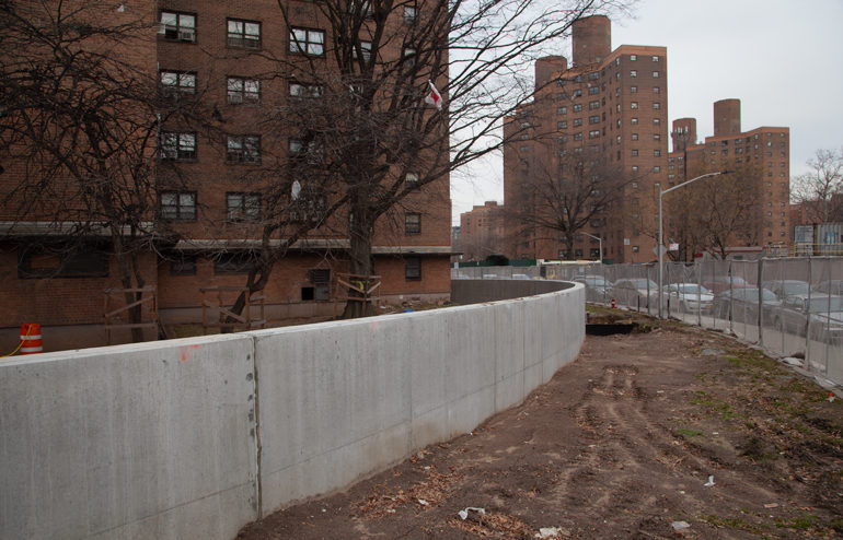
The Walling World: a newly erected concrete wall around NYCHA’s Baruch Houses in Manhattan’s Lower East Side. Construction crews have installed a dirt ramp in order to access both sides of the otherwise unscalable, approximately six-foot wall designed to stop flooding and storm surges from the nearby East River.
June marks the start of hurricane season on the Atlantic Ocean. Even amidst the ravages of a novel coronavirus and state violence, the perils posed by a heating planet are not going away. If the city turned out to be woefully underprepared for a pandemic, what about measures to protect against storms and floods? While large-scale interventions — think earth moving, land making, barrier building, charismatic megaprojects — are studied, debated, and temporarily abandoned, more humble adaptations emerge along the waterfront, and in low-lying areas. Amy Howden-Chapman documents a “walling world” where sandbags, berms, and other piles of earth are providing new buffers against the seas. From Lower Manhattan to the Rockaways, new infrastructures of defense — some military in provenance, some providing a softer transition to higher waters — are already transforming daily life. But even in the urgent need to prepare for tomorrow’s threats, Howden-Chapman suggests, we don’t have to swallow up all of today’s joys.
Long before the coronavirus shelter-in-place orders shuttered playgrounds across the city, the swings and jungle gyms of the Baruch Houses complex on Manhattan’s Lower East Side were already off limits. Unlike the palpable perils of the current pandemic, for many New York residents the threat of the climate crisis still hovers indeterminately between the imminent and the abstract. And yet the physical fabric of the city is beginning to tell a different story. Eight years after Superstorm Sandy, physical structures intended to protect housing, businesses, parks, roads, and other vital city infrastructure from similar flooding are becoming ubiquitous. Interventions are sprouting up across the five boroughs, with results that range from delightful — the undulating bike lanes of the Rockaway Boardwalk — to awkward — sandbags eating up already tight sidewalk space on the Lower East Side.
Proposals for massive and permanent climate impact interventions to protect iconic sections of the city have been hotly debated for over a decade. Federal funding to pay for these measures is being pleaded for. Meanwhile, the New York City Office of Emergency Management’s (OEM) Interim Flood Protection Measures program is filling the gaps with barriers of compacted sand and “just-in-time” aluminum-based “walls” that slot into place across doorways just before the next deluge of water rushes in. And in less visited corners of the city, other infrastructure intended to protect against climate-exacerbated severe weather is already propagating, from berms and marshes to snaking concrete walls. These interventions are the preview for adaptation measures that in following decades will touch every part of the city, be it inland communities preparing for flash flooding caused by severe downpours, or the many neighborhoods that hug the city’s 520 miles of shoreline.
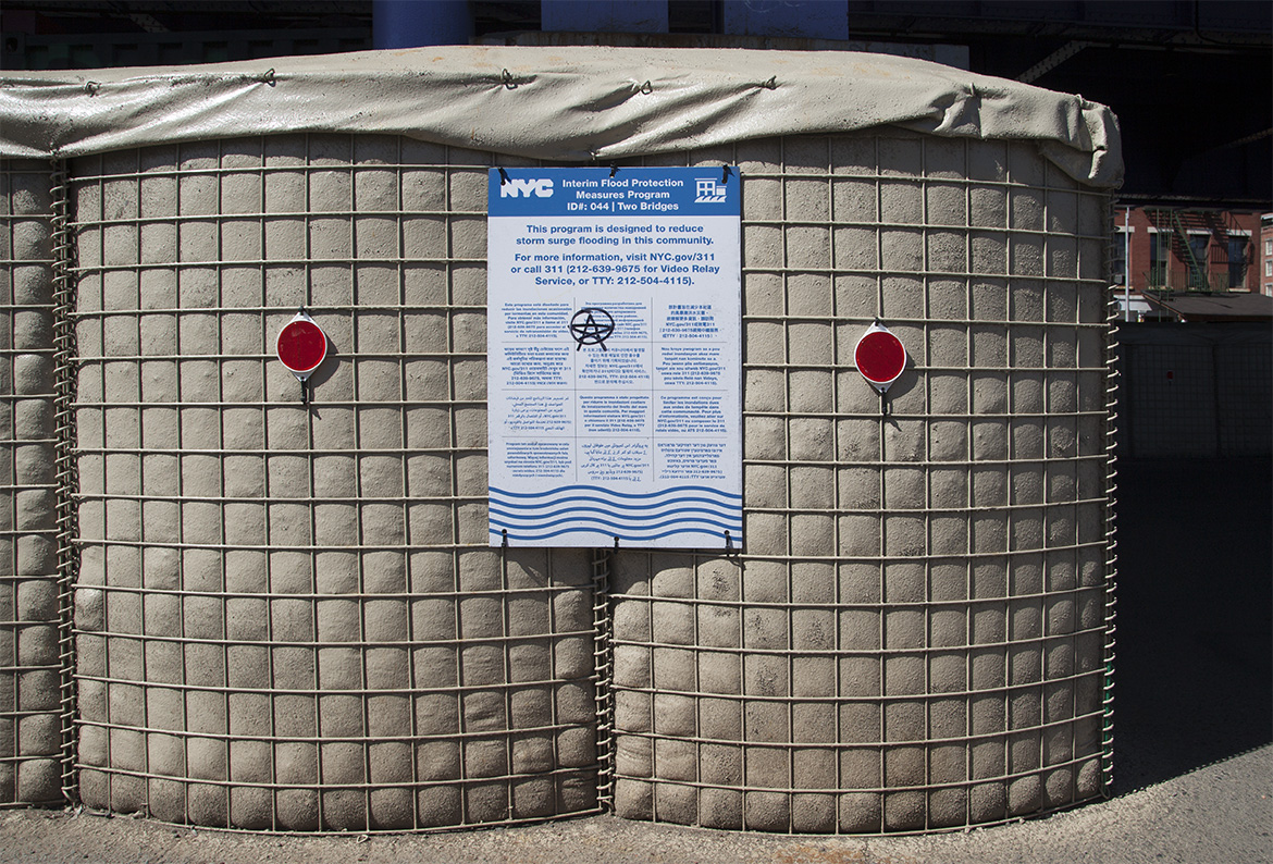
Along the river walkway at the South Street Seaport, HESCO barriers have been erected as part of the city’s Interim Flood Protection Measures program. Here, a sign which reads “This program is designed to reduce storm surge flooding in this community” has been adorned with an anarchist tag.
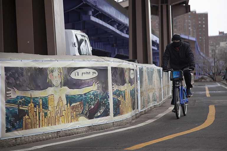
Where Manhattan’s southern tip touches the East River, dirt-filled mega-sandbags sit stoutly, waiting to repel the next storm surge. Otherwise known as HESCO barriers, these three-foot-wide, four-foot-high sandbags begin as collapsible wire mesh cages. When deployed, they are lined with heavy-duty fabric, filled with sand, and then painted to reduce permeability. The speed at which they can be erected means they are widely used both for flood control measures (by the New York City Office of Emergency Management, in New Orleans for Hurricane Katrina) and as military fortifications (in Iraq and Afghanistan by the US Army). In an attempt to temper the impact of a tool of war which is likely to sit on New York City streets for at least five years, OEM has instigated a program for the barriers’ beautification, wrapping them with murals by local and international artists.
A sandbag barrier mural by artist Kayla Lee.
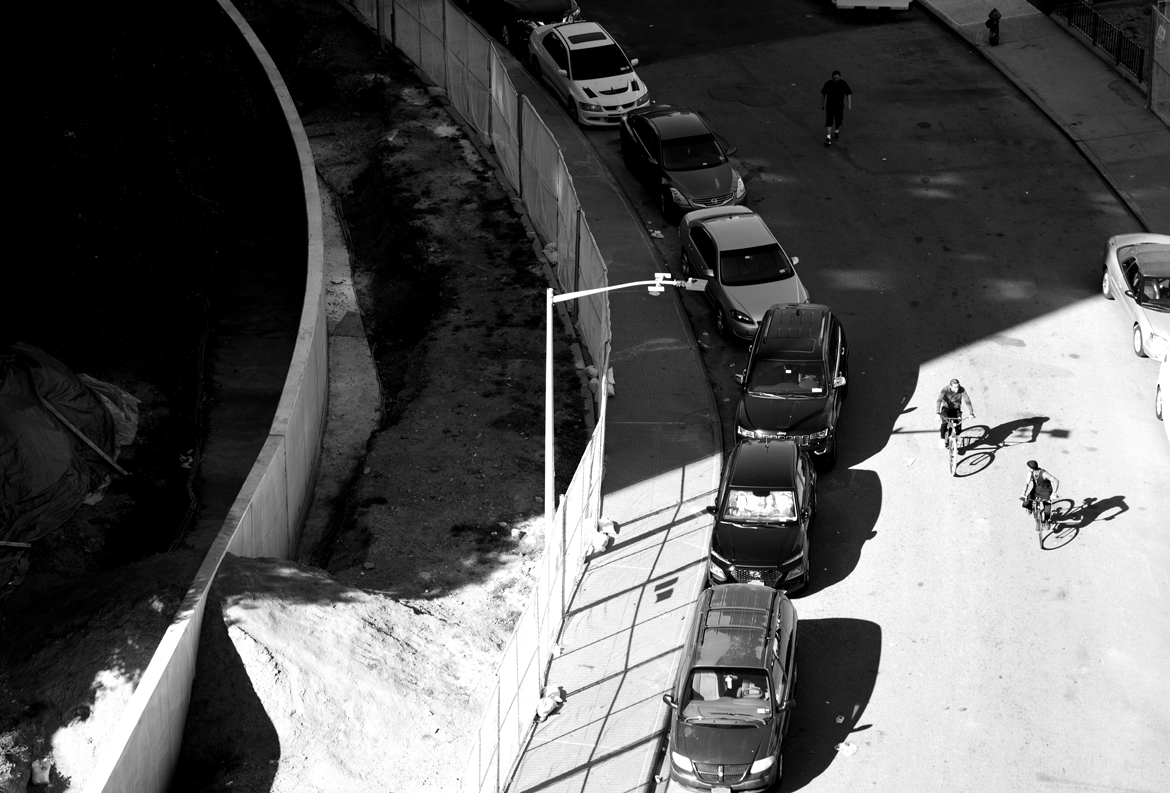
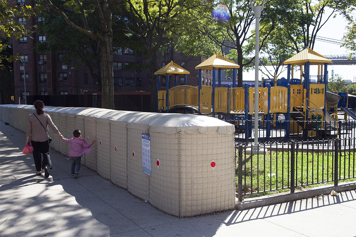
A sandbag barrier wall on Catherine Slip in Manhattan, installed to protect NYCHA’s Smith Houses, narrows sidewalk space and cuts off the playground behind.
These semi-temporary interventions offer a modicum of protection as the city plans for more costly and permanent solutions. The New York City Panel on Climate Change estimates that sea level will rise between four and nine feet by 2100, so onshore barriers may only be the first step. Until recently, the Army Corps of Engineers was studying flooding mitigation measures in New York City that range from “beach nourishment” to a giant storm surge barrier. In early 2019, Mayor de Blasio announced a plan to extend the shoreline of Lower Manhattan, arguing that space there is already too constrained to incorporate the types of berms and flood walls needed to protect the area.
Communities in the Lower East Side already suffer from a dearth of adequate and accessible open space. Locals concerned with losing what little they have are fighting to maintain access to existing waterfront parks. A partnership of community groups — including East River Park Action, whose tagline is “Don’t kill our park for a bad flood plan” — have filed a lawsuit against the City in order to halt a plan which they characterize as burying a park under an eight-foot layer of dirt in order to raise it above the floodplain.
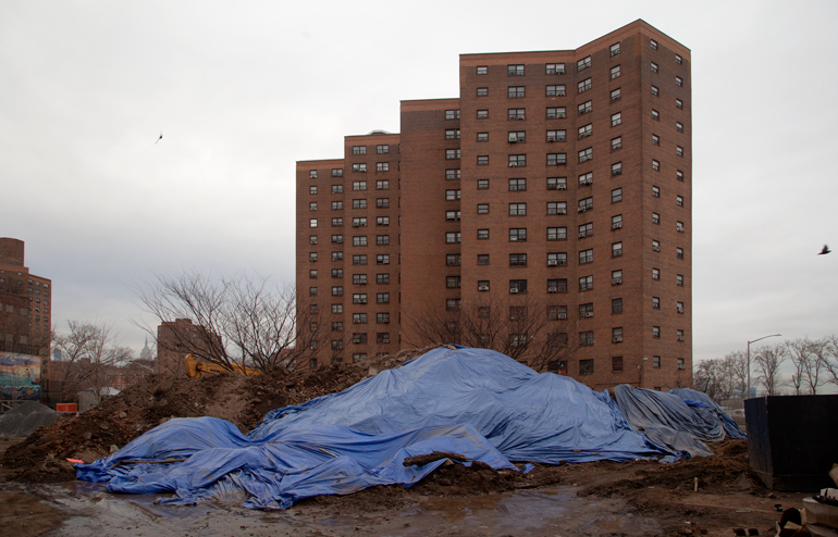
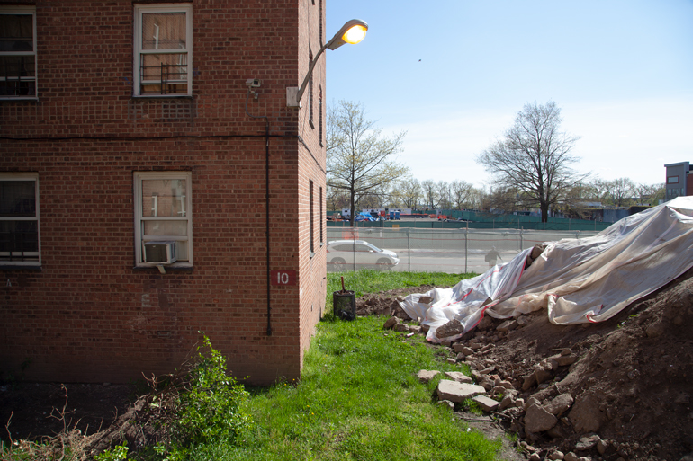
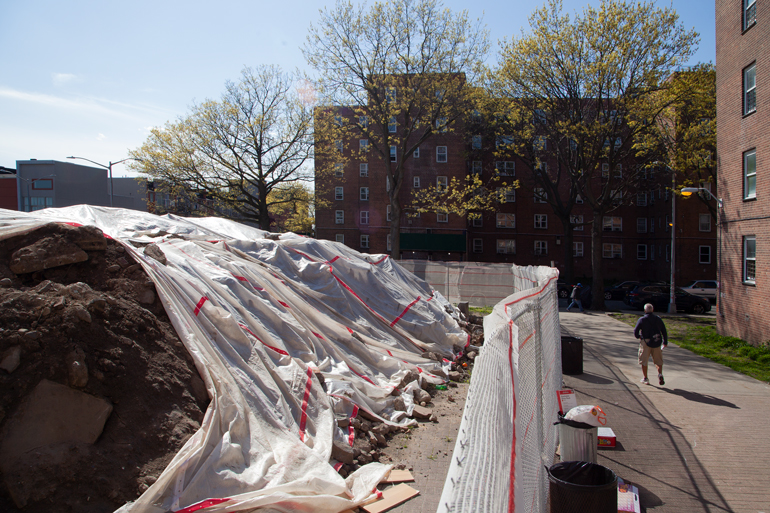
Construction outside NYCHA’s Baruch Houses in Manhattan.
Close by in the shadow of the Williamsburg Bridge, large-scale disruption is already a fact of life at NYCHA’s Baruch Houses. For months, residents have entered their homes by balancing on boards between muddy trenches, as foundations are dug for concrete walls to encircle the properties. Citywide, 88,700 buildings were flooded by Superstorm Sandy, and the calculus is that disruption of the type NYCHA residents are experiencing today is necessary to prevent widespread destruction tomorrow.
Mega-sandbags again line the water’s edge in Red Hook. When flooding occurs, the gaps between the existing segments of walls will be filled with inflatable barricades known as “tiger dams.” The city has been clear that the Interim Flood Protection Measure program exists to protect buildings and equipment, not people. So other initiatives are being rolled out to ensure that when the next flood comes to low-lying Red Hook, residents will be able to safely evacuate.
A mural by “Students of Red Hook Playgroup” on sandbags along the Red Hook waterfront is part of the Interim Flood Protection Measures Mural Arts program.
Home to more than 6,000 people nearby, the Red Hook Houses (like many NYCHA complexes built on marginal land) are especially vulnerable to flooding. Extensive construction is underway to redesign the entire 28 building campus to prevent the kinds of flooding and associated power outages that were caused by the Sandy storm surge. The hope is that when the next storm hits, not only will the power stay on, but residents will be able to safely evacuate their buildings through newly raised entrances.
A majority of the open space around Red Hook Houses is already fenced off as construction begins to raise interior courtyards above the flood plain.
Major earthworks outside the windows of Red Hook Houses. Despite attempts to mitigate the obvious disruption, residents report that dust from the dirt pile has been blowing into their apartments for months.
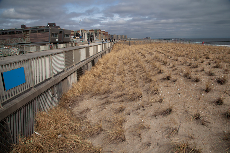
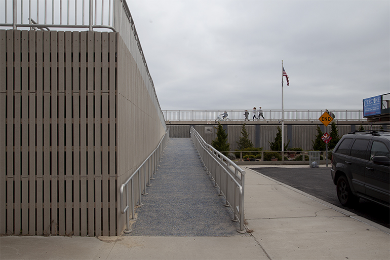
The Rockaway Boardwalk is one of New York City’s largest resiliency projects to date. The much-used public thoroughfare is a hardened barrier disguised in part by sand dunes and public amenities. Playgrounds, lifesaving stations, concession stands, and seating dot the five-mile long stretch of concrete. The original boardwalk, dating from the 1920s, was of comparably flimsy construction. Thousands of planks of tropical wood have now been replaced by a massive retaining wall backfilled with sand by the Army Corps of Engineers, and topped with a 40-foot wide boardwalk of “sand-colored” concrete planks, in a project designed by WXY Studio.
Lifeguard stations elevated on stilts allow a sightline over the raised boardwalk and planted sand dunes.
The concrete boardwalk is elevated above the 100-year floodplain and reinforced with over four and a half miles of retaining walls and planted sand dunes. This infrastructure will go some way to protecting the Rockaways. A particularly vulnerable peninsula, with the Atlantic Ocean to the South and Jamaica Bay to the North, the community is home to over 100,000 people. The Boardwalk achieves such protection while also improving amenities for locals and providing a destination to which tens of thousands of other New Yorkers can flock during those other climate exacerbated events — the city’s increasingly dangerous heatwaves.
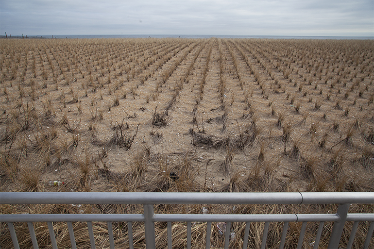
On the ocean side of the Rockaway Boardwalk, newly planted dunes create living infrastructure designed to absorb storm surges. The planted slope also disguises the mass of the wall. When seen from the street side the scale of the boardwalk intervention is notable.
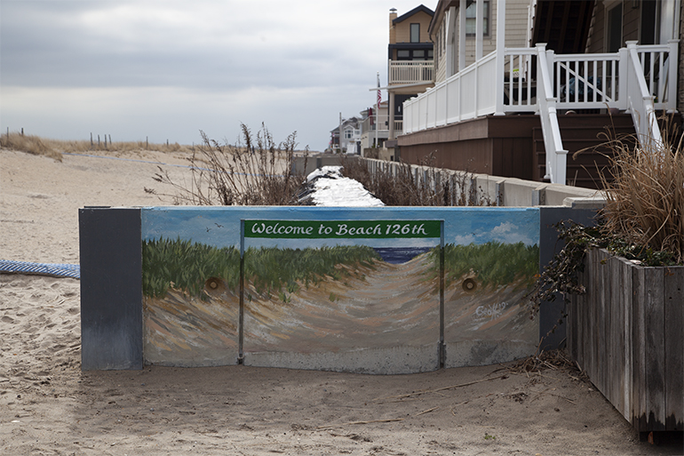
Where the larger boardwalk structure ends at Beach 126th Street, a smaller concrete wall has been erected between the dunes and houses. A local artist has attempted to integrate the infrastructure with a mural that depicts the immediate surrounds.
Sunset Cove Park sits at the edge of Broad Channel, the strip of land that connects the Rockaway Peninsula to Howard Beach and the rest of Queens. From the vantage of the park, the sun can be seen setting over a distant Manhattan, but in the foreground the vista is of the water reeds and marsh islands of Jamaica Bay. Sunset Cove Park consists of a single crescent-shaped berm topped with a promenade. Wetlands work as living infrastructure to soak up tidal flows and storm surge flooding before it reaches the berm, the last line of defense for nearby housing. Sunset Cove Park is a humble neighborhood nook, but it represents a triumph of community effort. The park is located on the former site of an abandoned marina, where derelict boats leaked hazardous chemicals. During the park’s construction, thousands of cubic yards of contaminated soil were replaced with 16,000 tons of clean sand. 200,000 new plugs of spartina or saltmarsh cordgrass were then planted in order to reestablish the salt marsh. Today the rejuvenating marsh provides food and habitat for many species of marine life as well as birds such as herons, rails, and egrets.
The berm at the center of Sunset Cove Park under construction in summer 2019.
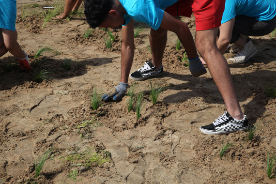
Students participating in a summer program run by the Jamaica Bay Rockaway Parks Conservancy and the American Littoral Society plant spartina, also known as saltmarsh cord grass, at Sunset Cove Park, summer 2019.
If current building sites signal what residents and communities will have to cope with in the transformation of New York City into an urban landscape that is truly ready for future inundation, the transition towards a climate resilient New York will not be easy. Seaside communities and residents of NYCHA developments have had to endure months, if not years, of invasive construction right outside their windows. Such significant earthworks should result in more than a concrete wall blocking the view. There are alternatives to adaptation plans that simply swallow up today’s joys to prevent tomorrow’s threats.
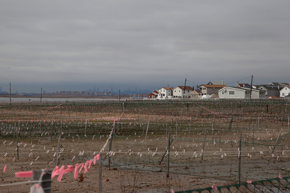
Sunset Cove Park, March 2020. The pink flags and fencing are there to keep geese from getting into the rejuvenating areas of newly planted grass.
If New Yorkers are to welcome adaptation measures, then such infrastructure must bring with it benefits for the communities in which it is located, be it recreational space, or green infrastructure that restores ecosystems. If military-style mega-sandbags are to be erected in New York City, it should not be at the expense of sidewalk and promenade space, and no amount of decoration is likely to convince communities otherwise. The COVID-19 crisis is highlighting how essential uncrowded public space is for residents to exercise, and to gather, while still maintaining social distance. If designed well, climate mitigating measures also have the ability to improve communities. An adapting city should be designed for residents to walk and bike on uncrowded streets towards parks and promenades planted with species that can survive the coming surge.
All photographs copyright Amy Howden-Chapman
The views expressed here are those of the authors only and do not reflect the position of The Architectural League of New York.


Comments