
We are celebrating 15 years — and counting — of stories that are deeply researched and deeply felt, that build a historical record of what the city has been.
We are celebrating 15 years — and counting — of stories that are deeply researched and deeply felt, that build a historical record of what the city has been.
Something sneaky snakes below the streets of eastern and northern Brooklyn. Despite New York City’s ambitious climate agenda — and a statewide ban on fracking — gas extracted from the Marcellus Shale in Pennsylvania is set to be pumped underneath some of the borough’s most under-resourced communities. Initiated in 2017, National Grid’s Metropolitan Natural Gas Reliability Project managed to fly under the radar of many neighbors, largely due to its innocuous-sounding name. But as the project nears completion, residents from Brownsville to Greenpoint are mobilizing against what is now widely referred to as the North Brooklyn Pipeline.
Environmental injustice takes many forms, but few are as tangible and visibly contested as fracked gas pipelines. Following a storied resistance campaign against the Dakota Access Pipeline in 2016, led by members of the Standing Rock Sioux Tribe, gas infrastructure has become a primary target for grassroots movements pushing back against environmental and social injury, economies of extraction, and the climate crisis writ large. Beyond the imminent threats they pose to health and safety — largely to Black, brown and indigenous communities — pipelines have become a potent symbol of the struggle between those who stand to benefit from continued reliance on fossil fuels (energy companies) and those on the losing end of so-called “energy independence” (people and the planet). This archetypal struggle has now come to Brooklyn. Inspired by locally-driven efforts to stop the NBP’s construction in its final phases, architect Ada Tolla of LOT-EK — who lives within the project’s evacuation zone, and witnessed its construction take place under her nose — biked the pipeline’s path with camera in tow, casting its underground infrastructure against the resilient physical and social fabric of the communities above.
Two conflicting narratives have emerged around an ongoing infrastructure project in Brooklyn. One, constructed by National Grid, labels the work as the Metropolitan Natural Gas Reliability Infrastructure. The utility company claims it “is making significant investments to modernize its natural gas system in Brooklyn,” and that the new infrastructure “will improve Brooklyn’s natural gas system by increasing the system’s safety, reliability, and operational flexibility. The project will also improve the gas system’s capacity to support the area’s economic growth.” The second narrative is being written by a consortium of Brooklyn residents, nonprofit organizations, and local elected officials, who have dubbed this project the North Brooklyn Pipeline, or NBP, and describe it as “a massive fracked gas transmission pipeline . . . to charge us, the rate-payers, millions of dollars in rate hikes to fill their shareholders pockets.”
The pipeline’s route, extending almost seven miles through eastern and northern Brooklyn, is planned to carry fracked gas from Pennsylvania through Brownsville, Bedford-Stuyvesant, Bushwick, and East Williamsburg, before connecting to National Grid’s depot on Maspeth Avenue along Newtown Creek (an expansion of this facility is also a part of the project). Since work began in May 2017, 5.5 miles of pipeline have been installed, with four of five project phases almost complete. Completion of Phase 4 and Phase 5 construction began in March 2020, during the COVID-19 pandemic, and is expected to be completed by fall of 2021.
The pipeline crosses predominantly Black and brown communities, as well as neighborhoods with troubled histories of environmental damage. Opposition to the project stems from its perpetuation of social, health, and environmental injustices, and to how it both sets back New York City’s renewable energy goals — as stated in the Climate Leadership and Community Protection Act — and subverts New York State’s ban on fracking. Furthermore, the cost for the new fossil fuel infrastructure, while currently paid by National Grid, will be sustained by residents of Brooklyn, Queens, Staten Island, and Long Island through an increase in their monthly utility bills. According to groups involved, the increased rate to complete Phase 4 and to build Phase 5 is estimated at $185 million. Communities and neighborhoods, already highly impacted by the pandemic and ensuing economic crisis, are particularly vulnerable to health and safety issues posed by gas leaks and even explosions.
National Grid is a British corporation. The long-term intention of the campaign against the North Brooklyn Pipeline is to bring utility companies like National Grid into public ownership.
The images and reflections below have been collected from a long bike ride along the pipeline’s path in Brooklyn, split over two days. My ride was prompted by urgency; by the need to be out of the house during COVID-19; by curiosity; by the drive to explore the complexity of a city always anew; by questions of adjacency and transparency; by the need for some clarity and sense of justice. The path took me through a group of neighborhoods: some far from where I live, and others close and well known to me. The linear bike path and experience — seeing communities above ground through their adjacency to the invisible, toxic, and comparably linear infrastructure below ground — defamiliarized all neighborhoods equally. Ordinary urban moments are transformed by an underlying risk, requiring pause and observation, but also moments to record and celebrate life and resiliency.
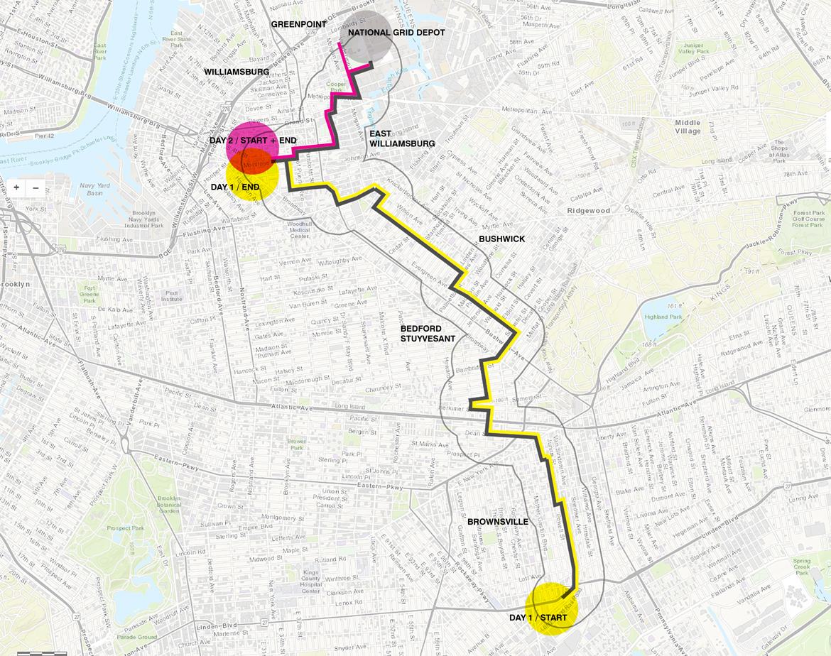
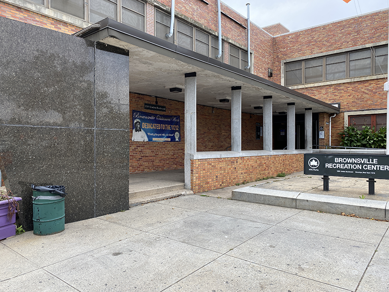
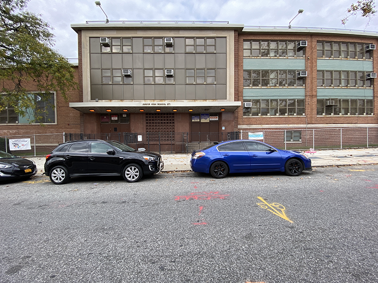
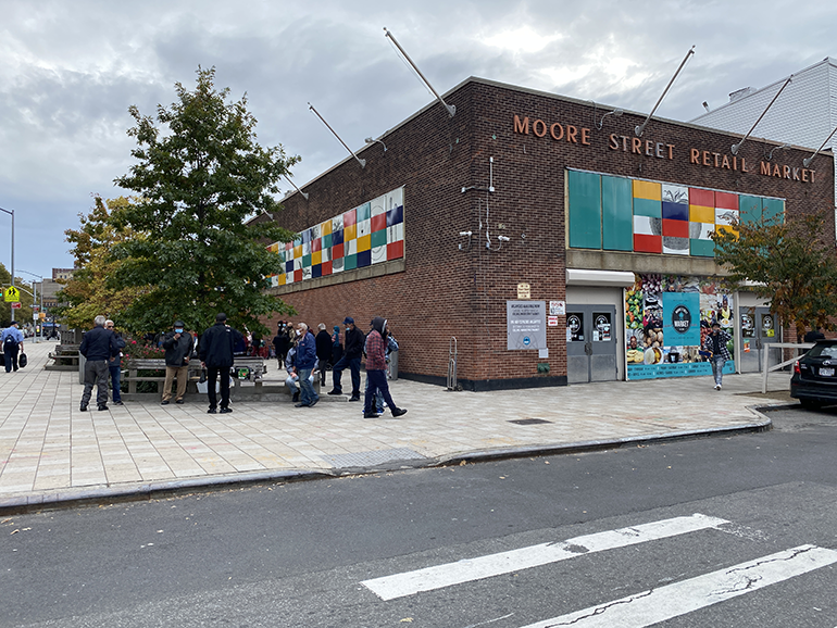
Paradoxically, the NBP begins right across from the Brownsville Recreation Center, a community facility run by NYC Parks with space for indoor and outdoor sports, community performances, and afterschool programs.
It has been shut down since the beginning of COVID-19, as a somber sign illustrates.
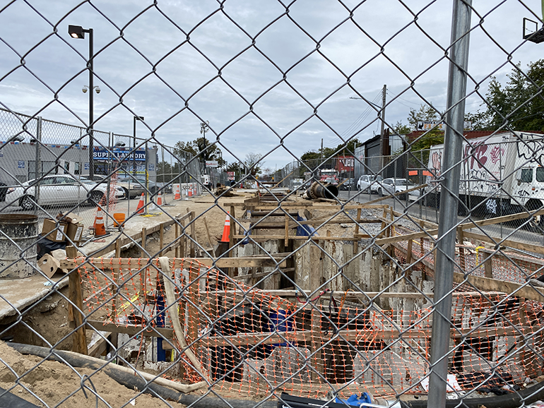
From the Recreation Center’s outdoor patio, baseball and basketball fields — as well as from an adjacent playground — you have a straight view of the NBP site and its detritus along Linden Boulevard, with a lane still closed to traffic, occupied by steel pipe segments and assorted construction debris.
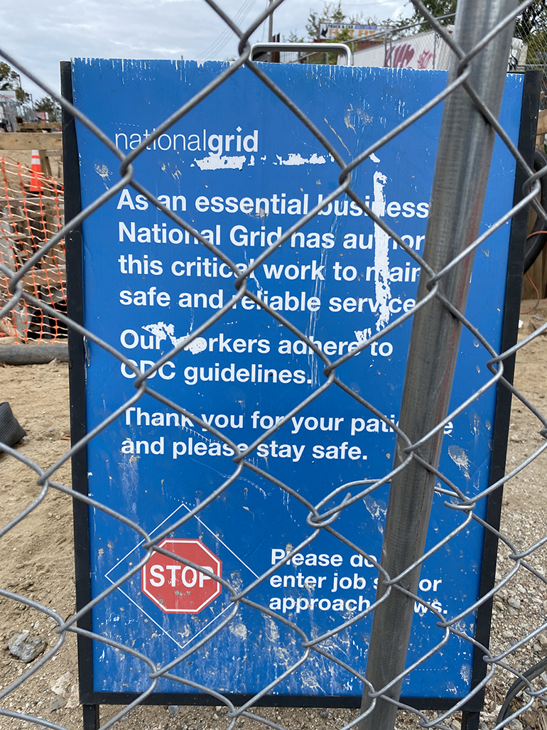
Cross Linden Boulevard and the scar is still open. Behind fences, an underground dig is marked by a sign from National Grid reassuring neighbors about workers’ safety during “this critical work.”
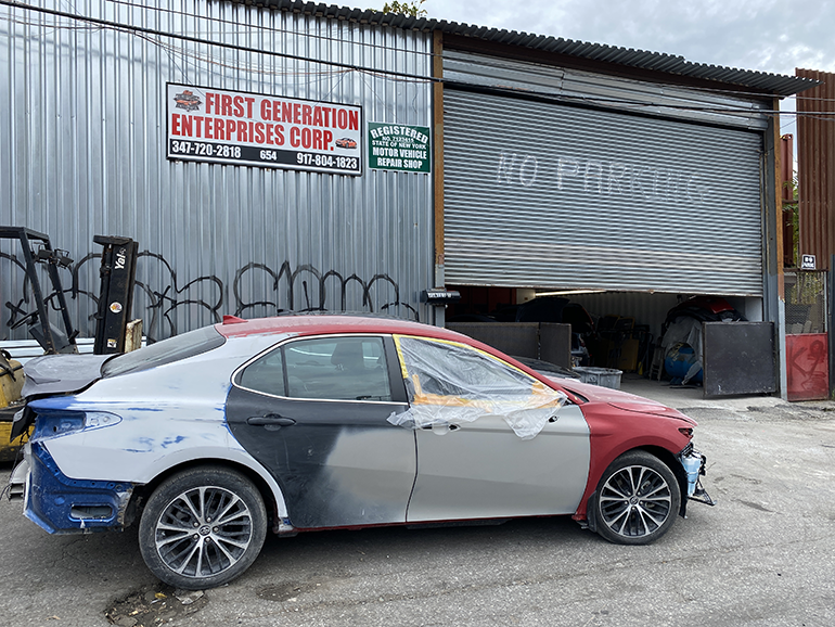
To the right, an auto repair shop is open, and mechanics are working on a gloomy Sunday afternoon.
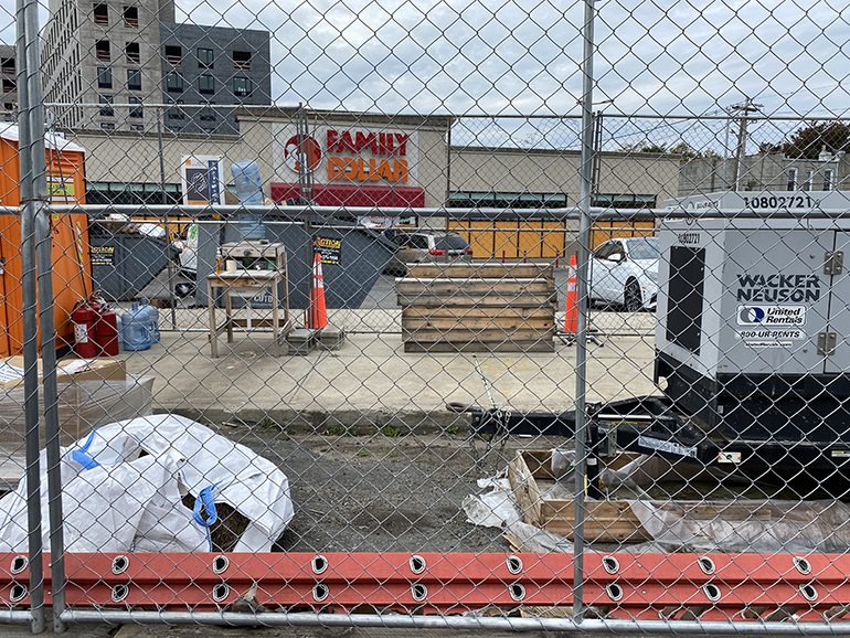
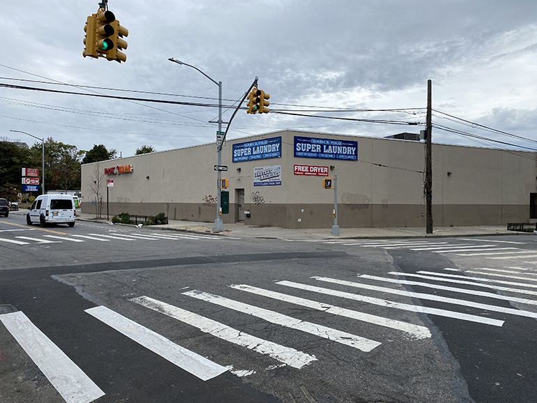
To the left, a strip mall with a Family Dollar, Super Laundry and a beauty parlor. It is Sunday, and there’s quite a bit of neighborhood activity underway: grocery shopping, parents strolling with children, people carrying large laundry bags, going to church, hanging out at a park. Such activities are visible everywhere I ride my bike across Brooklyn, following the NBP.
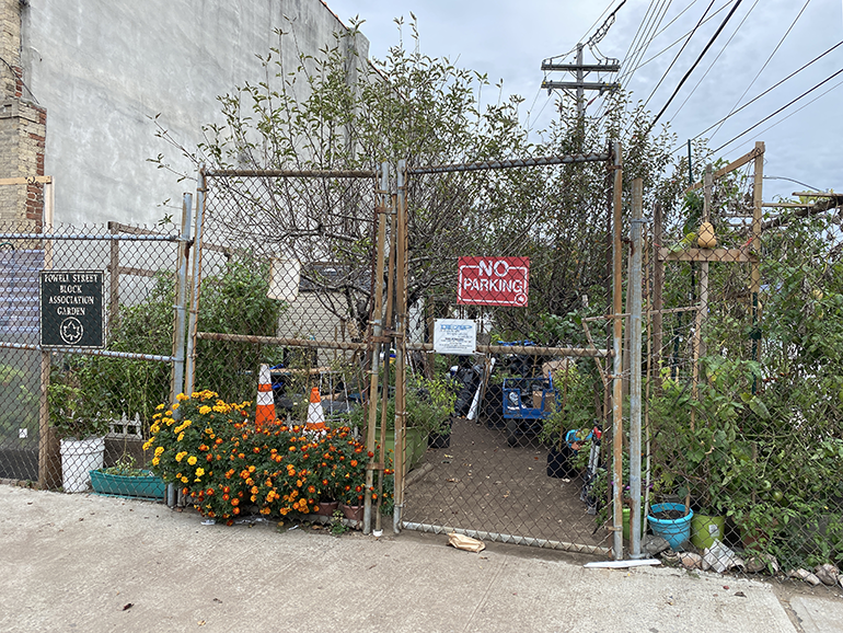
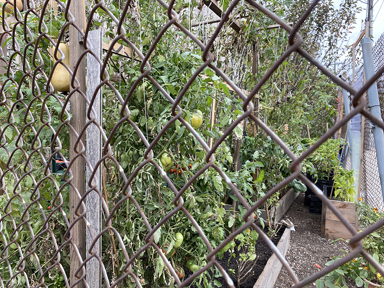
Across from the generic mall, the Powell Street Block Association Garden, a community garden proudly showcases large tomatoes, butternut squash, flowers and herbs.
The nearest subway stop is New Lots Avenue, along the L train.
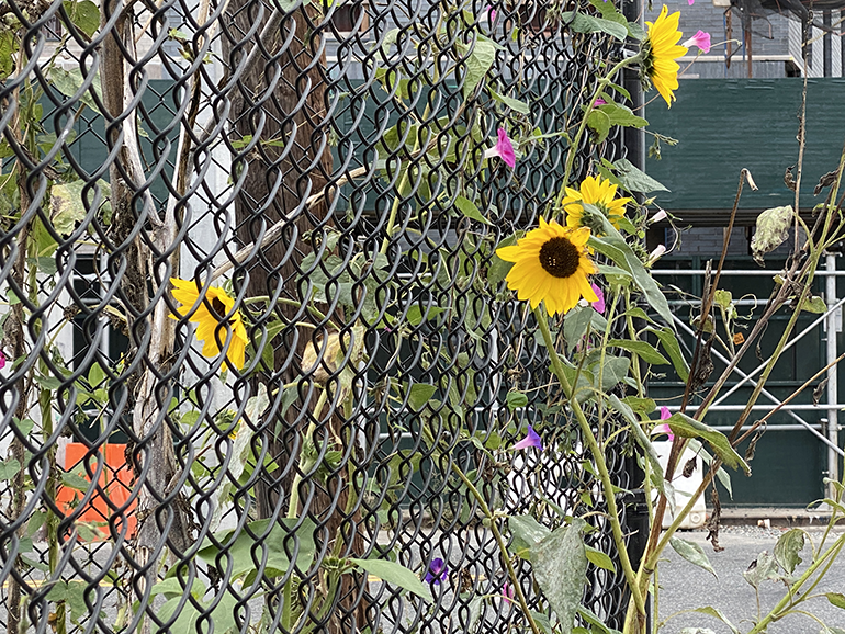
I ride down three parallel streets — first on Junius, lined by the tall MTA wall, then on Powell, a small-scale pleasant residential street, then again on Sackman — looking for the continuation of the scar, the path of the NBP. At the corner of Sackman and New Lots Avenue sits a larger community garden, with a greenhouse and planters filled with collard greens, herbs, chard, and blooming sunflowers, carefully organized and labeled.
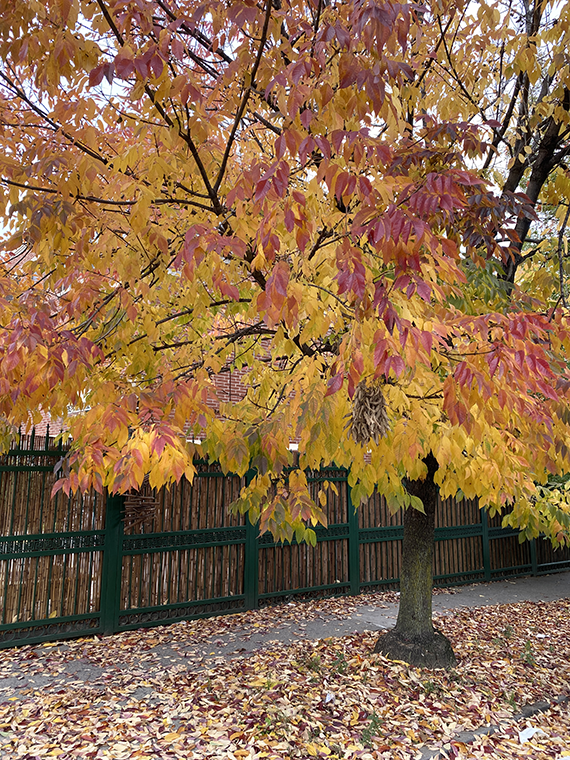
I see no sign of construction. No fences, no steel plates on the floor, no damaged asphalt. I take Junius, as it appears to be the path on the NBP map. Yellow leaves are everywhere, coloring front yards and sidewalks.
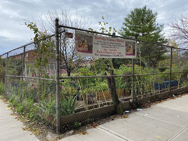
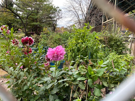
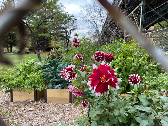
At the corner of Livonia Avenue: yet another community garden with a sign for a seasonal farmers market (June through November, rain or shine, 8am to 4pm. Accepts: Cash, WIC, Senior Coupons, Health Bucks, Food Stamps/EBT, Debit Cards), and the most beautiful dahlias.
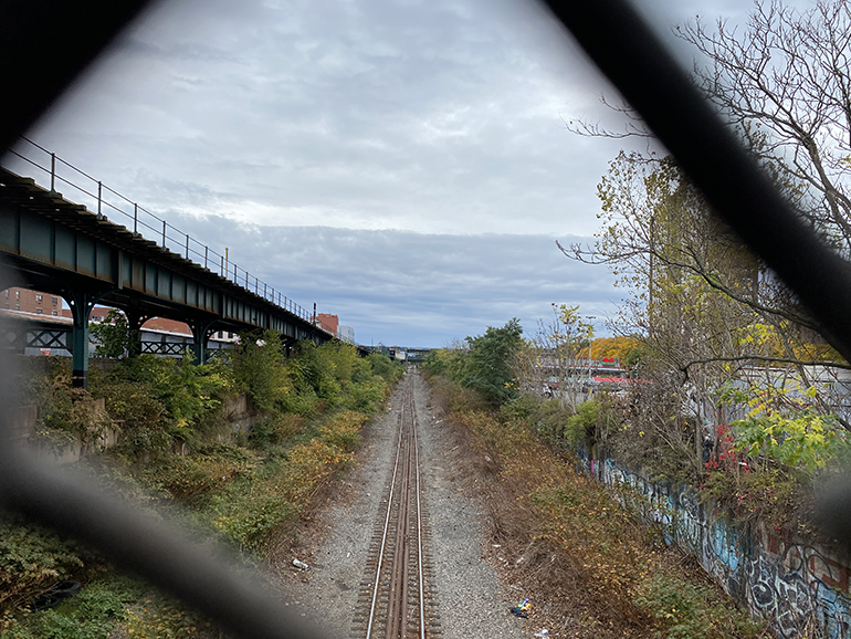
The map shows a turn in the pipeline’s path at Blake Avenue. Still searching for signs of massive underground construction — the pipe diameter is up to five feet — I look along parallel avenues. On the Blake Avenue bridge, I see the path of the L train. No traces of work here either: just the cut of this powerful line, in full fall colors. Another line, another physical infrastructure, another divide in Brownsville.
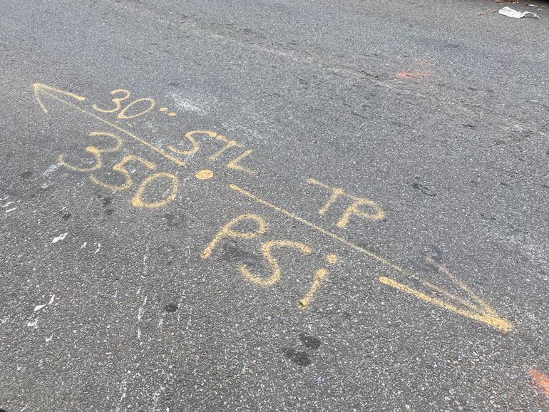
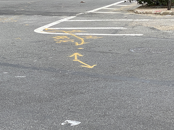
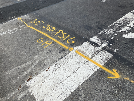
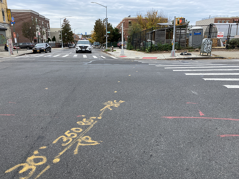
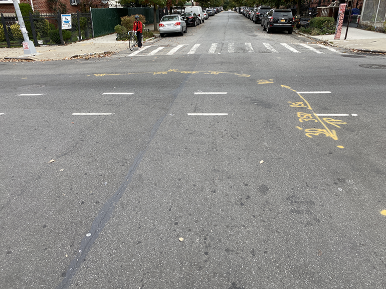
I take Powell, and suddenly notice the marks on the street paving. Yellow marks, arrows on either end: 30 STL TP 350 PSI. Yellow dots, forming a long line on the street.
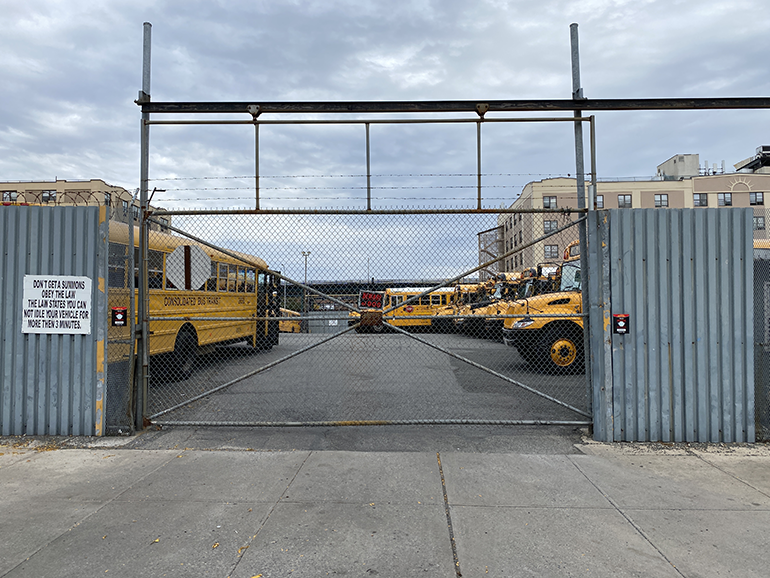
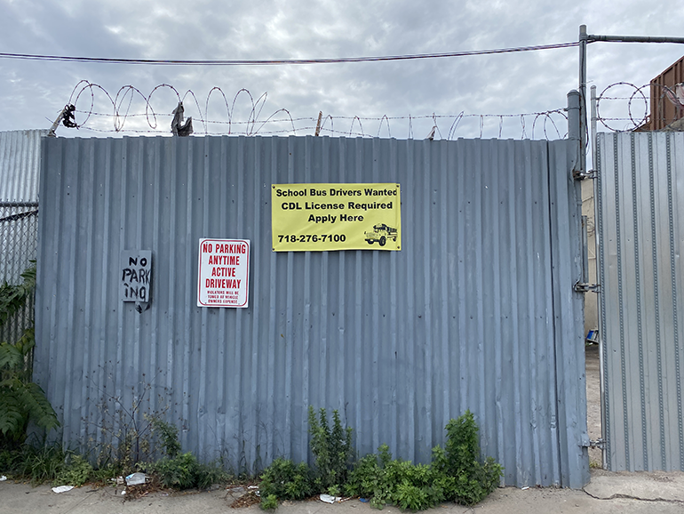
I follow. I pass a school bus deposit, with a “School Bus Drivers Wanted” sign across the street.
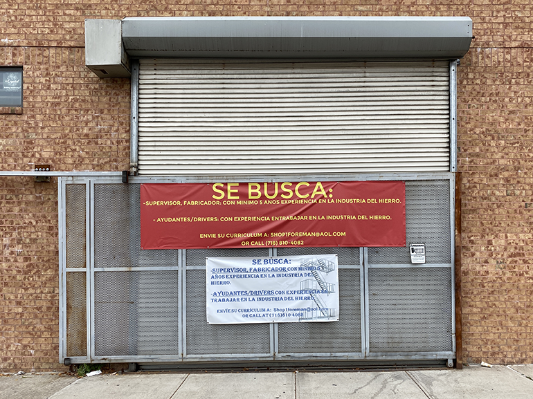
Just few doors down, two other signs — this time in Spanish — for a couple of positions available in the steel industry. The same text is repeated twice, both only in Spanish. One sign includes an image of a fire escape.
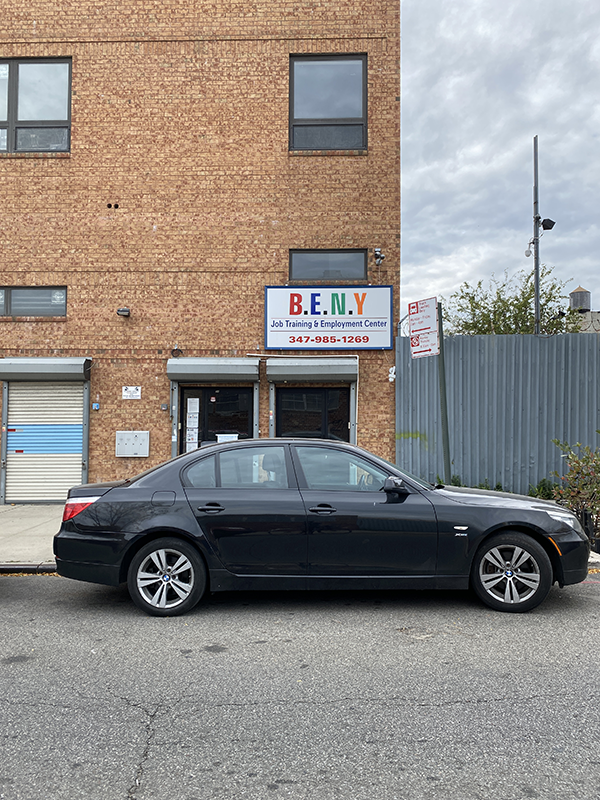
At the corner of the same building, the entrance to B.E.N.Y. — Brownsville East New York Job Training and Employment Center.
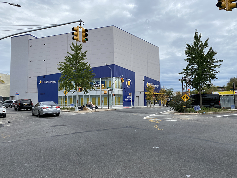
Past East New York, the path turns again, this time to follow Dean Street. A large, new building stands at the intersection, Life Storage. Life Storage? As in storing life until future, different, better times?
The yellow marks on the street paving are now my main guide. I double check the NBP map, but can easily follow the marks. I think of Hansel and Gretel as I follow these urban “crumbs.”
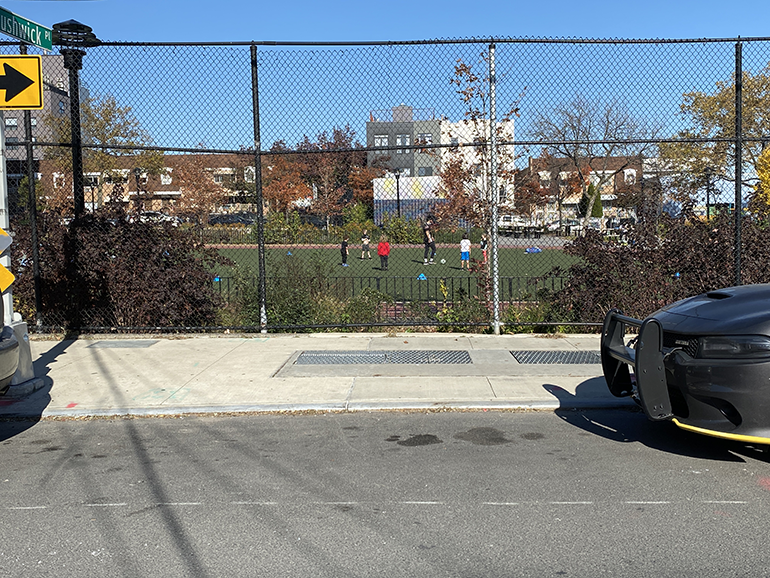
I ride alongside playgrounds, and so does the pipeline. I ride alongside schools, and so does the pipeline.
I ride by Achievement First Brownsville — an elementary and middle school, with signs of construction still present — and Eagle Academy for Young Men II, a public high school. I’ve just exited Brownsville and entered Bedford-Stuyvesant.
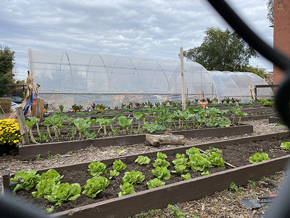
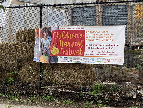
At the corner of Saratoga Avenue and Hull Street, I find the Saratoga Urban Agro-Ecological Center.
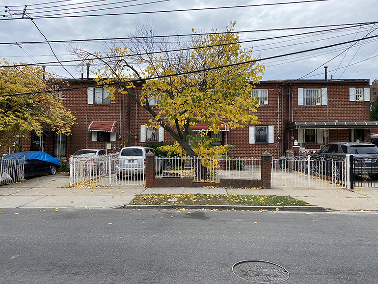
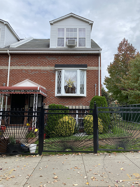
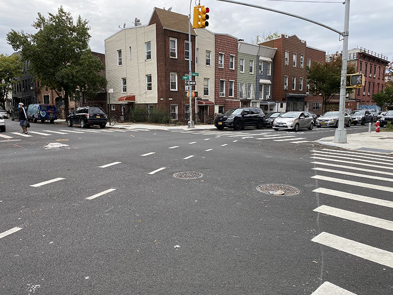
At the corner of Hull Street and Thomas S. Boyland Street, a tree in fall colors across a very well cared-for house (one of many) and then a church (one of many). People are coming out of the service; an ordinary Sunday.
I continue to follow the marks. The map provides general directions, but the marks guide me. Still, no signs of construction. I wonder whether the work below ground has been actually done, despite the declaration that the NBP is in Phase 4 of 5.
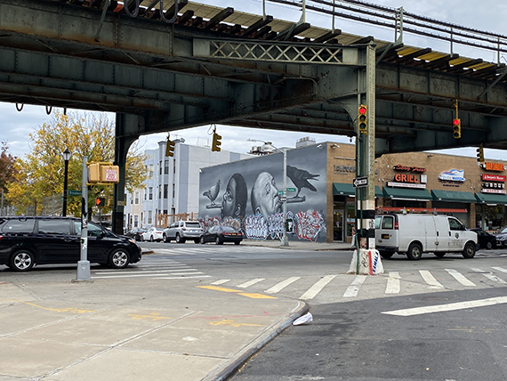
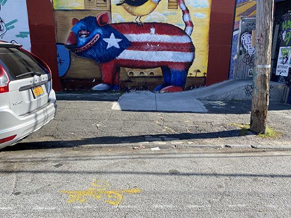
The corner of Broadway is occupied by a huge black and white mural. So smart. Hitchcock with his elegant black raven, the Notorious B.I.G. with his pigeon.
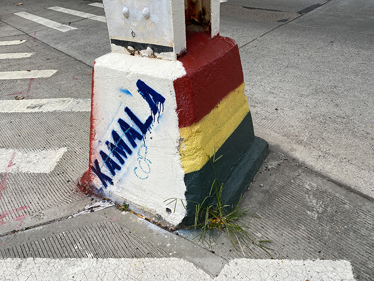
One of the legs of the elevated J and M line has been painted to support the then-Vice-Presidential candidate —with the intimacy of first name only.
Crossing below the elevated train tracks, I transition to Bushwick — translated from Dutch, the name means “town in the woods.” I later learn online that the area was “bought” by the West India Company from the Lenape people. “Bought.”
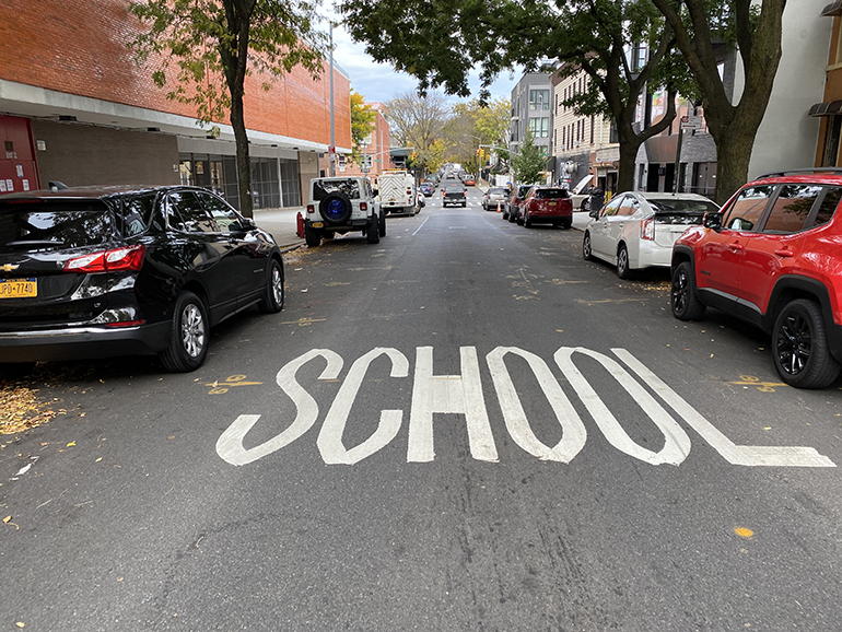
I turn left on Evergreen Avenue. A large “School” marking on the road is surrounded by yellow pipeline marks, as if to clarify their to neighbors.
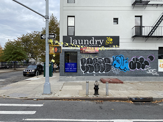
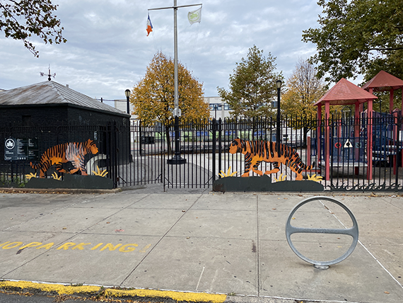
Down the road: a brand-new laundromat with yellow flags announcing its opening; across the street, the Tiger Playground.
A new, silver rolling gate features a Basquiat-like Black Lives Matter mural. As I stop to admire and photograph the work, I hear the owner of the contiguous yard clearing up the area with a leaf blower in the background. Another cared-for home.
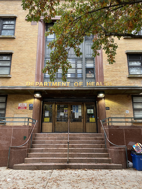
Another paradox: On Central Avenue, the Bushwick Department of Health, in a 1958 historic building right along the pipeline’s path . . .
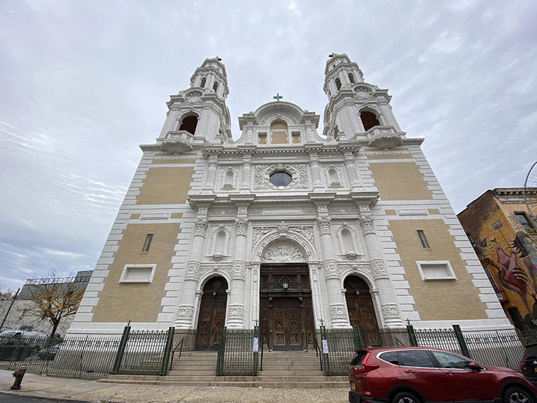
. . . followed by the just-remodeled and grand Church of Saint Barbara, built in 1909 on the site of Eppig Beer, the German brewery that donated the land upon which the church now sits. The church looks familiar — a replica of a Roman church typology claiming German origins.
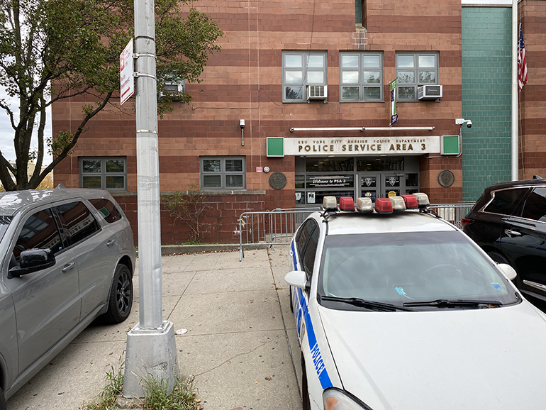
The last block of Central Avenue, right at the edge of East Williamsburg, is entirely occupied by a police station — the NYPD’s Housing Bureau to be exact — a “service area” servicing the multitude of surrounding housing.
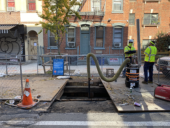
On Bushwick Avenue I encounter steel plates and pipe fittings leftovers, a sign of the underground action.
I’m now around the corner from where I live, by Leonard Street. In the summer of 2019, I saw construction work every weekend as I walked to the nearby bakery. I would stand in the site prep area, photographing materials and the huge pipes. Not for one second did I question the purpose of this pipe, mesmerized by the ingenuity of its installation — the NBP carrying fracked gas through disenfranchised neighborhoods, with no local distribution, adding further asthma and pollution risks to complex places of life and resistance to systemic exclusion.
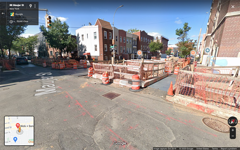
At the corner of Leonard and Maujer Street, I turn around to see signs of the cuts and scars that I followed with my own eyes and camera last year. I see nothing but a smooth layer of black asphalt and its signage: deceivingly, a pedestrian and bike friendly intersection; deceivingly, right in front of Pre-K and Elementary School PS18.
The current Google Map street view of this intersection, dating October 2019, still shows openings — the visible that is now totally invisible, leaving no trace of the immense underground and infrastructural work.
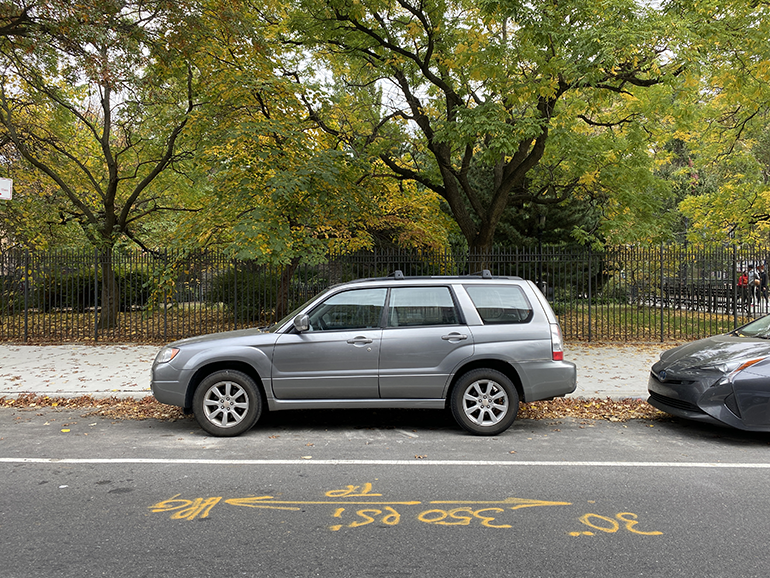
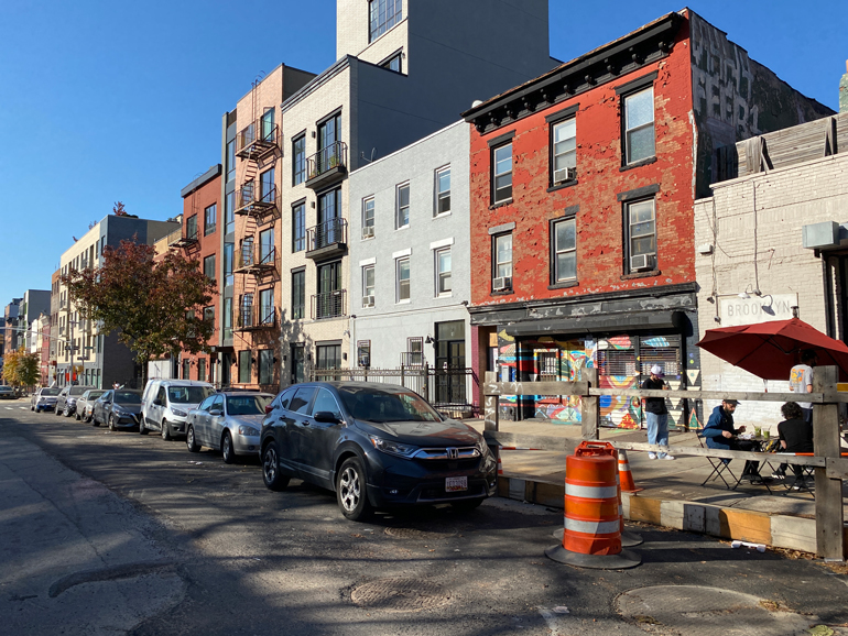
I start my ride at Montrose Avenue, where the NBP t-shapes prior to heading north toward Greenpoint. The new asphalt patch is clear, skirting the southern edge of the street. Alongside it are my own neighborhood baseball fields, rich with community activities, from softball and soccer practice to league games (and related gatherings, with music, BBQs, and intense domino tournaments); PS250, my first voting site once I became a US citizen; and the Holy Trinity Roman Catholic Church, with its steeple — a longtime landmark in this community of old immigration, offering mass services in English, Spanish and Polish.
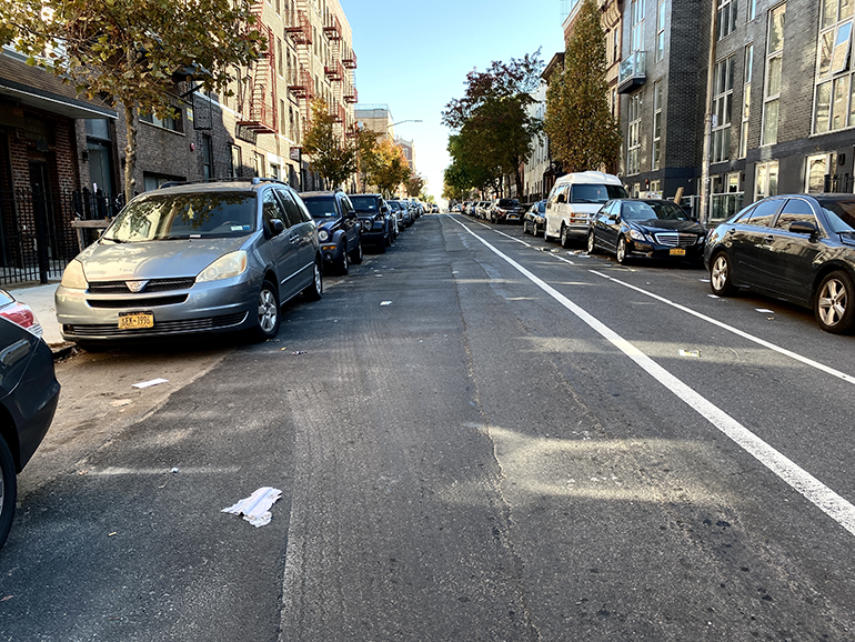
On Meserole Street, the asphalt patch on the paving is straight and clear, running parallel to a bike lane. The street is a cross section of two idiosyncratic, linear realities: one above, properly marked and codified; one below barely noticeable.
On this spectacular Saturday — warm, with a clear blue sky — a segment of the pipeline is still in the works. “Essential Infrastructure Project,” reads the sign on the fence, protecting two workmen and their equipment. Whether or not this work was “essential” was questioned during the COVID-19 lockdown in spring, resulting in a temporary construction stoppage.
The road patch crosses Bushwick Avenue, framed by the pedestrian crosswalks to its right and left. Flat adjustments next to flat information, both belonging to the known and familiar, not to prompt curiosity or questioning. Just another repair job.
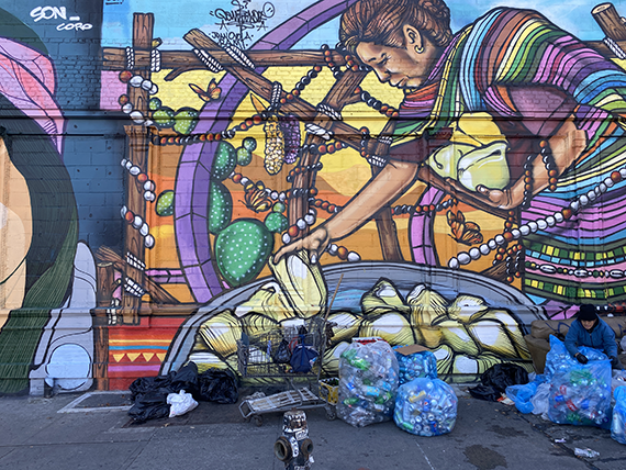
A hidden line now marks a path between the active Ten Eyck Playground and the sidewalk opposite, where gleaners collect cans and bottles. This is the entry point to a warehouse area in Bushwick, still partially active with storage and manufacturing, and a great site for street art.
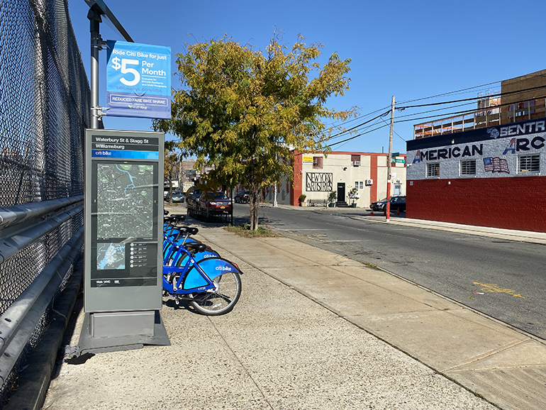
The industrial area is near the Williamsburg Houses, a housing complex built in the 1930s that covers twelve city blocks — a visionary modernist project. Here, a Citi Bike docking station offers reduced fares.
A straight, clear mark on the ground proceeds to Grand Street, adjacent to a high school’s large outdoor football field, tennis and handball courts.
On Grand Street, I notice some visible transformation, with new, well-camouflaged six-story “townhouses” next to the old carriage houses and garages.
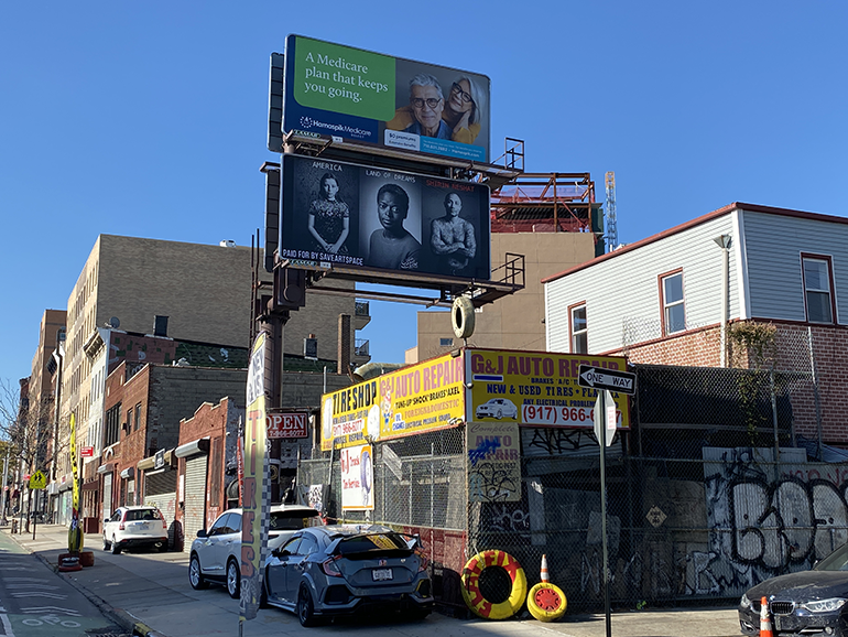
Above a bright tire shop, two billboards: one advertises “a Medicare plan that keeps you going,” and another features the work “America Land of Dreams” by artist Shirin Neshat.
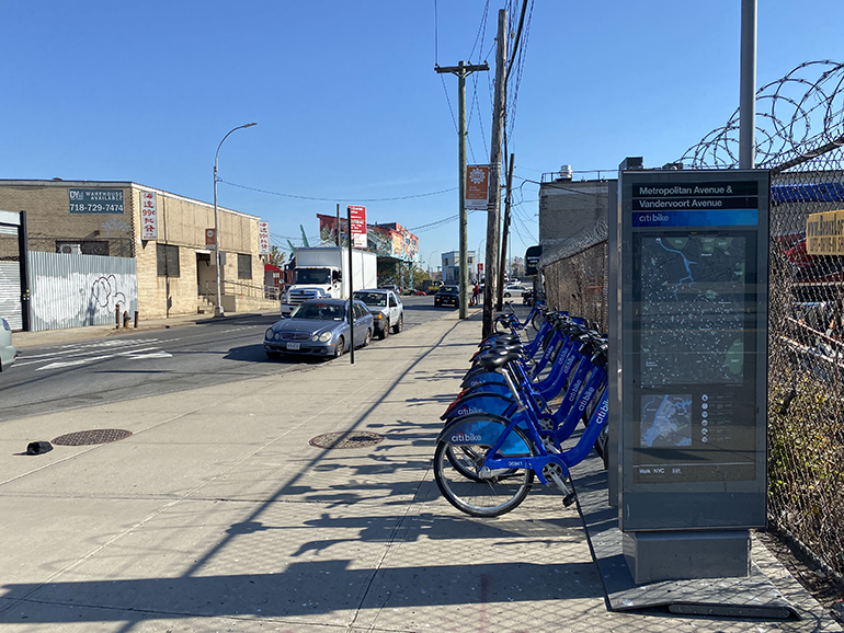
At the corner of Metropolitan and Vandervoort Avenues sits the last bike share docking station in Brooklyn before crossing the Newtown Creek, leaving East Williamsburg and entering Queens. The landscape is now empty of residences: no special rates are offered at this bike docking station.
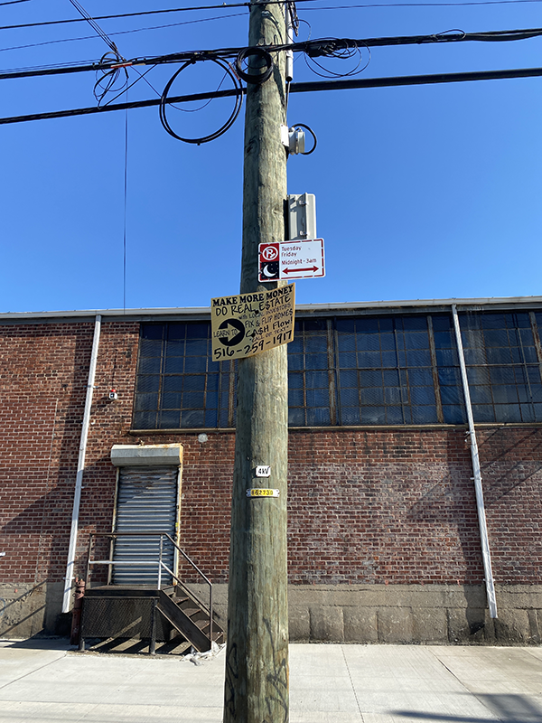
“Make more money do real estate” says a sign posted to several light poles as I enter this heavily industrial area — an omen of what it will inexorably become: the next opportunity for “luxury” development.
A “Safety Checkpoint” shop, emblematically placed as I leave Metropolitan Avenue behind.
Vandervoort Avenue is a heavily-trafficked, four-lane, two-way road. It is not a place for bicycles. Safety is an issue starting above ground.
Maspeth Avenue is a dead-end road blocked by Newtown Creek. To my right is a FedEx Ground center, with a sign that states “Heroes work here” — an expression repeated by many as a small act of gratitude toward our essential workers. Also, a sign of essential workers here; many, judging from the large fleet of trucks
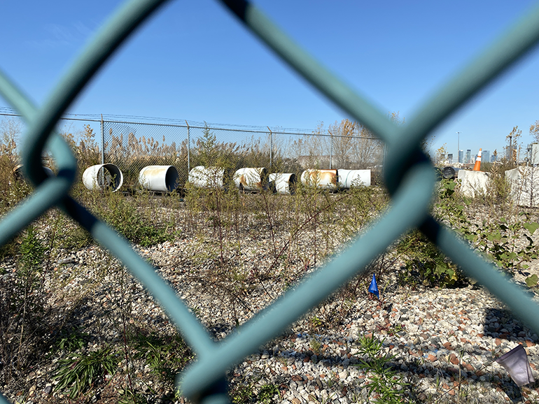
To my left, a long line of assorted vehicles: transporters, recyclers, and other vehicles lining the boundary of the 90-acre-plus depot — neither a FedEx fleet or National Grid vans, but belonging to workers at the margins of those economies.
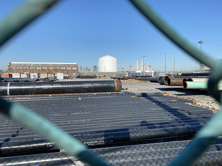
Behind the depot’s fence, pipes occupy the foreground. Manhattan is in the far background.
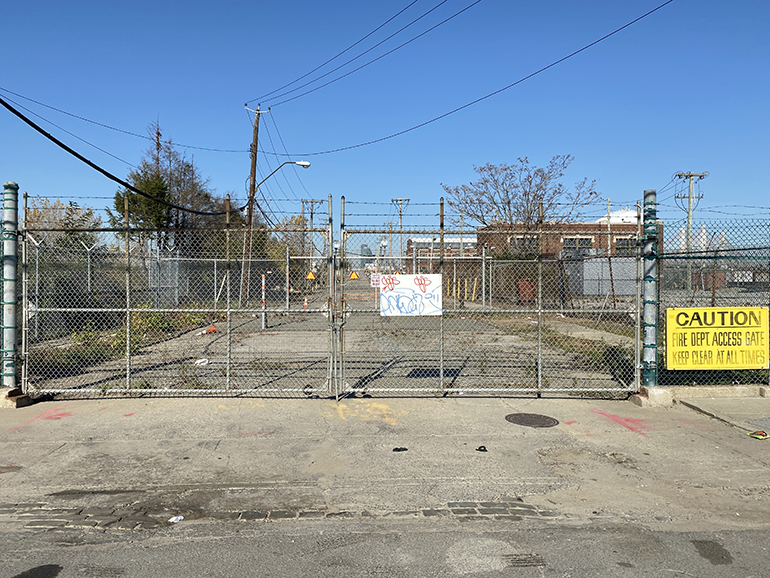
Varick Avenue is blocked off for the full length of the National Grid depot, and gated on both ends. On the map, the NBP turns and ends here. The site is inaccessible: a rather anticlimactic ending after this long path. It’s Saturday morning on November 7, 11:35 am. My phone buzzes. I receive a text from a friend as we are all anxious to hear the results of the presidential election. I check my New York Times app and scream.
Now this is a much more grandiose finale, though my journey still feels undone, not having reached the pipeline’s invisible terminal.
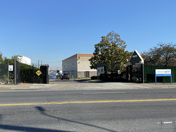
As I’m heading back along my path, I stare at the National Grid depot at the corner of Maspeth and Vandervoort Avenues. The baseball backstop seems totally out of place. I follow the fence to where it opens: the entrance of the National Grid offices and their Meter Operation Facility.
“Social Distancing Saves Lives” reads one sign. Another indicates that “heroes work here,” side-by-side with the villains.
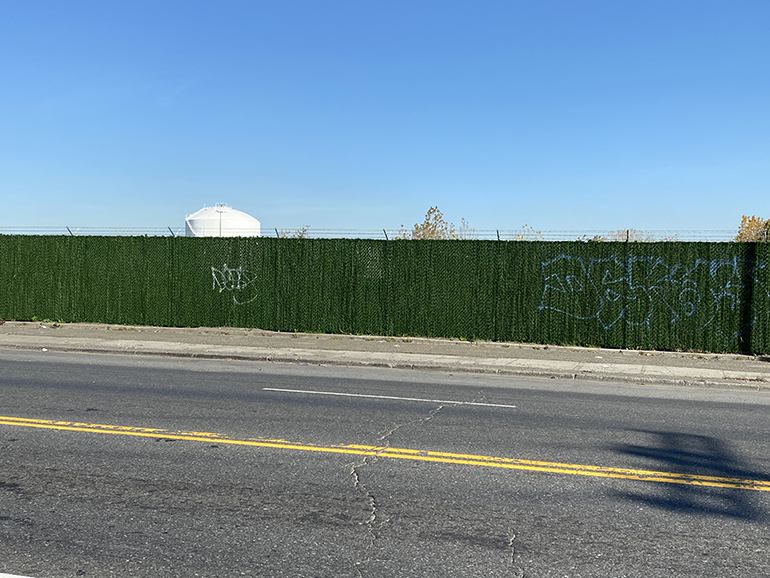
I ride back along the National Grid depot on Vandervoort Avenue. The fence here is more “finished,” and also opaque. The AstroTurf texture complements the planted areas around the office building and the implied baseball field — a petroleum green wall. It also hides a powerful urban statement camouflaged as “greenery”: non-transparency, this time on a vertical plane.
The most recent street protests against the NBP, in October 2020, were on Montrose Avenue. I ride back there as people are cheering everywhere for the new president-elect. Car horns, dancing, chanting; people standing still at corners and waving, excited, in the perfect bubble of this unusually mild, sunny November Saturday. On Montrose Avenue, neighbors are having brunch outside, the remains of a recent construction right next to them on the street.
At this very spot, on October 16, an activist chained herself to the pipe in the open construction site in an effort to block the work. I realize this is exactly where my day started, on the exact spot — across from the school where I once voted, right by the park with the fields and the games, right by the row of residential buildings. In less than a month, the single tree on this sidewalk lost its leaves, cars went right back to occupy their spots. More domestic garbage rests above ground; a more damaging one underground, unnoticed — if we don’t intervene.
To learn more about the campaign agains the North Brooklyn Pipeline, click here.
The views expressed here are those of the authors only and do not reflect the position of The Architectural League of New York.


Comments